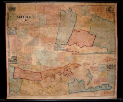
CHACE, J. Map of Suffolk County, L.I., New York
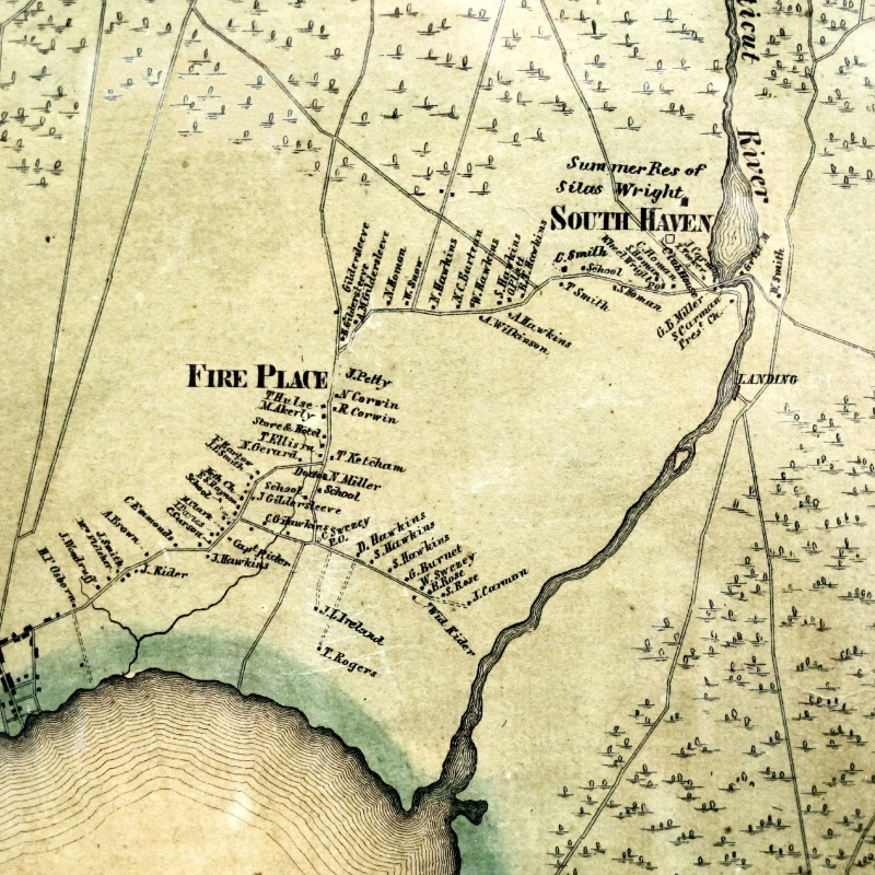
A copy of this map is available at the Suffolk County Historical Society, Riverhead, NY. It is from this map that the enlarged section shown here was photographed. It was surveyed and constructed by Chace under the supervision of the Smith-French survey of New York, the most ambitious and advanced mapping project for any American state to that date. Due to Suffolk County’s long and narrow form, Chace chose to divide the map into two parts, with the western part of the county shown at top, and the eastern at bottom. Interspersed are thirty-three inset plans of Suffolk towns, including Southampton, Easthampton, Bridgehampton, Amangansett, Sag Harbor, Riverhead, Islip, Stoneybrook (sic), Sayville, Patchogue, Smith Town, Amityville, and Greenport. In addition to the original copy available at the Suffolk County Historical Society, another is available at the State University of New York at Stony Brook library.
Copies of this map occasionally become available for sale at prices that have ranged from $3,500 to $9,500, depending on condition.

CHACE, J. Map of Suffolk County, L.I., New York
Philadelphia: John Douglass, 1858. Wall map, 49 x 57½ inches, including numerous insets. This original map is scarce. This is reputed to be the best nineteenth-century map of Suffolk County, New York. This map is also known as the “1858 Smith and Chase Wall Map of Suffolk County, Long Island.”