
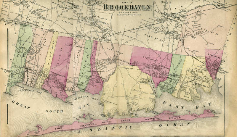
1873 Beers Map of the Southern Portion of the Town of Brookhaven
from Map of Suffolk Co.
by F. W. Beers, New York. Beers, Comstock & Cline, 1873
This is an 1873 map of southern Town of Brookhaven. The solid curving line running west-east at the bottom of the map is the proposed path of the South Side Railroad extension from Patchogue to Eastport, later to become the Long Island Rail Road. The actual tracks were not laid along this path when constructed in 1879-1881, but in a slightly more northerly, nearly straight-line path without the curve south into the center of Bellport Village. Montauk Hwy. was then built adjacent to the railroad, bypassing the Village.
Click on a section of the image to view this section of the map at large scale (map has been divided approximately into thirds). Full a large scale image that includes all sections, (this file is quite large and may require substantial time to download).
A copy of the complete Suffolk County Beers Atlas is available at the Longwood Public Library