
The Carman’s River(Ref. ID SH01.1-S) originates in the central part of Long Island and flows generally south about 10 miles to the Great South Bay. Along the way there are two county parks, three “lakes” — actually remnants of old mill ponds — and the Wertheim National Wildlife Refuge. The earlier names for the river were Connectiquot or Connecticut. The native Americans may have also called it Cumsequogue
During most of it’s path, it’s not much of a “river” — it’s natural width perhaps 10-15 feet. The lower reach, of interest here, is an estuary and therefore tidal. When I first moved to the Hamlet, there were several duck farms on it’s west shores, and a great deal of not so pleasant muck on it’s bottom. The farms are now long closed, and the river has more-or-less returned to it’s natural state.![]()
The core 1800 acres of the Wertheim National Wildlife Refuge(Ref. ID SH01A) was donated to the Federal Government by Maurice Wertheim in 1947. Sometime around the 1920s-30’s Wertheim had purchased a large portion of the failed Tangier land tract on the east bank of Carman’s River for his own private shooting and fishing preserve. The wildlife refuge has grown to approximately 2550 acres through land purchases and donations.
Immediately upstream to the north is the South Haven County Park, Suffolk’s County’s first significant parkland. Originally the home of the Suffolk Club (Ref. ID SH13), a gentleman’s hunting and fishing club dating to the early 19th century, the county began acquiring the land in 1962 with an initial purchase of 600 acres. It has now grown to approximately 1500 acres.
Carman’s River, looking north from the foot of Beaverdam Rd. — Squassux Landing. This is a favorite spot for crabbing. When the children were young there were always chicken necks in the freezer available for use. And a favorite summertime meal was steamed crabs provided by the young-uns.
In the 18th and early 19th centuries, the river was used for commerce, which ended with the advent of railroads and the silting of the inlet (now called Old Inlet) to the Atlantic Ocean, which was nearly directly opposite the mouth of the river.
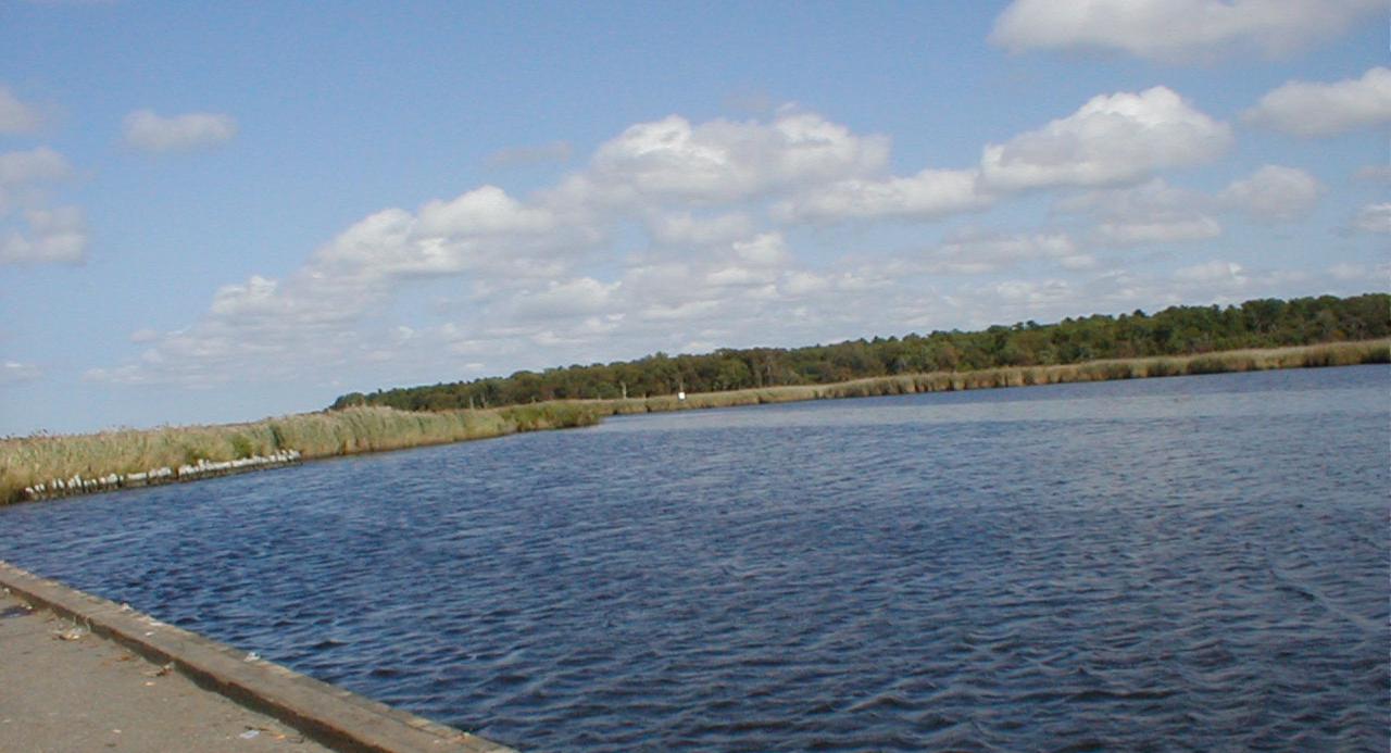
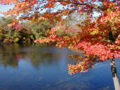
Carman’s River looking south from the Squassux Landing. The river leads to the Great South Bay. To the right (not visible) is the Squassux Landing marina, owned by the Brookhaven Village Association. At one time (many, many years ago) there was a ferry to Smith’s Point Beach which left from the landing. In the 18th century, whaling boats landed here, as well as elsewhere upstream along the river. I’m told that during Prohibition it continued to contributed to the wealth of Hamlet residents. The river is now well used by canoeists who sometimes launch at the Landing.
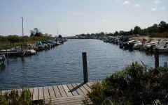
Just to the right of the view above is the Squassux Landing marina (Ref. ID Br16). This marina is not a commercial enterprise, and is owned and maintained by by the Brookhaven Village Association for the residents of the Hamlet
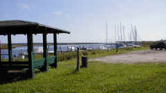
The Squassux Landing property was given by the Post family to the Village Association and has berths for about 220 boats. For a while, we maintained a small sailboat here, and I later used it as a launch point for my Sunfish (before the passion for motorcycling developed).
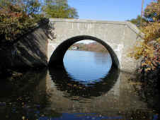
The Long Island Railroad bridge over the Carman’s River. This bridge is located about 2 miles upstream of Squassux Landing within the Wertheim National Wildlife Refuge. Some might say that you have left the Hamlet by this point. But this graceful little concrete arch bridge is so beautiful I believe it must be in the Hamlet!
The railroad was extended along the south shore between Patchogue and Eastport through Brookhaven about 1881. Recent research indicates that the original 1881 bridge across the River was trestle work on pilings. This bridge has a date of 1911 on its face.
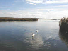
This little pool is at the historic “goin’ over” of the Carman’s River. The pool itself is located between the Montauk and Sunrise Highways, upstream of the railroad bridge. Even I must concede that you are no longer in Brookhaven Hamlet. The “goin’ over” was the location of the original South Haven community. In pre-Revolutionary War times, the Old South Haven Church parish was founded here, as well as the South Haven mills![]() and Samuel Carman’s house — which also served as a tavern, store and post office. The mill was probably constructed in the late 17th century. The old church cemetery is about all that remains of the original settlement — the mill and original mill dam were destroyed when Sunrise Highway was extended through the area in 1958, the church was moved in 1960. The river is tidal to about this point. It is a favorite fishing pond and launch point for canoes, kayaks, and row boats.
and Samuel Carman’s house — which also served as a tavern, store and post office. The mill was probably constructed in the late 17th century. The old church cemetery is about all that remains of the original settlement — the mill and original mill dam were destroyed when Sunrise Highway was extended through the area in 1958, the church was moved in 1960. The river is tidal to about this point. It is a favorite fishing pond and launch point for canoes, kayaks, and row boats.
The other picture is a Currier and Ives lithograph Catching a Trout supposedly depicting Daniel Webster catching his famous trout in the same pond![]() . An original of the lithograph is at the Bellport-Brookhaven Historical Society.
. An original of the lithograph is at the Bellport-Brookhaven Historical Society.
A balanced view of the fish story may be found in Nick Karas’s book, Brook Trout, (New York: Lyons & Burford, c1997) — or at least as balanced a view as one is ever likely to get from a fisherman.
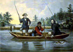
“We hab you now, sar!” — Apaius Enos, Daniel Webster’s slave, talking to the senator’s legendary 25-inch brook trout as it was pulled from the Carman’s River![]() . Some versions have the slave belonging to Sam Carman; it is one of the few cases where a slave has both a first and last name.
. Some versions have the slave belonging to Sam Carman; it is one of the few cases where a slave has both a first and last name.
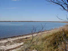
We’re now back at the mouth of the Carman’s River at the Great South Bay as seen from the Manor of St. George. We’re on the east side of the River, on Mastic Neck. Straight ahead is the Hamlet. The entrance to the river is along the shoreline to the right.
If you click on the picture, you will be able to see the Brookhaven Town landfill on the horizon; this Mount Trashmore has changed the landscape of the south shore of Long Island. It’s north of Sunrise Highway, which, as far as Hamlet residents are concerned, makes it in Yaphank.
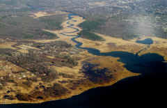
This aerial view of the Carman’s River was taken by local resident Marty Van Lith while hanging onto the wing of a 727 making it’s approach to Islip-McArthur Airport. Squassux Landing and the marina are about in the center of the picture. At the very top is Sunrise Hwy. — the lake being the remnants of the old Carman’s Mill pond and now in South Haven County Park.
Video: Saving the Carman’s River.
Produced by the Long Island Pine Barrens Society. Used by permission
View
Film is 30 minutes long. Requires Windows Media Player or similar software installed on your computer. Original DVD has been reformatted for web viewing.
?2010 L.I. Pine Barrens Society.
This video is also available from the L.I. Pine Barrens Society web site.