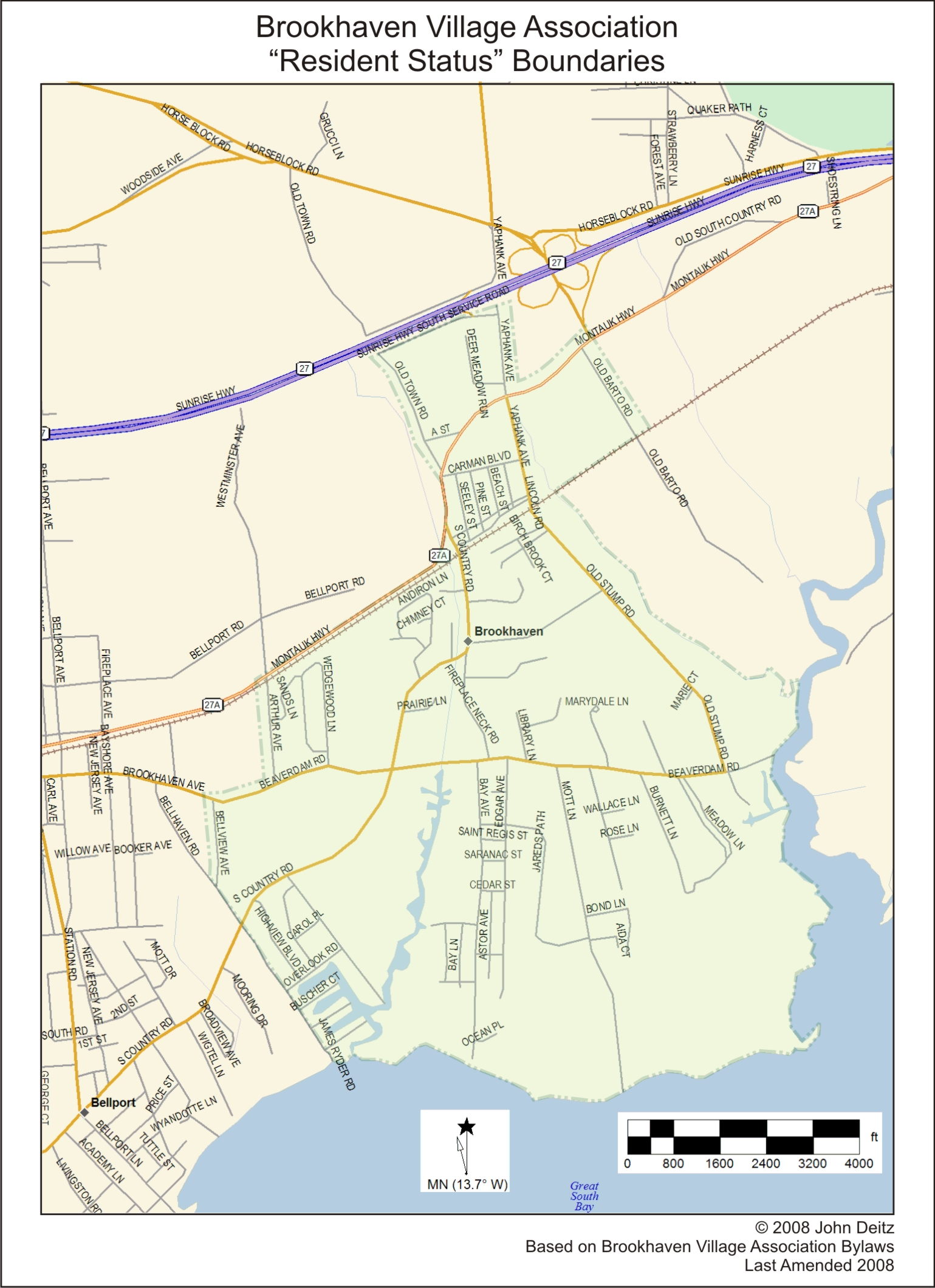
The following map is based on the description found in Article II. Section 1 of the Brookhaven Village Association Bylaws: “The Brookhaven Village for the purpose of determining resident status shall be that area defined in the following manner: beginning at the mouth of the Carmans River running northerly along the west shore to Little Neck Run, thence running northwesterly following the path of the west shore of this stream to the railroad track, thence running easterly to the east side of Old Barto Road, to the north side of Montauk Highway and thence running westerly to the east side of Yaphank Ave. to the south side of the S. Service Rd. to the west side of Old Town Road, thence directly across to the south side of Montauk Highway to the west side of Arthur Ave. to the north side of Beaver Dam Road to the west side of Belleview Ave. to the east side of Bellhaven Road to the Great South Bay, thence easterly along the north shore of the Great South Bay to the mouth of the Carmans River.”