Click on image for enlarged view.
102
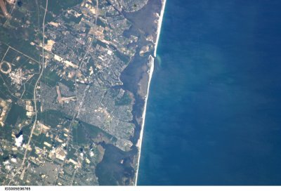
Satellite View of Brookhaven Hamlet
1-Modern
5 Jul 2002
Br01
Brookhaven Hamlet District
NASA
ISS005 E 6765
Image courtesy of Earth Sciences and Image Analysis Laboratory, NASA Johnson Space Center (http://eol.jsc.nasa.gov). Top is easterly. Built up area in center of picture is Mastic Neck. The river running through the green space below Mastic Neck (Wertheim Wildlife Refuge) is the Carman's River. And slightly below that is Beaver Dam Creek – the land between them being Fire Place Neck. From right to left, running top to bottom, are Fire Island starting at Moriches Inlet near the top; the Moriches Bay and the Great South Bay (Bellport Bay) separated by Smith Point and the Smith Point Bridge, Sunrise Highway, the Long Island Expressway. White spots are light clouds, with associated dark shadows on the ground.
668
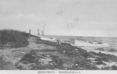
Shore Front
4-Post Card
c1910
Br01
Brookhaven Hamlet District
Deitz
Post Card
Brookhaven Hamlet shore front on the Great South Bay, perhaps at the foot of Bay Road
10-04-2014 12:00:00
134
Beaver Dam Road
2-Historic
Before 1905 (a post card using this image is dated 1905).
Br01
Brookhaven Hamlet District
Post-Morrow
RG1 Series 10
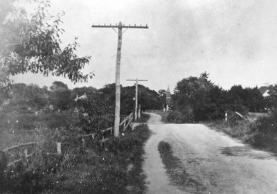
From "Early Photographs of the Hamlet of Brookhaven collected by George Perley Morse."
Caption reads: "Beaver Dam Road looking east."
In foreground is the bridge over Beaver Dam Creek. In the background is the St. James Church with it's old gothic tower. Just barely visible to the right is the Badetty guest house (Historic Structure Br29A)
You will probably need to click on the picture to see the church.
246
Beaver Dam Road
4-Post Card
Uncertain
Br01
Brookhaven Hamlet District
Post-Morrow
RG3 Series 1
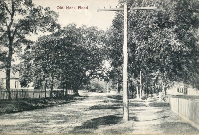
I believe this post card showed Beaver Dam Road looking west at Fire Place Neck Road -- the road to the right.
The tree on the left side of the road is the ancient oak that was on the south side of Beaver Dam Road near St. James Church. St. James Church [Br28A] is to the left beyond the oak tree. And further along is Bay Road turning off to the left.
Immediately to the right, not visible beyond the fence, would have been the Charles Swezey house [Br27A.1-S]. I am uncertain about the house seen to the right -- perhaps the N. Hulse/Gwynn house [Br28], except that the house in the picture appears to be too close to the road to be that house.
106
South Country Rd.
4-Post Card
abt 6 Oct 1908
Br01
Brookhaven Hamlet District
Post-Morrow
RG3 Series 1
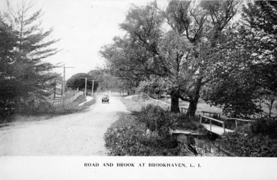
From the collection of postcards at the Post-Morrow Foundation.
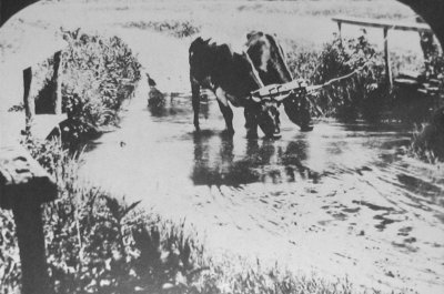
It shows South Country Rd. where it crossed Beaver Dam Creek, looking west. Note the rutted track crossing the brook to the right of the road, apparently allowing animals to drink (see oxen photograph). The Valentine "Brook Store" has not yet been moved to it's present location.
The farm house to the left is likely the house labeled O. Robinson on the 1873 Beers map.


