Click on image for enlarged view.
182
Carman's River Aerial View
1-Modern
Unknown
SH01.1-S
Carman's (Connecticut) River
Marty Van Lith
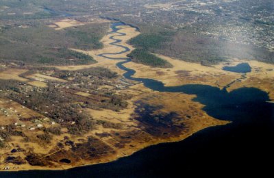
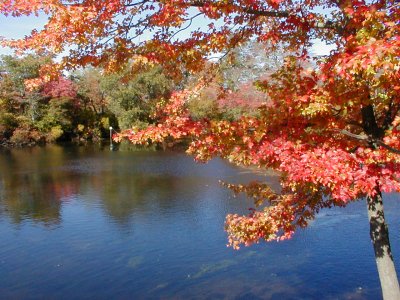
This aerial view of the Carman's River was taken by local resident Marty Van Lith while hanging onto the wing of a 727 making it's approach to Islip-McArthur Airport. Squassux Landing and the marina are about in the center of the picture. At the very top is Sunrise Hwy. -- the lake being the remnants of the old Carman's Mill pond and now in South Haven County Park.
179
Carman's River
1-Modern
20 Oct 2002
SH01.1-S
Carman's (Connecticut) River
Deitz
021024/P1010020
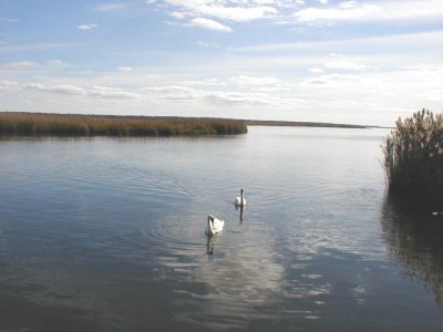
Looking south from Squassux Landing
345
LIRR Bridge Over Carmans River
2-Historic
abt 1911
SH01.1-S
Carman's (Connecticut) River
Ken Spooner
http://www.spoonercentral.com/GoingOver/LIRR.html
This is a picture of the bridge shortly after its construction was completed in 1911.
10-18-2005 12:00:00
346
RR Bridge Constructed
2-Historic
abt 1911
SH01.1-S
Carman's (Connecticut) River
Ken Spooner
http://www.spoonercentral.com/GoingOver/LIRR.html
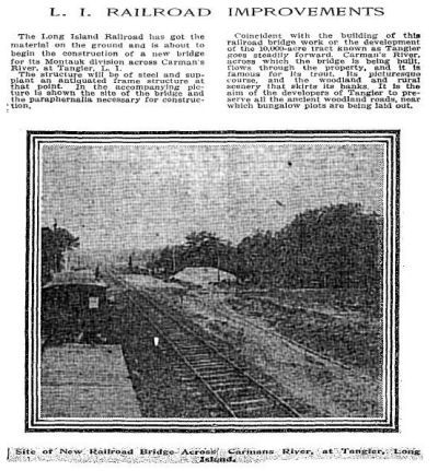
The concrete arch bridge replaced a simple wood trestle built when the rail road was extended west about 1880.
The "Tangier" development mentioned in the article was a grand plan for western Mastic Neck that predated Shirley, and included the Carman's River. Fortunately it failed, and Maurice Wertheim eventually purchased much of the riverside property which he was later to donate to the Federal government to become the core of the Wertheim Wildlife Refuge.
Ken Spooner has documented much on the Tangier proposals at his site, F. J. QUINBY & THE TANGIER DEVELOPMENT:
http://geocities.com/mymastic/Quimby.html
Click image to better read the article. I'm not sure of its source.
10-18-2005 12:00:00
262
LIRR Bridge 1900
2-Historic
abt 1900
SH01.1-S
Carman's (Connecticut) River
South Country Library
LI REF 974.725 BAY
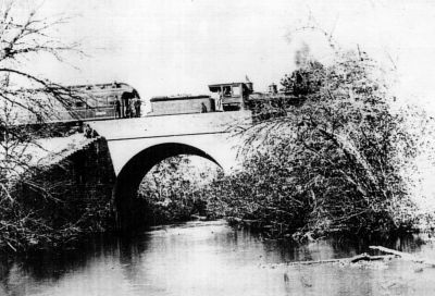
Caption reads: "Railroad Bridge and train over Carman's River East of Yaphank, in 1900." This picture is in "The Early Years in Brookhaven Town". Despite it's similiarity with the rail road bridge above (#180), it is actually located where the Main Line crosses the Carman's River further north (which I have confirmed by hiking to the bridge). I have included it because the train shown would have been typical for the Long Island Railroad at the turn of the century.
I apologize for the quality of this picture; it's a scan of a "zerox" copy of the not very good printed picture in the pamphlet.
Author: Bayles, Thomas R. (based on work by his father Richard. M. Bayles)
Title: The early years in Brookhaven Town, L.I., N.Y.
Publisher: Coram, NY : Brookhaven Town Historical Society, [1971?].
Description 40 p. : ill. ; 25 cm
137
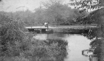
Going Over of Carman's River
2-Historic
about 1917-1923
SH01.1-S
Carman's (Connecticut) River
Bellport-Brookhaven Historical Society
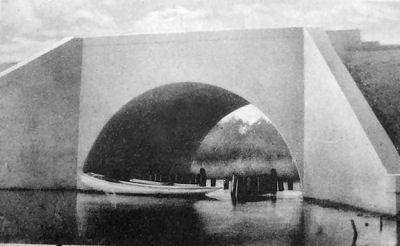
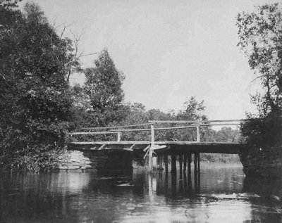
While the back of the photograph at the Bellport-Brookhaven Historical Society has the caption quoted below, this is likely the bridge over the Carman's River in South Haven, not the crossing of Beaver Dam Creek at Beaver Dam Road.
There are several post cards in the Post Morrow Foundation Historical Collection which use this photograph and identify the Carman's River as the location. The width of the waterway is more consistent with that of the Carman's River at South Haven.
The caption on the photo image at the Historical Society reads: "Bridge over Beaverdam Creek. Probably taken by Walter E. Tamlyn, long time summer resident of Brookhaven. Believed to be bridge on Beaverdam Rd. taken late 'teens' or early 1920's Elizabeth Tamlyn Harris"


