Click on image for enlarged view.
His notation: "The Carman House as it looked for many years before being torn down in 1936. Here came famous men to spend the night, for this was a stop on the stage coach route to Sag Harbor and Easthampton. And here Daniel Webster and his friends often stayed when they came to south Haven to fish. In this building the members of the South Haven Church often met to conduct their business. Here in 1802 they decided to incorporate the church, and chose the first trustees.
While the 2-story and attic main wing to the left had deteriorated to such an extent that it was torn town about 1936, the 1 1/2 story wing to the right was left standing. About 1950 it was puchased by Robert Stirling (reportedly for about $300) and moved to the end of Edgar Ave. in Brookhaven Hamlet. This structure now has Historic Site ID Br37.01-S.
The lumber from the torn down section was reported to have been used to construct barns and farm outbuildings for the Robinson Duck Farm.
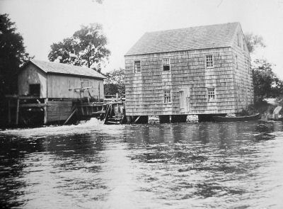
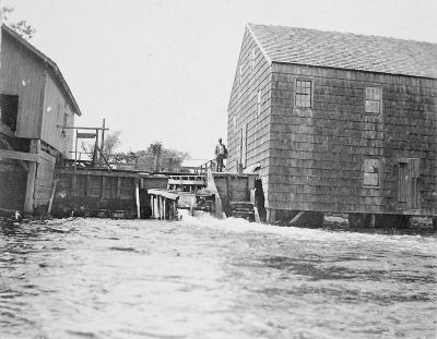
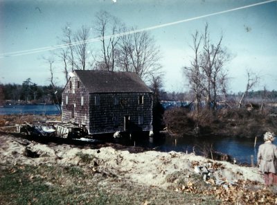
The planning mill is to the left, the grist mill is to the right. The tail race and turbine engine was in the structure between the two buildings.
Two very similar pictures are extant, one is on a post card backing, the other follows below. The principal difference in these pictures is that there is a large tree at the center. While the post card has a 1¢ stamp and message, it is not cancelled. The date of the post card is therefore uncertain; it was certainly well before 1 Jan 1952 when the postal rate for postcards was permanently changed to 2¢. (See also the following picture which shows the tree.)
In this view, the tail race and turbine engine (water wheel) are clearly seen between the planning mill to the left and the grist mill to the right. The turbine engine was said to have been horizontal with a vertical shaft, which appears to be the case from the picture. While it was also said to have been an "overshoot turbine or wheel" (rather than the less efficient "undershoot wheel"), this terminology seems only to have been usually appled to vertical wheels -- but this is being further researched. It is also not clear from the picture how the power was transmitted to the two buildings, but probably there were gears and a shaft rather than a belt mechanism.
It is also interesting to note how little head (drop of water or water pressure) was present, perhaps only 8 or 10 feet. The amount of head and volume of flow are the two main factors which determine the power of a water engine (Power = Head x Flow). In the case of the Carman's Mills, it was the substantial steady volume of water flow (aided by a large mill pond), all of which was harnessed because of the dam, which made the site economically viable. The Carman's River supported at least two other mills further upstream in Yaphank.
The person has not been identified.
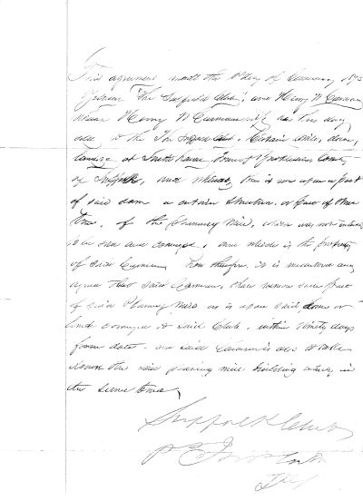
This agreement made the (1st?) of January 1875, between The Suffolk Club and Henry W. Carman which Henry W. Carman has this day sold to the Suffolk Club certain mill, dam, bridge at South haven, Town of Brookhaven, County of Suffolk, and whereas there is set upon a part of said dam a certain structure of these two of the planning mill, which was not intended to be sold and conveyed, and which is the property of said Carman. Now therefore, it is (mutually?) ___ agreed that said Carman shall remove such part of said planning mill as is upon said dam on land conveyed to said club within ninety days from date and said Carman also to take down the said planning mill building entirely in the same time
Signed Suffolk Club ______
Because of variations in old photographs, there is some question as to whether the agreement to remove the planning mill was ever immediately excercised. It is certain, however, that the planning mill was removed prior to the main grist mill building.
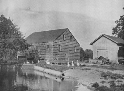
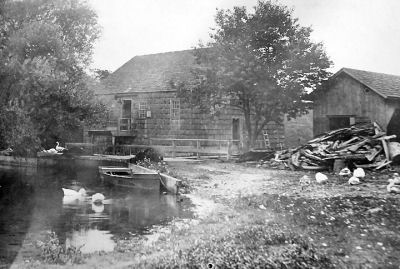
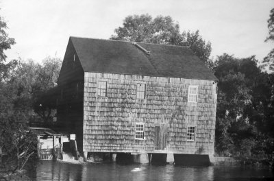
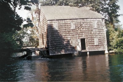
His notation: "The old Carman grist mill at which the grain of many South Haven Church members was ground for many years. It was in one of the quiet pools below this mill that Caniel Webster caught his trout. Near this mill was another in which many of the boards and some of the timbers of the present church ediface were sawn."
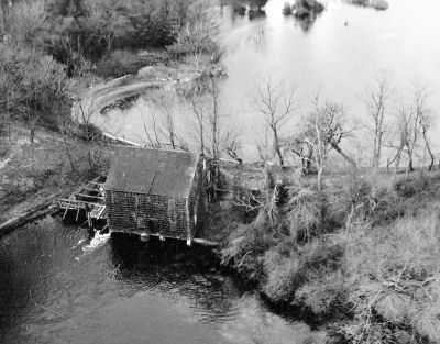
The picture was probably taken at the same time as other aerial views of South Haven shown on these pages.
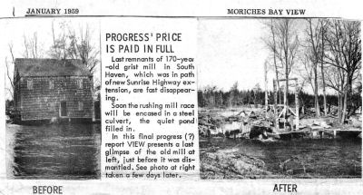
Nearly all of what appears in this picture has been replaced by the Sunrise Highway construction. There is some little archeological evidence that the actual mill site and old dam may have been just a hundred feet or so south of the highway embankment and river underpass.
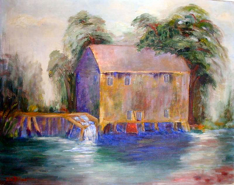
"This painting is by Ella Ballard who was our neighbor and friend. This was just across the highway from the Old Southaven Church. I swam here in the summers and caught bass and trout here often. The Old Mill was a major piece of Long Island History and in typical NY fashion was torn down in the late 50's or early 60's to accommodate highway construction, which facilitated the mass arrival of yet more city people who came to tear down even more historic treasures."
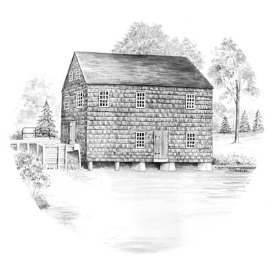
The drawing of the "Carman's Mill" by L.S. Hudson, appeared on a Town of Brookhaven, N.Y. 328th Anniversary Commemorative plate, signed by L.S. Hudson. Text in the reverse side: "The Carman's Mill on the Connecticut (Carman's) River, Southaven (sic), New York. Built circa 1740 and removed 1958 [actually January 1959] to make way for the extension of the Sunrise Highweay, the grist, saw and fulling mill was named for its owner. Samuel Carman. The mill was run in conjunction with a tavern, general store and was a general meeting place for this area of Brookhaven Town." Plate is dated September 11, 1983.
While Hudson likely drew the image about 1983, he must have used an earlier photograph, as the mill was raised in January 1959. Samual Carman's ownership of the mill (with partners) did not occur until some forty years after its original establishment, shortly after the Revolutionary War.

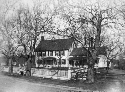
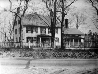
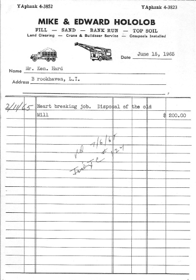
The Carman homestead stood on the north side of South Country Rd. (now Montauk Highway), just east of where Gerard Rd. then terminated. It is uncertain as to when the structure was built. It is well documented that the Carman family lived in the homestead, and operated an inn and store there, in the early 19th, and probably late 18th century after the Revolution War. The store was likely in the 1 1/2 story wing to the right, although some say this is where the slaves/servants lived.
The inn served as a stage coach stop for the Brooklyn to Sag Harbor line, and as lodging for sportsman who came to fish and hunt. Later, the Suffolk Club formed as an exclusive sportman's preserve with its own clubhouse (Historic Site ID SH13). As the mill became less used, and South Haven declined as a commercial center, the structure deteriorated.