
Old FEMA Flood Insurance Rate Maps (FIRMs)
Federal Emergency Management Agency (FEMA) FIRMs have been revised and are now available as a “layer” on Suffolk County’s (NY) Graphic Information System (GIS) maps. These maps are available to the general public. Therefore I am no longer updating these maps on the BrookhavenSouthaven.org site. For historical and archival purposes, older versions of these maps are presented below. However, should you want up-to-date FIRMs, visit the Suffolk County GIS.
Notes on FEMA maps and National Flood Insurance Program:
- Definitions of FEMA Flood Zone Designations
- The original Flood Insurance Rate Maps (FIRM) obtained from FEMA are fairly large high resolution files, In addition to the map images, they contain legends and notes. These, other maps, and the Flood Insurance Study (FIS) paper may be purchased from the FEMA Map Store, either as hard copies or digital images. Paper copies of these maps are also available from the Brookhaven Free Library.
|
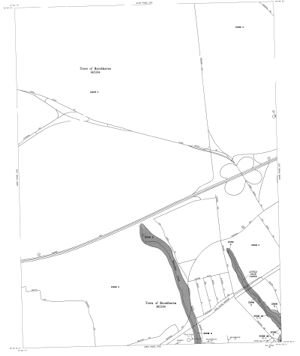
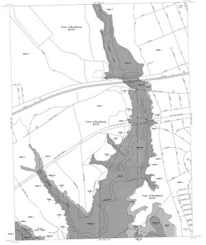
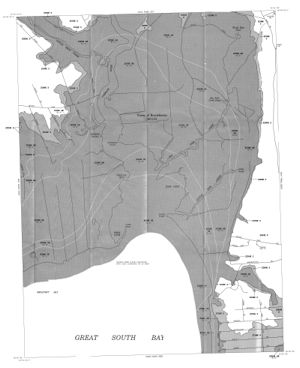
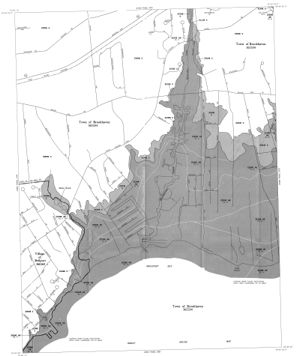
FEMA FIRM Map ID’s |
|
| 36103C0716 | 36103C0717 |
| 36103C0718 | 36103C0719 |
|
FEMA FIS Product ID |
|
|
36103CV000 |
|
The flood maps identify the following areas (as relevant for Brookhaven Hamlet):
- Zone A (dark grey): Special Flood Hazard Areas subject to inundation by the 100-year flood (1% chance per year). This zone is divided into several areas of relevancy to Brookhaven Hamlet —
- Zone AE. Base flood elevation determined
- Zone VE. Coastal flood with velocity hazard (wave action); base flood elevation determined.
- Zone X: Areas of moderate or minimal hazard —
- Zone X (light grey). Areas of 500-year flood (0.25% chance per year); areas of 100-year (1% chance per year) with average depths of less than 1 foot.
- Zone X (white). Areas determined to be outside 500-year (0.25% chance per year) floodplain.
- The FIRM digital images are in TIF format. Viewing TIF formatted files requires graphics software. Therefore, in order to make the four maps relevant to Brookhaven Hamlet more accessible on the web, I have converted them to GIF format and cropped their size.
- I don’t claim any special expertise in the National Flood Insurance Program, or in the interpretation of the Flood Insurance Rate Maps. The FEMA maps are subject to change. I therefore cannot certify the maps displayed here for current accuracy in representing official Special Flood Hazard Areas. For more information, visit FEMA National Flood Insurance Program.