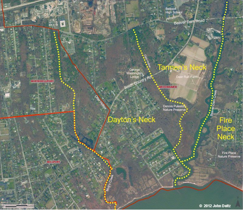
This map overlays on a modern Suffolk County GIS map the approximate boundaries of the two western most necks in Brookhaven Hamlet—Dayton and Tar Men’s Necks. In 1678, Samuel Dayton received a grant of forty acres from the Town of Brookhaven on what was to become known as Dayton’s Neck. He also received a portion of the small neck known as Tar Men’s Neck.
Dayton’s Neck is located between Mott’s Creek, the eastern boundary of the Village of Bellport, and a small marshy hollow known as Clam Hollow.
He moved his family from his home lot in the founding community of Setauket, on the north shore, to his new homestead on the south shore. While the exact location of this homestead is not known, some suggest that it was near the site of the George Washington Lodge on South Country Road. He and his family are generally considered to have been the first permanent European settlers in the Bellport/Brookhaven area.
At the same time, the Town also granted Samuel Dayton an allotment of land near the apparently by then abandoned Tar Men’s house on Tar Men’s Neck—the small neck to the east of Dayton’s Neck, between Dayton’s Neck and Fire Place Neck. This house was apparently a temporary dwelling used by workers who harvested pitch pine sap used in the production of turpentine and lubricants.
Tar Men’s Neck is located between Clam Hollow on the west and Beaver Dam Creek on the east.