Loading...

Old Inlet and Fire Place Beach Clubs History by Bob Starke

HISTORY OF THE OLD INLET & FIRE PLACE BEACH CLUBS
by Bob Starke

Recorded Jan 23, 2003
Revision 1, by Bob Starke, January 28, 2003
Revision 2, by Bob and Helen Starke, February 5, 2003

was born in 1916 and I’ll be 87 years old on Feb. 11 this year. My father had brought this property in Brookhaven [68 Bay Road] in 1900 along with his brother, Charles. Pop had 22 acres and Charles had 14, so we had all the property from where the house is now to the Bay. My mother died shortly after I was born so I was raised by a housekeeper here with my brother, Newell, who was six years older than I. I went to school out here, for the 1st, 2nd and 3rd grade. After pop married again we lived in the city, in Flatbush, and so we only came out here during the summer. But for my first school years I went to the schoolhouse here on Fire Place Neck Road. The old schoolhouse was where the current elementary school is today, but was an old wooden building, two stories, the ground floor had four classes and the upstairs had the other four. Only three people ran the school, two teachers and a custodian.

After the war and my discharge from the Navy in 1946, Helen and I wanted to live in Brookhaven and for a while used the old barn, which was renovated into a house for a year and a half. At that time, 1947, my stepmother, since we had homes in Flatbush and in Brookhaven, decided to sell the Brookhaven property. Accordingly, it was listed for sale and Daniel Bohan, a developer from Bellport, made an offer of $25,000 for the house-barn [now 1 River Lane] and 22 acres. I opted for the house [68 Bay Road] and property to the Beaver Dam Creek, a plot 200 feet on Bay Road and 150 on the creek, a total of about four acres, which we still own today. We also bought an additional three acres, the property adjacent and just north of us, from Mrs. Morasco.

A few years went by and I was voted in as president of the Brookhaven Village Association. The most important matter on our agenda at the time was the original Tiger Nursery property, which was sold a number of times and finally ended up in the hands of Mr. Gallo. Mr. Gallo wanted a change in zoning to permit a large number of small houses to be built. Everyone in Brookhaven Hamlet was edgy seeing what had happened to my father’s old property [now Clover, Bay and River Lanes] and what was going on in Shirley just to the east of South Haven. To fight this situation, we, the BVA, engaged Peter Snyder as our attorney and he was a great help, and I believe never charged us except for out-of-pocket expenses. He suggested and we hired an expert consultant on land use and we won out as the zoning change request was denied.

Now let’s talk about the history of Old Inlet and the Fire Place Beach Club. The two clubs that were there were very different from each other in this respect that the Old Inlet was a private beach club with a regular membership committee, and if you wanted to belong to the Old Inlet Club you got a hold of a member and had to be nominated by at least one member. It was open to Brookhaven Hamlet residents, too, but there were few. My father was a member, as were the Wellingtons and the Huberts, but I don’t know if Mr. Post belonged.

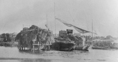
During this time this was the only club in the area on the beach except for the Smith’s Point House and that was run by the Nesbitt family. They had bathhouses there, a dock, and they had surf-shore dinners occasionally, usually on Sundays. It was located west of where the current bridge is, just opposite the real Smith’s Point, close to where the Coast Guard station was.

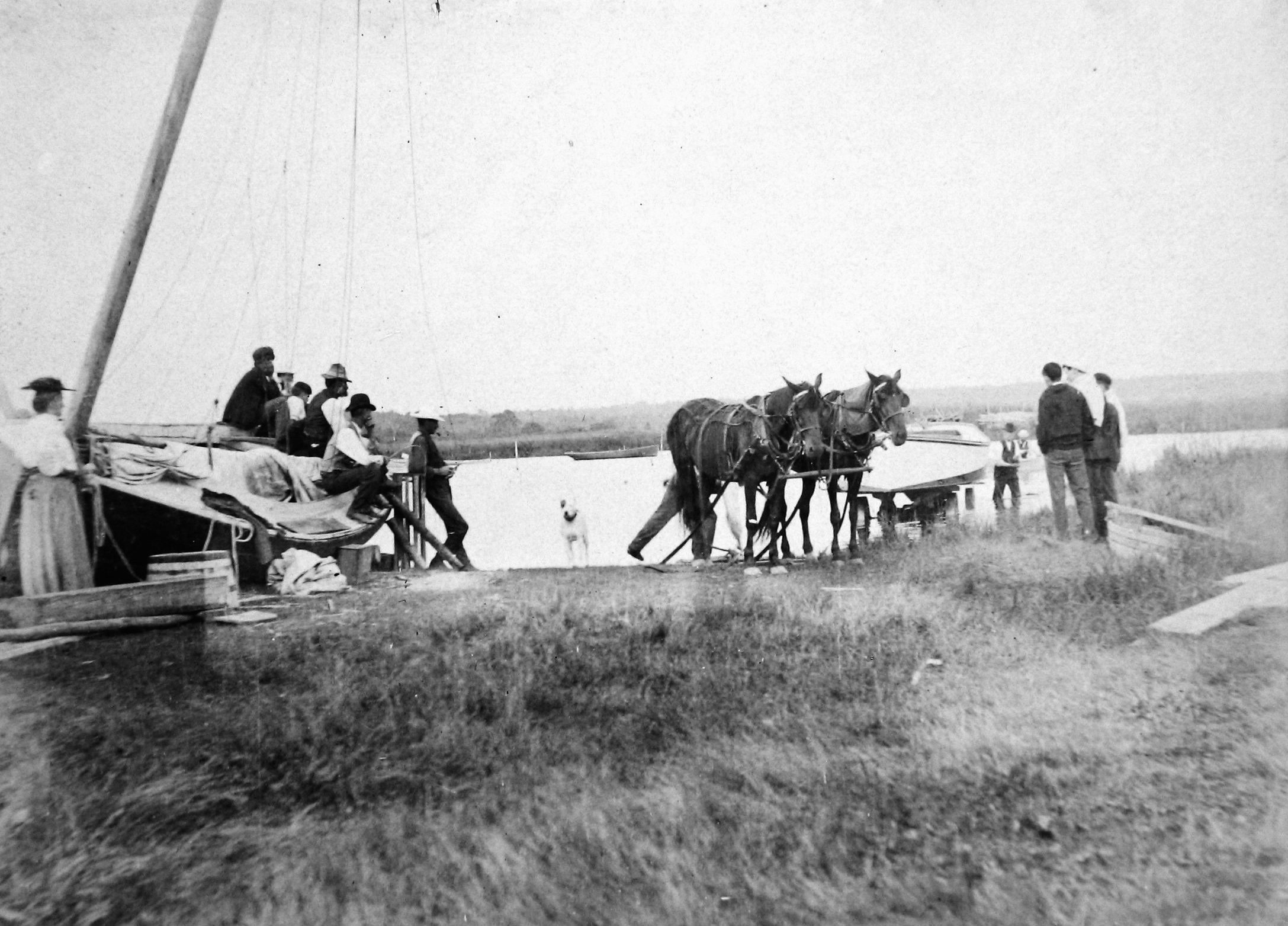
There were two ferries, sailboats, from Brookhaven. The first was run by Blyth Gerard and his boat was called the Fanny Fern. The other one was called the Woodmere [run by Frank Smith], and they went to Smith’s Point and that was the only other access to the beach other than the Old Inlet Club in the early days. There was no reason to have a Brookhaven beach club because we had ferries going to the Smith’s Point House from Carmans River. They were in competition with each other and both were sailboats, but I think the Fanny Fern had a kicker with it, a little one-cylinder engine.

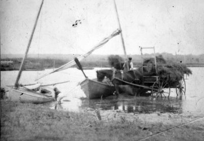
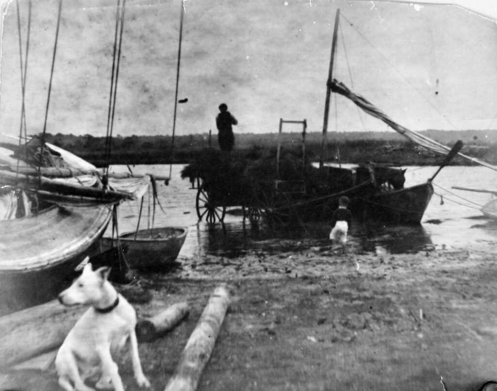
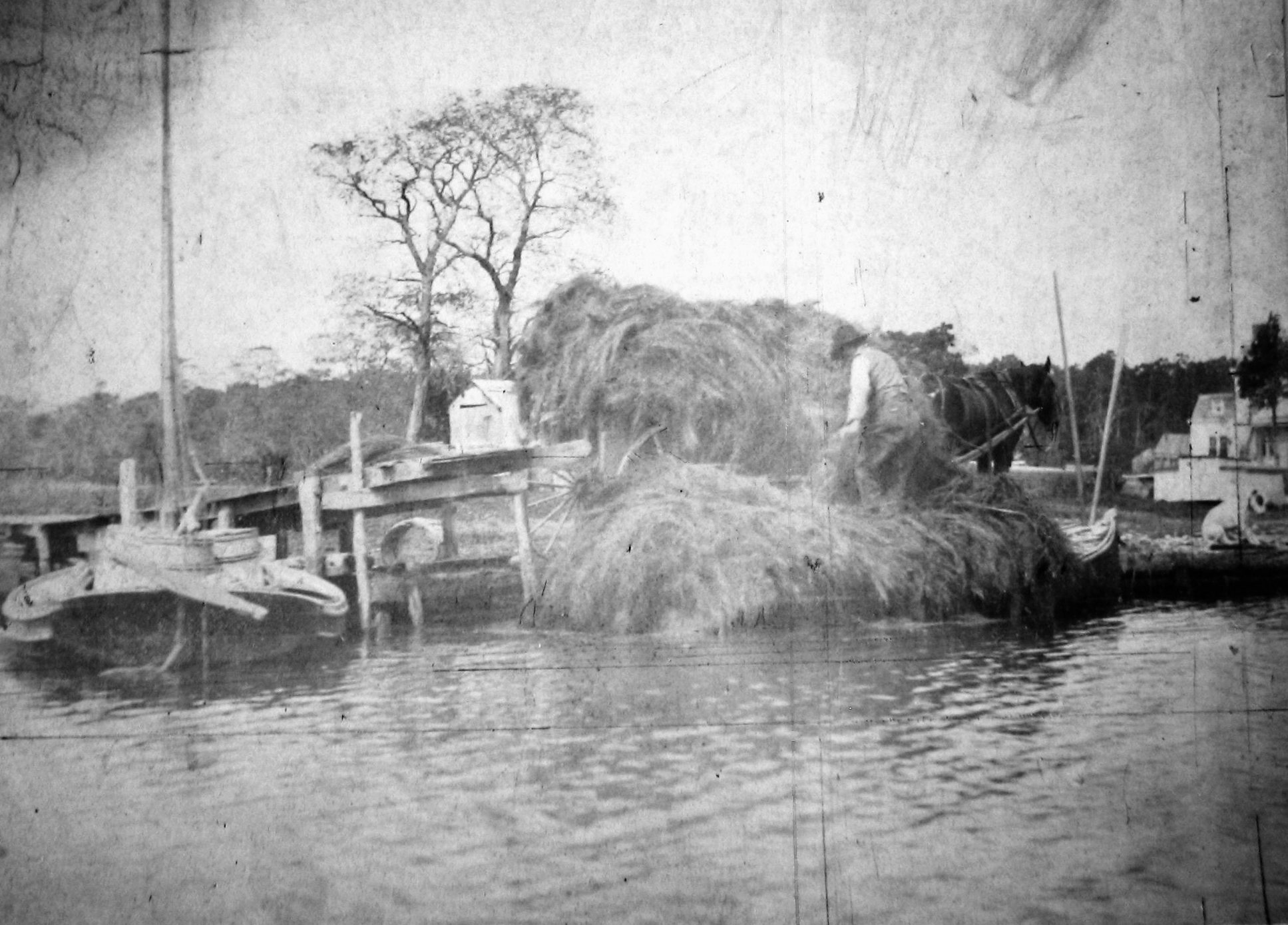
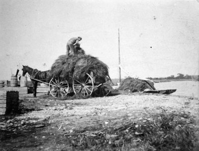
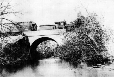
[The wooden bridges built in 1916, 1921 and 1927, spanning the area where the current Smith’s Point Bridge stands, lasted only a few years each as winter storms and ice destroyed them]. It was great snapper fishing from the wooden Smith’s Point bridge built in 1927, in fact, when I was 12 years old I got a boat of my own, a little sailboat, and I used to go over to Clint Miller’s. He had a little shack on the beach and hauled for bait, and I used to sell bait to the snapper fishermen on the bridge. I used to get 25 cents a quart for shiners. There was a hotel on the beach side of the bridge, it was called the Hedges Hotel, but I don’t know who owned the hotel. I also don’t know who paid to have the wooden bridges built. But Smith’s Point was really the Nesbitt beach house over near the Coast Guard Station. The boats and ferries would come in on the long dock they had there. One of my most memorable childhood experiences on the beach was before 1930 when the Betsy White wrecked and broke in half with the bow section landing west of Old Inlet and stern section to the east. She was “visited” by lots of locals, my brothers Newell, Bill and I included. We ended up with a piece of the anchor chain, which laid under our front porch for years. Other locals cut up the rest of the chain, hauled it back to the mainland and later the fire department used it for the restoration of the Brookhaven Hamlet memorial which they encircled with the chain. However, they were a few pieces short so I gave them my pieces to complete it.

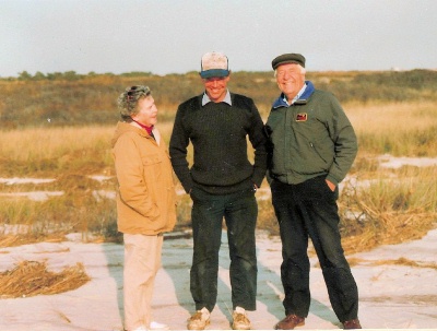
Helen, son Bill, and Bob Starke at site of Old Inlet Club, 1991

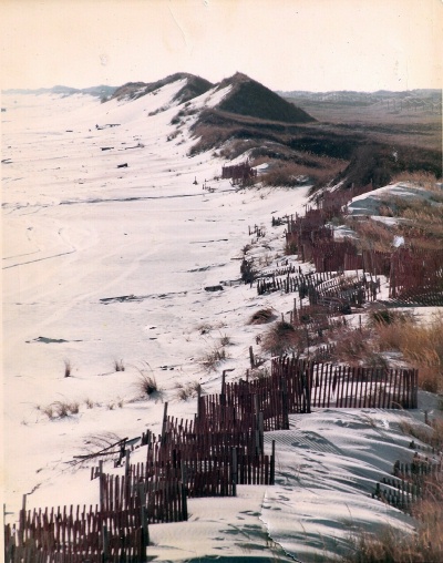
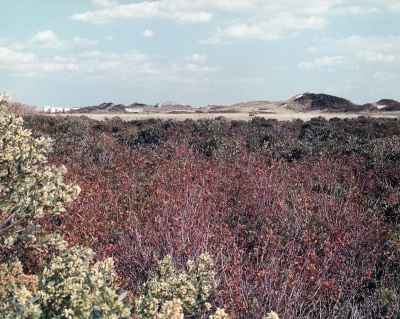
Dunes at the Old Inlet Beach Club area about 1960
Photo: © Marshall Bull

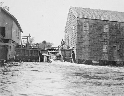
The Old Inlet Club was exactly where the current, 2003, boardwalk crossing is. Before the ’38 hurricane, Old Inlet had a place where you could get a sandwich or a cup of coffee and so on, and they had bathhouses and you rented them for the season. And they had family houses and they had women’s court and a men’s court, which were just lockers, and they had freshwater showers. Then the hurricane of ’38 came along and wiped everything out, including Nesbitt’s Smith Point House, which was never rebuilt. We [the Old Inlet Club members] had a meeting right after the hurricane and decided to rebuild the whole thing. Ted Everett had a new water tank made out of cypress and Ted towed it over to the beach. We rolled it up the boardwalk to a little promontory on the dune on the west side of the boardwalk down where the bathhouses were. Fortunately, the hurricane did not destroy the old pumping engine, which was an old, one-cylinder Fairbanks & Morse make-and-break connected to a freshwater well. We also had to replace the cesspools, which were located on the beach. Everything was put back in good shape. The members that chipped in to rebuild Old Inlet were noted in the record as equity members, and it came to pass later when the property was sold to the National Seashore those members who rebuilt the club got extra compensation. So, in short, after we rebuilt it Old Inlet resumed as before.

Now let’s talk about the 1950s and the creation of the Fire Place Beach Club. How that came to pass was that I was president of the Brookhaven Village Association at the time and we more or less decided that with the threat of Robert Moses’ plan to build a highway down the middle of Fire Island and also the interest in it becoming a National Seashore, if we wanted to have our own access to the beach and a beach club we’d better damn well buy a piece. We bought a stretch, from bay to ocean, that was 200’ wide from the Tibbs girls, Nancy Llungqvist and Barbara Horan. It was altogether, I believe, about five acres. We asked ourselves “How are we going to get the money to buy this piece?” So, we decided to follow what Old Inlet originally did. They had established the Hospital Point company and they bought the property and leased it to the Old Inlet Club and they put out bonds and stock in the Hospital Point Company. [As an aside, Hospital Point, which is adjacent to where the Old Inlet Club was to be built, got its name from an incident that happened in the early 1900s. Because of the deep water there, the Coast Guard used that point to rescue shipwrecked people and took them to Bellport for help.]

So we did the same. But we didn’t have a company. But like Old Inlet, which was not connected to the incorporated village, we were a private club. We thought of incorporating at the time but it was too much a complication, so we formed the Mattabank Corporation. It’s an Indian name for the barrier beach. We told the people of Brookhaven they could buy one share of stock for $25 and one bond which was $100. And the bond would pay 6% interest. We sold enough stocks and bonds to pay the $3,000 an acre, or $15,000 for the lot. I don’t remember the exact date, but it was somewhere in the mid-1950s. We then leased it to the BVA who, in turn, named it the Fire Place Beach Club.

The Fire Place Beach Club was different from the Old Inlet Club in this respect: The Old Inlet Club was a private club, as we [BVA] were, but our members were restricted to a geographic area – Brookhaven Hamlet. We did not have the non-residents same arrangement as we did with Squassux Landing, where we allowed them to come in at a premium. To be a member of the Fire Place Beach Club we defined the bounds of the Hamlet as follows: on the east Carmans River, on the north Montauk Highway, on the west Arthur Avenue and Bellhaven Road and on the south the bay. The reason we wanted to keep it small is because we didn’t want to spend a lot of money. We didn’t feel we could spend the amount of money that they did in Bellport [with the Old Inlet Club] so we figured if we had the money for the boardwalk, and the change house and the toilets was the best we could do. By the way, I also kept my membership in the Old Inlet Club until it was dissolved.

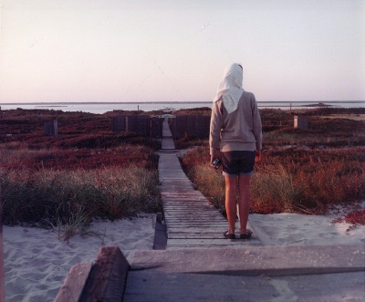
Fire Place Beach Club Boardwalk looking toward
Great South Bay and Fire Place hamlet.
Photo: © Marshall Bull

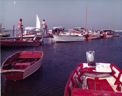
Boats and Dock at the Fire Place Beach Club
Photo: © Marshall Bull

Because of the way these two clubs evolved historically, Bellport’s Old Inlet club was more east of Brookhaven’s Fire Place Beach Club, just the opposite of the Villages’ position on the mainland. But we both used the Old Inlet channel to get to our respective beaches. As an aside, the Incorporated Village of Bellport was smart enough to realize the National Seashore was going to go out and buy property on the beach and they would have to automatically skip any incorporated village property so they bought what is today Ho-Hum Beach.

Then came the National Seashore. They [the Feds] were very friendly with Ted Everett [President Old Inlet Club] over the years, and I got together with Ted to see what we could do to see that whatever they offered us let’s make sure it was a fair deal. After a time both the Hospital Point and Mattabank Corporations were made offers, and I thought that was a fair offer for our piece, $32,000, nearly twice what we had paid for it a decade earlier, plus a couple of thousand extra for the boardwalk and the building. The Hospital Point Corp. was offered quite a bit more because they had five times as much property [25 acres] and after many discussions with Ted we decided that we’d take it. However, we decided we’d push for a lease back and make that a condition. We both met with the fellow doing the negotiating for the National Seashore at the same time, and we told him we would not challenge him on the price but we’d like to have a lease back and asked for five years. They agreed, we sold it to them, and we continued to run Fire Place Beach as before. The Mattabank stockholders made out quite well, receiving about $500 for their original $125 investment. But when our five years were up, they didn’t renew and tore up the Fire Place Beach Club dock, boardwalk and buildings.

A positive thing that came out of this is that the Brookhaven Village Association, which held a number of Mattabank’s stocks and bonds, received several thousand dollars and used that money to create the west canal at Squassux Landing. And, after the five year lease back of the Old Inlet Club, the National Seashore decided not to demolish the Old Inlet structures and said that this would be available to anyone with a boat and we could continue to have access to the beach as before, so we were happy that we still had access to the beach. But, as you know, the Federal government did not continue to do repairs and gradually everything fizzled out to what you see today, just a boardwalk crossing.

What the Old Inlet Club and the Fire Place Beach Club had in common was that our members liked boats, enjoyed going over to the beach, and going over there by boat was half the fun. They enjoyed swimming in the ocean and they all appreciated that the beach was one of the finest beaches in the world, and so it is, with the white sand, dunes, and to say nothing of the beach plums, which everyone picked in the fall. I think I mentioned that Dennis Puleston and Ted Everett drove up to Cape Cod at the suggestion of the Federal negotiator to see how the National Seashore was run there. Cape Cod is a little different in that they could get to most places by car. The barrier beach that we’re talking about you could only get to by boat. What I hope for now is that the National Seashore would maintain just two things: the boardwalk and the dock. If they do that we could continue to have access to the beach, just like Cape Cod. It’s just a small fraction of the amenities that the Old Inlet Club had. Heck, you could take a freshwater shower, you had your own bathhouse, your own locker. It was peaches and if you didn’t want to take a picnic lunch you could at least have a hamburger and a cup of coffee. And they [Old Inlet] made very nice chowder, by the way.

Old Inlet Club Viewed from the Fire Place Beach Club
Photo: © Marshall Bull

Interview and transcription by Marty Van Lith
Originally published in the Post-Morrow Foundation Newsletter, Fall 2003.
© Marty van Lith, 2009.

St. George’s Manor

Manor of St. George

The Manor of St. George (or Georges) occupied nearly all of modern Brookhaven Town from the Carman’s River eastward to the Town of Southampton, and from the Atlantic Ocean to the middle of the island, an area I estimate to be about 90 square miles. Also included was a noncontiguous estate on the north shore at Setauket, which was the early seat of the Manor. The original patent for the Manor of St. George was granted by Gov. Fletcher of New York to Colonel William “Tangier” Smith in 1693. An additional patent was granted in 1697 annexing a large tract of land on the east.

Included within the bounds of the patents was a small parcel on the western side of the Carman’s River (then known as the Connecticut River) called Yamphank Neck. However, a deed five years earlier recorded the sale of the Neck to a Town freeholder, Samuel Terrill; and the Town apparently always considered the parcel within the Town governmental jurisdiction. This area included much of what we now call the Hamlet of South Haven. For 200 years there were legal disputes over the parcel. The Neck theoretically remained under the jurisdiction of the Lord of the Manor until Town jurisdiction was formalized in 1789 when the newly independent government annexed the Manor to the Town and the Manoria prerogatives ended. In Colonial times, the Manor was an important influence in the Town of Brookhaven and all of eastern Long Island; and it is mentioned several times in these pages and in the Hamlet People genealogies.

This drawing of the northerly Manor House at Setauket of the Manor of St. George is from Smith and Brainbridge’s The Tangier Smith Family.

Originally from
The New-York Magazine, October 1792
(original caption: Seat of the Honorable Selah Strong, Esq., St. George’s Manor, Suffolk County, Long Island)

1956 aerial picture of the Manor House at Mastic. .

View of Brookhaven Hamlet from the Manor House site at Mastic.

The Manors in New York, published by the New York Genealogical and Biographical Society

When the colony of New York came under rule of the British Crown, an attempt was made to get away from the more democratic forms of local government established under the settlements of the New England colonies and eastern Long Island. The previous presence of large landholders under Dutch rule and the increasing number of persons of wealth and “good” family coming to the already thriving colony set the stage for the introduction of a class of landed gentry such as existed in England. Those colonists with extensive land holdings were therefore allowed of obtain a patent for a manorial Lordship, if they so desired, with local autonomy to collect taxes, and to be exempt from the authority of the local town governments—and many were also given authority to hold “court leet and court baron” over the tenants.

A total of 23 manorial grants were made—21 of them within the present state of New York, and one each in Massachusetts and Rhode Island. The largest was over 1 million acres in present-day Albany, Rensselaer and Columbia counties; the smallest was about 300 acres. The 3300 acre Gardiner’s Island off the eastern tip of Long Island is the only manor in New York still owned entirely by descendants of the original grantee – David Lord Gardiner.

The experiment was not a success. New colonists, instead of flocking to become manorial tenants of the Lord’s lands, went instead to surrounding areas where they could easily become owners of their own lands and be their own masters. The manors survived by granting long leases or by selling off parcels outright. Moreover, many manors were not entailed and so were broken up by inheritance.

The Manor of St. George and Patent of 1697

With the help and advice of New York Gov. Dongan, Col. William Smith began to acquire land in southeastern Brookhaven Town in 1688. In May of 1691 a tract of land eastward from the Connecticut (Carman’s) River to the Mastic (Forge) River was purchased from the Indian, John Mayhew. A patent for this land was granted by New York Gov. Fletcher on Oct. 9, 1693. This included the beachfront from Huntington East Gut (Old Inlet) to “Cuptwauge” (Cupsogue) at the Southampton Town line. This included the islands near the beach. This property ran north to what today is Middle Country Road (NYS Rt. 25). These lands were confirmed under the title of St. George’s Manor.

On May 14, 1691 Colonel William Smith bought from the native, John Mayhew, much of the land east of the Mastic River (Forge River) to the Southampton line (Eastport) except the two necks, “being Meritces (Moriches) and Mamanok Necks, lying together.” Colonel Smith received a patent from Gov. Fletcher on 17 June 1697 for this land, which was annexed to the original St. Georges Manor. (A patent for the much smaller tract that remained separate was granted to Richard Smith, son of Richard Smith “Bull” the patentee of Smithtown, NY, on 17 Nov 1697, and came to be known as the Moriches Patent or Moriches Patentship.) Col. Smith managed to hold but a small portion of his land against the claims of settlers already living within this area, some of whom had deeds from the natives.

The total lands in Colonel Smith’s manor and associated patents comprised an area approximately 64,000 acres, roughly 40% of the land area of the present Town of Brookhaven.

These two patents, with but a few exceptions, meant that Colonel Smith essentially owned all the southeastern portion of the Town of Brookhaven from the Connecticut (Carmans) River east to the Town of Southampton, and from the Atlantic Ocean north to midway across Long Island (to Middle Country Rd.).

In addition, Colonel Smith held non-contiguous lands on Strongs Neck at Setauket, on the north shore. The drawing on this page was of the Manor House at this site—the older of the Manor houses and the original “seat” of the proprietorship. Family convention referred to the northern estate as “St. Georges Manor” and the southern tract as “the Manor of St. George”. The present St. George’s Manor House in Setauket was extensively rebuilt in 1844 to replace the manor house that was there during the Revolutionary War.

The original Manor lands did not long survive intact. On the death of Colonel Smith “Tangier” in 1705, the Setauket estate was inherited by Colonel Henry Smith, William “Tangier” Smith’s eldest surviving son. The Mastic estate was inherited by Major William Henry Smith, the next eldest surviving son. This division of property suggests that the Setauket property was considered the more valuable in spite of the vastness of the Mastic lands. There was a third surviving son, Charles Jeffrey, who may have received some property—I have not researched this. (Charles Jeffrey died unmarried of small pox on 23 May 1715 at the Setauket manor house.)

The Setauket property by the end of the 18th century, was owned by Selah Strong. I have not researched this evolution.

On the death of Major William Henry Smith in 1743, his eldest surviving son, Judge William Smith, inherited the Mastic estate. After the Revolution, Judge Smith divided the his estate among his sons—his eldest son John “The General” was given most of the still remaining Mastic section, and his second son, William was given a smaller estate “Longwood” in the northern part of Yaphank (see map). Much of the Longwood estate remained intact in the Smith family until 1968, and in 1974 the estate house and 35 acres became the property of the Town of Brookhaven as a museum and park (see Longwood for a much more comprehensive history).

On the large southern tract, a Manor House was built on Mastic Neck (now sometimes called Smith’s Point) overlooking the east end of the Great South Bay. There is some controversy as to when the first manor house was built at the south—some say 1690 while others say about 1709. I’m inclined to believe that it was the latter date, which would have been shortly after Col. William “Tangier” Smith’s death in 1705 and the southern tracts came into the possession of his son, Major William Henry Smith. It would have been then that there was the need of another manor house; up until that time the family was well ensconced in Setauket.

During the Revolutionary War the British confiscated the Manor House and erected a small fort. The location was well suited to protect the eastern end of the Great South Bay and the inlet from the Atlantic Ocean that then existed there. The Fort and Manor were destroyed by Major Benjamin Tallmadge and his dismounted dragoons when they attacked Fort St. George in 1780 and returned to Connecticut with the captured British soldiers. The Manor house was rebuilt after the war. Family legend has it that there were three generations of manor houses—the original house, the house destroyed during the Revolutionary War, and the present house. The original house was said to have been built about 100-125 feet from the present house. It is also said that the present house incorporates parts of the original house—however, I think this unlikely. It is hard for me to imagine that any useable portion of the Revolutionary War era structures could have remained after being torched by Major Tallmadge. As far as I know, there have been no archeological studies or records research which would suggest otherwise.

Some of Colonel “Tangier” Smith’s original land therefore also remains intact as the Manor of St. George at Mastic, with its buildings and 127 acres. It is now also a public museum and park. The Manor House and grounds were given to the people of Brookhaven Town and the public at large in 1955 by Eugenie Annie Tangier Smith. The grounds are accessible from the William Floyd Parkway in Shirley.

The Manor of St. George remained an independent political jurisdiction until after the Revolutionary War, when, by act of the newly independent New York State legislature in 1789, it was formally annexed to the Town of Brookhaven. At that time, the Lord’s manorial prerogatives ceased, although the Lord’s property rights remained. The “Lords” of the manor continued to be prominent in the affairs of the Town.

Fire Place Connections: Colonel William “Tangier” Smith’s granddaughter, Gloryana Smith, married Justice Nathaniel Brewster (ii), a large land owner in Fire Place and Occumbomock (Bellport). And his great-great-grandson William (5th “Lord” of the Manor) married Hannah Carman, daughter of Samuel Carman, Sr., of Fire Place/South Haven. (It is said that William, who claimed ownership and control of the river then called Connecticut, had it renamed Carman’s River in honor of his wife.) There may have been other “Fire Place” connections not yet identified—Fire Place being the “poorer” community on the other side of the river.

Floyd Estate

In about 1718, some 4000 acres of the Manor in eastern Mastic Neck was acquired by Richard Floyd, who gave it to his son Nicoll, who built the original estate house in 1724. He cleared and planted the lands and made it into a prosperous plantation. He and his wife had nine children and in 1755 both died of typhoid fever.

The large estate and responsibility for the younger children fell to the twenty year old eldest son, William, who was a signer of the Declaration of Independence. William was born on the estate in 1734, the first of the Floyds to be born there. He was the first President of the South Haven Presbyterian Church’s Board of Trustees. As Long Island was under British control during the Revolutionary War, the Floyd family had to flee to Connecticut. William Floyd’s descendent, Mary Gelston Floyd, married John Lawrence Ireland of Fire Place. William Floyd and family moved to Westernville, Oneida County, NY in the early 19th century.

The mansion house and 35 acres of land are all that remain of the original Floyd estate. They are maintained by the National Park Service.

Frederick Kost’s Salt Haying

Frederick W. Kost

Frederick W. Kost (1861-1923) was a landscape and impressionist painter at the turn of the 20th century. He was a resident of Brookhaven Hamlet and lived in the Deacon Daniel Hawkins House [Historic Structure ID 24B].

He also took many photographs of scenes in Brookhaven Hamlet, a collection of which may be found in the Post-Morrow Foundation archives, including some of his original glass plates.

Salt Haying

Among Kost’s photographs are pictures documenting the harvesting of salt hay within Brookhaven Hamlet. While these pictures are from around the turn of the 20th century, the work was likely little different from the harvesting done from the 17th century onward. The harvesting of salt hay was also the subject of several of Kost’s Paintings.

Salt hay was the principal natural resource which lead to the initial settlement of Fire Place by the early Setauket farmers in the 17th century. Salt hay grows naturally in the marshes along the ocean bays of New England and Long Island. It was highly valued by the early farmers as a supplement to “English” hay, in that it required no cultivation or clearing of land. This hay also was shipped to markets, such as the Bushwick Hay Market in Brooklyn, and sold as packing material, insulation for ice, fodder, bedding for cattle, and mulch for crops.

On 10 June 1664, residents of the original Brookhaven Town settlement at Setauket purchased a large tract of land from the native Americans which became known as Old Purchase at South, which included the area of Brookhaven Hamlet. A portion of this purchase was quickly divided into valuable “meadow shares” extending from the Great South Bay north to where the more forested upland region began (essentially to where Beaver Dam Road is now). The evidence of these original shares can still be seen in the general north-south alignment of properties in aerial views of the Hamlet. (The less valuable upland shares were divided later.)

The original prints of some of the photographs below were not of very good quality. They have been enhanced by adjusting the contrast, minor cropping, and converted to grayscale. Overall. they give a good overview of haying. One is dated 1906, which is likely the date for all. Kost purchased his Brookhaven home in 1906.

Notation on back: Wallace Swezey, Carman River, Brookhaven

Notation on Back: Wallace Swezey

Notation on back: Wallace Swezey – Fred Swezey
[Fred is likely the boy. He would have been about 8 in 1906. Wallace was his father.]

Notation on back: Wallace Swezey, Fred Swezey, Kost’s dog “Murphy.”

Notations on back (in several different hands): Carman River 1906
Carman House* on Carman River. Later Lush House. Later Michelson House. Burned down about 1968.
“Murphy” Dog (Mr. Kost’s dog)
* Likely referring to the house in the right background.

Wallace Swezey, seen in these photographs, was an ice dealer and had at least one ice house in Brookhaven Hamlet. The hay being harvested here was likely to be used for insulation in the ice houses.

He harvested the ice from several fresh water ponds in the Hamlet.

Early Suffolk Cub Documents:

♦ Jones Rogers Fifteen-Year Lease with Samuel Carman for the “Suffolk Association;”
♦ The Suffolk Club Incorporated Twice—11 Apr 1860, as “Suffolk County Society,” and 27 Mar 1866, as “The Suffolk Club;”
♦ “The Suffolk Club” is Conveyed Property, 19 Apr 1866

The following are notes by Richard A. Thomas on the incorporation and founding of the Suffolk Club, an exclusive fishing and hunting club of the nineteenth century in South Haven, Suffolk County, NY. It is based on an email written 2 July 2011 to members f the Fire Place History Club of Brookhaven and South Haven hamlet.

Lease from Samuel Carman to Jones Rogers and Other Members of the Suffolk Association of the City and County of New York, 01 January 1858
Prepared by Richard A. Thomas, July 02, 2011

For $300 per year, “Jones Rogers and other members of the Suffolk Association of the City and County of New York” got a 15-year lease from Sam Carman (beginning 01 January 1858) with:

The following rights and privileges Viz. The exclusive right of the said party of the first part to the trout fishing in the pond and Stream at South Haven town aforesaid from the Mill dam Northerly to the rail road. [That is, the party of the second part, the Suffolk Association, got the exclusive right of the party of the first part, Samuel Carman, to the trout fishing.] Also as long as the said parties of the second part lease or leases And have the exclusive right of the said pond and stream for trout fishing and the right of any preserving and prosecuting any person or persons taking or claiming the said Trout in the pond or stream. They also have the privilege of trout fishing in any waters south of the Mill dam belonging to the said party of the first part. Also the privilege of turning out increasing preserving hunting and Shooting game without doing unnessary [sic.] damage to the said property On all lands now in possession of the said party of the first part on the same while in the possession of his heirs executors or administrators during the period of the said lease or leases. It being understood that should the said party of the first part his heirs executors or administrators sell any of the above premises except the Pond and Stream the above privilege ceases on the same conveyed 1View original document 2View original document 3View original document.

The lease wasn’t recorded until eight and a half years later. Samuel Carman appeared before David T. Hawkins, Justice of the Peace of Suffolk County on 10 May 1866 and stated that he did indeed sign the lease, then it was recorded on 01 Jun 1866.

Jones Rogers had transferred the lease “for and during the residual of the term thereby granted” to Joseph Grafton of the City of New York (for one dollar) on 29 April 1864.

Joseph Grafton, almost two years later, also for one dollar, transferred the lease to “The Suffolk Club” its successors and assigns on the 19 Apr 1866.

The Suffolk Club Incorporated Twice, 11 Apr 1860, as “Suffolk County Society,”
and 27 Mar 1866, as “The Suffolk Club”

The Suffolk Club had been incorporated by a special act of the New York State Legislature on 11 April 1860 with the name the “Suffolk County Society.” Jones Rogers and Isaac M. Right were two of the five original incorporators. It was incorporated “for a period not exceeding fifty years.”

There were five directors listed in the Act.

In 1865, the New York State legislature passed a new law that made it possible for recreational societies and clubs to incorporate more easily, so it was no longer necessary to have a special act passed by the legislature for each incorporation or renewal of incorporation.

You can read the details here:

Here is the first part of the 1865 law:
CHAP. 368.

AN ACT for the incorporation of societies or clubs for certain social and recreative purposes.

Passed April 11, 1865.

The People of the State of New York, represented in Senate and Assembly, do enact as follows:

Certificate to be filed. 1. Any five or more persons of full age, citizens of the United States, a majority of whom shall be also citizens of this state, who shall desire to associate themselves for social, gymnastic, esthetic, musical, yachting, hunting, fishing, batting, or lawful sporting purposes, may make, sign and acknowledge before any officer authorized to take the acknowledgment of deeds in this state, and file in the office of the secretary of state, and also in the office of the clerk of the county in which the office of such society shall be situated, a certificate in writing, in which shall he stated the name or title by which such society shall be known in law, the particular business and object of such society, the number of trustees, directors or managers to manage the same, and the names of the trustees, directors or managers for the first year of its existence ; but such certificate shall not be filed, unless by the written consent and approbation of one of the justices of the supreme court of the district in which the principal office of such company or association shall be located, to be indorsed on such certificate; but nothing in this act contained shall authorize the incorporation of any society or club for any purpose repugnant to any statute of this state or prohibited thereby.

On June 10, 1873, the law was amended to establish the method and filing requirements for increasing the number of trustees to not more than thirteen or diminishing the number to not less than three.

“The Suffolk Club,” although already incorporated elected to re-incorporate under the 1865 Act and to incorporate under a different name, “The Suffolk Club.”

It did so on 27 Mar 1866. This second incorporation is recorded in the Liber “B” of the Certificates of Incorporation of Suffolk County, copied on Friday, 01 Jul 2011 View original document.

The incorporation reveals some new names:

Peter H. Vandervoort
Victor Delannay (or Delaunay), and
J. Gurley Grafton

“The Suffolk Club” is Conveyed Property, 19 Apr 1866

On the same day Joseph Grafton conveyed the lease to “The Suffolk Club,” he also conveyed a large property he owned to “The Suffolk Club.” [The size isn’t stated, but there is enough information in the deed to plot the parcel and compute the acreage.]

The Suffolk Club paid him $16,000 for the property.

I expect the property, or parts of it, had been in the hands of members of The Suffolk Club for a long period, since Isaac M. Wright had already erected a house upon it. The deed below indicates that one acre of the land within the boundary described, on which Isaac M. Wright had erected his house, was not being conveyed to The Suffolk Club by Joseph Grafton.

Isaac Wright may have already owned his one acre. That is, it may have been entirely surrounded by the Grafton property but not a part of it, and the property was excluded for that reason. Or Joseph and Elizabeth Grafton may have conveyed the one acre to Isaac Wright later. I can check that at Riverhead.
Liber 138 Page 427
Joseph Grafton and Elizabeth (Remsen) Grafton, his wife, to “The Suffolk Club”
19 Apr 1866
$16,000

This Indenture
Made the nineteenth day of April in the year one thousand eight hundred and Sixty Six
Between
Joseph Grafton of the city of New York and Elizabeth his wife
parties of the first part
And
“The Suffolk Club: an association duly inoperated [sic.] under the act of the Legislature of the State of New York passed April 11th 1865 Entitled an Act for the incorporation of societies or clubs for certain social and recreative purposes” and the amendment thereto passed May 1st 1865
of the second part.

Witnesseth That
the said parties of the first part for and in consideration of the
Sum of Sixteen Thousand Dollars
lawful Money of the United States of America to them in hand paid by the said parties of the second part, at or before the ensealing and delivery of these presents, the receipt whereof is hereby acknowledged
have granted , bargained, sold, aliened remised, released, conveyed and confirmed and by these presents do grant, bargain sell alien remise, release, convey and confirm
unto the said parties of the second part and to their successors and assigns for ever.

All that certain piece and parcel of land lying and being in the town of Brookhaven in the County of Suffolk and State of New York and bounded and described as follows viz.

Beginning at a point on the Northerly side of the Girrard road running from South Haven to Yaphank station adjoining apiece of land lately belonging to Zophas Tooker deceased at a stone and recently purchased by Samuel Carman:
from thence running North eighty three degrees and thirty Minutes West, Three hundred and eighty feet nine inches
thence north seventy three degrees and forty minutes West one hundred and forty feet,
thence north sixty four degrees and forty minutes West four hundred and seventy one feet and two inches;
thence north sixty-eight degrees and fifty five minutes West two hundred and ninety feet, two inches,
thence north seventy two degrees and thirty minutes west one hundred and sixty feet and nine inches;
thence north fifty degrees five degrees and thirty minutes West One hundred and fifty nine feet two inches,
thence north sixty six degrees West one hundred and seventy-nine feet, ten inches;
thence north nine degrees East, two hundred and twenty four feet,
thence north nineteen degrees and thirty minutes East, one hundred and ninety seven feet seven inches;
Thence north twenty-six degreed and ten minutes East two hundred and ninety nine feet six inches,
thence north nineteen degrees and ten minutes East, six hundred and fifty nine feet six inches;

etc., etc.
thence south six degrees West, five hundred feet to the place of Beginning

Excepting and reserving from said described premises a parcel of said premises containing about one acre, and on which Isaac M Wright has erected an house and outhouses.

Together with all and singular the tenements, hereditaments and appurtenances thereunto belonging or in any wise appertaining, and the reversion and reversers ions, remainder and remainders, rents issues and profits thereof.

And also all the Estate right, title, interest, dower rights of dower property possession claim and demand whatsoever as well in law as in equity, of the said parties of the first part, of, in, or to the above described premises and every part, o, in or to the above described premises and every part and parcel thereof, with, with the appurtenances.

To Have and To Hold all and singular the above mentioned and described premises, together with the appurtenances unto the said parties of the second part their successors or assigns, for ever

Suffolk Club Purchases Hunting Reserve Site from Henry Carman, 1875

Suffolk Club Purchases Hunting Reserve from Henry W. Carman
Carman Homestead Not Included in Purchase

In 1875, the exclusive Suffolk Club purchased the core of their hunting reserve from Henry Carman. Prior to that time they and their predecessor organizations had leased the lands and hunting rights from the Carman family. The Club also leased and owned other parcels along the Carman’s river as far south as the Great South Bay.

The “Carman homestead” dwelling was apparently not included in this sale to the Suffolk Club.. If it had been it would surely have been mentioned in the deed.

The deed contains the following clause:

(Reserving however to the said parties of the first part [Henry W. and Isabel B. Carman], their heirs and assigns the right to use the West bank of said streams from the going over place or bridge to the first locust stake above mentioned for milk house, wash house, watering cattle and other domestic purposes but such reservations shall in no way be construed to allow him or them to diverge the water or stream from its present course, nor to interfere with the exclusive rights of fishing and reserving also the same view on the North side of the dwelling house he now has up the pond, so that no erection shall be made to substantially interfere with it, ….)

which states, that in their conveyance of the property to “The Suffolk Club,” Henry and Isabel are reserving their view to the north from their dwelling house up to the pond.

So even though the land is conveyed, this reservation prohibits “The Suffolk Club” from erecting any buildings or doing anything whatsoever that would interfere “substantially” with their view to the north “up to the pond,” or their access to the river.

The description of the property says the southern boundary of the property being conveyed starts at the north side of the bridge at the old “goin’ over,” then goes north along the west bank of the river to the south side of the dam then goes again northwardly to a point two feet north of the planning mill and 18 feet west of the mill flume, then south-westerly to the north side of South Country Road (then west along the north side of South Country Road to where it intersects Gerard Rd).
The “planing mill” and the mill flume were structures attached to the dam. The planning mill was a small structure at at the westerly edge of the mill dam, and the flume immediately to its east (next east was the main grist mill structure). The point “two feet north of the planing mill” was likely a somewhat arbitrary point on the mill dam, and the line south-westerly from that point to South Country road would seem to be a bearing that would run north of the old Carman homestead. If all the Carman property on the north side of South Country road were intended to have been included in the purchase, there would have been no need to have described a boundary from the point of beginning that went north along the westerly side of the river to a point two feet north of the planning mill, then south-westerly back to South Country road.

On Henry Carman’s death in in 1919, the Henry Carman farm was purchased by Charles Robinson and developed as a duck farm. While the main farm site was south of Montauk highway, the old Carman homestead was unambiguously owned by Robinson, was their first residence, and eventually razed by him in 1936.

Much of this material was researched by Richard A. Thomas

Looking north. Planning mill to left; flume in center; main mill structure to the right. The man standing in the center is said to be Henry Carman; however this has not been verified.

Deed: Henry W. Carman to “The Suffolk Club,” 1 January 1875.

Suffolk County, New York, Deeds: Liber 214, page 122.

This Indenture,

Made the first day of January in the year one thousand Eight hundred and Seventy five. Between Henry W. Carman of the Town of Brookhaven, County of Suffolk and State of New York and Isabel B. Carman his wife parties of the first part and “The Suffolk Club” party of the second part,

Witnesseth That the said parties of the first part for and in consideration of the sum of Twenty Thousand Dollars lawful money of the United States to them in hand paid by the said party of the second part at or before the ensealing and delivery of these presents the receipt whereof is hereby acknowledged and the said part of the second part successors, executors and administrators forever released and discharged from the same by these presents have granted bargained, sold aliened remised released conveyed and confirmed and by these presents do grant bargain sell alien remise release convey and confirm unto the said party of the second part and successors and assigns forever,

All those certain lands, land under water, pond and mill situate at South Haven Town of Brookhaven County of Suffolk State of New York, bounded and described as follows,

Commencing at a point on the West side of the Connecticut or Carman’s River, at the going over place or North side of the bridge running thence Northwardly by and with the West bank of said River towards the South side of the dam, where a locust stake is driven for a boundary running thence again Northwardly to another locust stake at a point two feet northwardly of the planing mill, and distant from the west side of the mill flume about Eighteen feet, thence about south-westwardly to a locust stake fixed for a boundary on the North side of the South Country Road, thence by and with the South Country Road till it intersects the Gerard Road, thence Westerly by and with the Gerard Road past lands of Frederick Schuchardt and the “Suffolk Club” to a point on the North side of the Gerard Road, called the Southwest point of Cato’s Garden, and to the land of Robert Carman where formerly stood a blazed tree, where a locust stake is fixed for a boundary running thence Northerly along land devised by the late Samuel Carman to said Robert Carman to a stake and stone to land of Wm Sidney Smith, thence Easterly along land of said Wm Sidney Smith and to the East side of said River, thence Southerly along the East side of said river and including the Mill Pond to the Mill dam, together with the dam, flumes, race ways, pond, grist mill and Machinery, rights of flowage, water and reparian (sic) rights and all other rights and privileges appertaining, and all the rights of the said parties of the first part to take Sand on the East side of the River for repairing rebuilding and sustaining the said dam and running thence and including said dam, mill and appurtenances together with the stream and the land under the same down to the said going over place or bridge, thence across the river to the place of beginning,

And Also, all the right title and interest of the said parties of the first part, of, in, and to the river north of the aforesaid boundary up to the Yaphank line as this same is described in the Conveyance to Samuel Carman Jr. by his father Samuel Carman the Elder also in the will of the late Samuel Carman, —

Excepting there out and there from the lands conveyed by the late Samuel Carman in his Life Time to the “Suffolk Club” and also the land conveyed by the said parties of the first part to . . . . Kouser and now in possession of Frederick Schuchardt (Reserving however to the said parties of the first part, their heirs and assigns the right to use the West bank of said streams from the going over place or bridge to the first locust stake above mentioned for milk house, wash house, watering cattle and other domestic purposes but such reservations shall in no way be construed to allow him or them to diverge the water or stream from its present course, nor to interfere with the exclusive rights of fishing and reserving also the same view on the North side of the dwelling house he now has up the pond, so that no erection shall be made to substantially interfere with it, the aforesaid premises intended to be conveyed containing (without the land under the water) by estimation Three Hundred and Fifty acres, be the same more or less,

Together with all and singular the tenements hereditaments, and appurtenances thereunto belonging or in any wise appertaining and the reversion and reversions remainder and remainders rents issues and profits thereof,

And Also, all the estate right title interest dower right of dower property possession claim and demand whatsoever as well in law as in Equity of the parties of the first part of in and to the same and every part and parcel thereof with the appurtenances,

To Have and to hold the above granted bargained and described premises with the appurtenances unto the said party of the second part its successors and assigns to its and their own proper use, benefit and behoof forever,

And the said parties of the first part for their heirs executors and administrators do covenant grant and agree to and with the said party of the second part its successors and assigns that the said parties of the first part at the time of the sealing and delivery of these presents are lawfully seized in all and singular the above granted and described premises with the appurtenances, and have good right, full power and lawful authority to grant bargain sell and convey the same in manner aforesaid,

And that the said party of the second part its successors and assigns shall and may at all times hereafter peaceably and quietly have hold use occupy possess and enjoy the above granted premises and every part and parcel thereof with the appurtenances without any let suit trouble molestation eviction or disturbance of the said parties of the first part their heirs or assigns or of any other person or persons lawfully claiming or to claim the same,

And the same now are free clear discharged and unencumbered of and from all former and other grants titles charges estates judgments eases assessments and encumbrances of what nature or kind soever (sic),

And also, that the said parties of the first part and their heirs and all and every person and persons whomsoever lawfully or equitably deriving any estate right title or interest, of, in or to the herein before granted premises by from under or in trust for them or either of them shall and will at any time or times hereafter upon the reasonable request and at the proper cost and charges in the law of the said party of the second part successors and assigns make, do and execute, or cause to be made done and executed all and every such further and other lawful and reasonable acts conveyances and assurance in the law for the better and more effectually vesting and confirming the premises hereby granted or so intended to be in and to the said party of the second part successors and assigns forever, as by the said party of the second part successors or assigns or their counsel learned in the law shall be reasonably advised or required,

And the said parties of the first part their heirs the above described and hereby granted and released premises and every part and parcel thereof with the appurtenances unto the said party of the second part its successors and assigns against the said parties of the first part and their heirs and against all and every person and persons whomsoever lawfully claiming or to claim the same shall and will Warrant and by these presents Defend.

In Witness whereof, the said parties of the first part . . . .

Post Offices

Compiled by Richard Thomas
From: Osborn Shaw, letter to Thomas F. Lyons, dated 05 Sep 1956.

Zacariah Hawkins, Jr. was the first postmaster at the Middletown (later “Brookhaven,” still later “Middle Island”) post office.
Mordecai Homan, Jr. was the second postmaster there (1803 until 1810).

Post offices at Fireplace (located in Brookhaven hamlet or in South Haven, depending on who was postmaster)
(Robert Ellison purchased the parsonage land, on both sides of Fire Place creek, and buildings in 1805. The main building was a large hipped-roof house with a large chimney in the center of the roof, with two fireplaces upstairs, and small windows with heavy blinds and iron rod locks. It was located near where the Brook House now stands. It faced south and was close to the road.

Robert Ellison’s widow, “Aunt Betsy,” opened a store in it in 1815. Nathaniel Miller Jr. was born in this building in Sep 1815, and his sister Mary was born there on 25 Aug 1817. Hallock T. “Hack” Bishop purchased the building and in 1872 tore it down and built a new store and home on the site.)

1802 Robert Ellison (Fireplace PO at Brookhaven hamlet, west side South Country Road about half-way between the Brook House and the railroad bridge)
bef 01 Apr 1814 Silas Homan (Fireplace PO at South Haven)
27 Jul 1818 Dr. Nathaniel Miller (Fireplace PO at Brookhaven hamlet at Miller’s house on Fire Place Neck Rd)
04 Oct 1824 Augustus Gardiner
02 May 1828 John Hallock
19 Oct 1829 Dr. Nathaniel Miller
08 Mar 1837 Silas Homan (PO at South Haven)
14 Jul 1849 Dr. Nathaniel Miller (PO at Fireplace)
18 Jun 1853 Silas Homan (PO at South Haven)

12 Nov 1853 Fireplace PO at South Haven, name changed to “South Haven”,
12 Nov 1853 Silas Homan, postmaster
before Dec 1871 E. S. Duryea (South Haven) [No “E. S. Duryea” has been found; perhaps Edwin G. Duryea; not confirmed.]
after Dec 1871 Sylvester Homan (South Haven)
bef Nov 1904 Amelia Edwards Osborne (South Haven)
15 Mar 1911 South Haven post office closed

On same date, 12 November 1853, that the name of the Fireplace post office at South Haven was changed to “South Haven”, post office named “Fireplace” created in Brookhaven hamlet, Charles Swezey, postmaster
12 Nov 1853 Charles Swezey (NE corner of Fire Place Neck Rd and Beaver Dam Rd)
27 Apr 1861 Edward S. Raynor
21 Mar 1868 Charles Swezey

24 Feb 1871 Name of “Fireplace” changed to “Brook Haven”

25 May 1877 Charles Valentine
01 Mar 1887 Jacob “Jake” L. Valentine (at Valentine’s store, which he ran in partnership with Forrest Reeve, which stood near the site of the “Brook House.”
02 May 1892 Brook Haven PO authorized to issue money orders
1924 “Brook Haven” spelling modified to one word to become “Brookhaven”
10 Mar 1933 Jake Valentine & Forrest Reeve resign Brookhaven post office positions
Annual salary of Brookhaven postmaster, $1089
13 Sep 1933 Thelma M. (Mrs. Edward) Waldron, she had a store (George Edward Waldron is an Assistant Postmaster in 1946)
03 May 1945 Thomas Francis Lyons opens old Valentine store as a general store
01 Apr 1946 PO moved from Thelma Waldron’s house to Lyons’ store (formerly, Valentine & Reeve’s store)
Aug 1947 Thomas Lyons becomes postmaster

Appendix: Suffolk County Post Offices
Courtesy of David Roberts & [email protected] List
[email protected]
“New York Postal History: The Post Offices and
First Postmasters from 1775 to 1980”
by John L. Kay & Chester M. Smith, Jr.
American Philatelic Society: 1982.

The Middle Island post office was known as Brookhaven from 01 Jan 1796 until 24 Mar 1821 when it became “Middle Island.” When it was first established in 1795, it was listed as “Middletown” until the end of that year. Appollos Wetmore was the first postmaster.

MIDDLETOWN was established in 1795.
In 1796 Middletown was changed to BROOKHAVEN [1/1/1796].
It kept that name until 1821, when the post office became MIDDLE ISLAND [3/24/1821]

The area between the Connecticut River and Osborn Creek (a stream east of Bellport) was known as Fireplace.

A post office was established at Fireplace on 07 Sep 1802. This post office was at Robert Ellison’s store.

In 1832, Nathaniel Miller was the postmaster at Fireplace. Benjamin Hutchinson was the postmaster at Middle Island. James M. Fanning was the postmaster at Moriches. Smith Rider was the postmaster at Patchogue. There was no Bellport post office.

New York Annual Register:
April 1840,
Bellport, Suffolk County, Postmaster James G. Howell
Fireplace, Suffolk County, Postmaster Silas Homan
Middle Island, Suffolk County, Postmaster Benjamin Hutchinson
Moriches, James M. Fanning
Patchogue, James Ketchum

The New York Mercantile Union Business Directory of 1850-51
Bellport, Postmaster William Raynor
Fireplace, Postmaster Nathaniel Miller

In the 14 Dec 1853 edition of The Corrector (Sag Harbor) newspaper, it was announced that “The name of the Fire-place post office, Brookhaven, has been changed to South Haven. Silas Homan Postmaster.”

On January 1, 1858, there was a post office with the name of Fireplace and Charles Swezey was the postmaster. Silas Homan was still the postmaster at South Haven. Walter Howell was the postmaster at Bellport. B. T. Hutchinson was the postmaster at Middle Island. Mahlon Chichester was the postmaster at “Centre Moriches.” J. H. Miller was the postmaster at East Moriches. (Disturnell’s New York State Register for 1858.) In 1860 Fire Place contained 1 church and about 35 houses and South Haven contained 1 church and 20 houses.

The post office in Brookhaven became “Brook Haven” on 24 Feb 1871 according to some, but the change was announced as taking place on 01 Apr 1871 according to The South Side Signal (Babylon). In 1924, the spelling was modified to one word and became “Brookhaven.”

The first post offices in Suffolk County were established in 1794 and were along a route that roughly parallels NY 25 [Jericho Turnpike/Middle Country Road], NY 24 [Riverhead-Hampton Bays Road], NY 27A [Montauk Highway] & up to Sag Harbor.

The post road entered Suffolk County from Queens County along the Jericho Turnpike route:
#1. Huntington [9/25/1794]. This is NOT the present Huntington. In 1799, the name was changed to Winnacomac & after about two months was changed again, this time to Dix Hills. This would place the post office on the Jericho Turnpike/Middle Country Road route. As Dix Hills, this post office lasted until it was closed in 1871.

#2. Smithtown [9/25/1794]. In 1849 the name was changed to Smithtown Branch, but in 1953 was changed back to Smithtown & is still in operation.

#3.Coram [9/25/1794]. Still operating as Coram.

#4. Suffolk [9/25/1794]. I’ve seen the term “Suffolk Court House” used, but the official post office name was “Suffolk”. In 1855, Suffolk was changed to Riverhead.

#5. Southampton [9/25/1794]. Like Coram, it’s still operating under its original name nearly 204 years later.

#6. Bridgehampton [9/25/1794] ditto Coram & Southampton.

#7. Sag Harbor [9/25/1794]. This would eventually become the eastern terminus of the Long Island post road. Like Coram, S’hampton & B’hampton, Sag Harbor has been in operation under its original name nearly 204 years.

You can look at a modern map and go in a line from Dix Hills to Riverhead to S & B’ Hampton & up to Sag Harbor .. pretty direct line.

#8. In 1795, the 8th post office was opened in Suffolk County & it was also along this same route.

East of Coram, west of Suffolk, MIDDLETOWN was established in 1795. Whether this conflicted with the town in Orange County, I don’t know, but in 1796 Middletown was changed to BROOKHAVEN [1/1/1796]. It kept that name until 1821, when the post office became MIDDLE ISLAND [3/24/1821].

BY TOWNS:
HUNTINGTON Huntington/Winnacomac/Dix Hills
SMITHTOWN Smithtown/Smithown Branch
BROOKHAVEN Coram
Middletown/Brookhaven/Middle Island
RIVERHEAD Suffolk/Riverhead
SOUTHAMPTON Southampton
Bridgehampton
Sag Harbor

Suffolk Post Offices # 2.

The first post office established off the central route [NY 25 .. Jericho Turnpike/Middle Country Road] was HUNTINGTON. This post office was established in Huntington village, north of the main post road, on 3 June 1799. The change of names must have been in the works pending the post office being established in Huntington village. The original Huntington post office on the central post road was changed to Winnacomac on 24 May 1799; a week later a new . off the mail route .. Huntington is established. How the mail got to Huntington isn’t clear … maybe the post rider coming in from Queens County on the NY25/Jericho Turnpike route detoured up to Huntington village & then back to the central post road.

So at the end of the 18th century, there were 9 post offices in Suffolk County:
HUNTINGTON: Dix Hills & Huntington
SMITHTOWN: Smithtown
BROOKHAVEN: Coram & Brookhaven
RIVERHEAD: Suffolk
SOUTHAMPTON: Southampton, Bridgehampton & Sag Harbor

Suffolk Post Offices # 3

Following Huntington, the next post office to be establish off the central post road was what we know today as PORT JEFFERSON.

In 1801 SATUCKET was established [5/25/1801]; in 1810 the name was changed from Satucket to DROWN MEADOW, which it kept for about 25 years. In 1836, Drown Meadow was re-named PORT JEFFERSON [5/28/1836]. Port Jefferson remained a post office until 6/26/1971 when it
was reduced to a branch station of the Port Jefferson Station post office.

That brings us up to 10 post offices in 1801 …
the original 7 + present Middle Island, Huntington, & Port Jefferson

Suffolk Post Offices #4

In 1802, two new main routes were added to Suffolk County.

One coming east from Queens County along the South Shore, following NY27A Merrick Road/Montauk Highway and the other going east from Suffolk [Riverhead] along the North Fork, following NY 25 Main Road.

South Shore: entering Suffolk from Queens County.

#1. HUNTINGTON SOUTH [Sept. 7, 1802]. Huntington South was re-named BABYLON in 1830, and except for a brief period, November 1867 to January 1868 when it was re-named SEASIDE, it has used the name Babylon since 1830.When the Town of Huntington was divided in 1872, the name of this post office was used for the new Town of Babylon, Suffolk’s youngest Town.

#2. ISLIP [9/7/1802]. Islip was closed 1/17/1803, but was re-established 7/1/1808 under the named Islip and has been in operation as Islip ever since.

#3. PATCHOGUE. Also established 9/7/1802, Patchogue has been in operation under that name ever since.

#4. FIREPLACE [9/7/1802]. Fireplace kept this odd name from 1802 until 1871, when it adopted a form of the Town name and became BROOK HAVEN.
[2/24/1871]. In 1924, it modified the spelling to one word & became BROOKHAVEN. This is NOT the same place as the Brookhaven now known as Middle Island.

#5. MORICHES [9/7/1802] … ditto Patchogue .. same name

#5. WESTHAMPTON [9/7/1802]. This post office remained in operation about 25 years and was closed April 8, 1828.

This South Shore route along NY 27A merged with the old Central Route at Southampton. Logically, due to the formation of the North Fork route at this same time, it would seem that the mail to S’hampton, B’hampton & Sag Harbor would have been carried on this South Shore route.

NORTH FORK ROUTE: from Suffolk/Riverhead

#1. MATTITUCK [9/7/1802]. Still in operation.

#2. SOUTHOLD [9/7/1802]. Still in operation.

It would appear that these two were added to the Central Route after it hit Suffolk/Riverhead & the mail could go out the North Fork & end at Southold .This sortta follows the NY 25 number adopted a century+ later.

#3. An additional post office was added to the North Fork route in 1814 CUTCHOGUE [8/13/1814] .. east of Mattituck & west of Southold.

Suffolk Post Offices # 5
SETAUKET was established in 1807. Like Huntington & Port Jefferson, it wasn’t on a direct route from New York City to the East End.

SETAUKET started off as STONY BROOK [7/1/1807]. In 1810, it took the name SATUCKET, which was given up at the time by the new Drown Meadow [present day Port Jefferson] post office. In 1821, Satucket changed its spelling to SETAUKET, its current name. Post Office reorganization closed Setauket 8/23/1968, and merged it with East Setauket. The present post office name for the area is East Setauket. It’s interesting that Setauket lost its colonial name of BROOKHAVEN [it was the original colonial era seat of Brookhaven Town] to present-day Middle Island in 1796. You wonder why it didn’t re-adopt it in 1821 when Middle Island adopted Middle Island. Today, Brookhaven is across the Island, on the South Shore [old Fireplace], some miles from its home-base.

The South Shore route added a new post office in 1816.

EAST HAMPTON was established 10/28/1816 and is still in operation under that name. I’m not sure, but it seems logical that the mail route went east from B’hampton to East Hampton, then looped back up to Sag Harbor.
As the port, Sag Harbor would be the logical place to send & receive mail.

That’s it, up to the end of the 1810’s.

HUNTINGTON: Huntington, Dix Hills, Huntington South
SMITHTOWN: Smithtown
ISLIP: Islip
BROOKHAVEN: Satucket, Drown Meadow, Brookhaven, Coram, Fireplace,

Moriches, Patchogue
SOUTHAMPTON: Southampton, Westhampton, Bridgehampton, Sag Harbor
EAST HAMPTON: East Hampton
RIVERHEAD: Suffolk
SOUTHOLD: Mattituck, Cutchogue, Southold

Only the Town of Shelter Island lacked a post office by 1820.

Aquebogue: 1/14/1828 to 7/16/1842; closed; re-opened 3/15/1886 to present Cold Spring Harbor: 1/7/1825 to present;
Coldspring Harbor 1895-1905 Farms: 10/4/1824-3/13/1832 when the name was changed to Greenport
Good Ground: 7/28/1829-2/16/1922 when the name was changed to Hampton Bays
Miller’s Place: 4/7/1825-3/23/1894 when the name was changed to Miller Place
Oyster Ponds: 3/20/1821-3/8/1838 when the name was changed to Orient
Quogue:4/8/1828 to present
Speonk: 4/8/1828-1/19/1861; closed; 2/17/1862-7/27/1895; closed again;
7/9/1897 to present Stoney Brook: 3/21/1826-3/10/1884 when the spelling was changed to Stony Brook to present except 1895-1905 when it was Stonybrook
Wading River: 2/26/1825 to present
West Hills 5/27/1826 – 1/9/1840; 4/11/1840-12/10/1859; closed;
mail to Woodbury, Town of Oyster Bay, Queens County

HUNTINGTON: Huntington, Dix Hills, Huntington South
SMITHTOWN: Smithtown
ISLIP: Islip
BROOKHAVEN: Satucket, Drown Meadow, Brookhaven, Coram, Fireplace, Moriches, Patchogue

SOUTHAMPTON: Southampton, Westhampton, Bridgehampton, Sag Harbor
EAST HAMPTON: East Hampton
RIVERHEAD: Suffolk
SOUTHOLD: Mattituck, Cutchogue, Southold

Only the Town of Shelter Island lacked a post office by 1820.

List for 1829

HUNTINGTON: Cold Spring Harbor, Crab Meadow, Dix Hills, Huntington, Huntington South, West Hills
SMITHTOWN: Smithtown
ISLIP: Islip
BROOKHAVEN: Coram, Drown Meadow, Fireplace, Middle Island, Miller’s Place; Moriches, Patchogue, Setauket, Stoney Brook

SOUTHAMPTON: Bridgehampton, Good Ground, Quogue, Sag Harbor, Southampton, Speonk
EAST HAMPTON: East Hampton
RIVERHEAD: Aquebogue, Suffolk, Wading River
SOUTHOLD: Cutchogue, Farms, Mattituck, Oyster Ponds, Southold

Still no post office in the Town of Shelter Island by the end of the 1820’s.

Notes:
Satucket became Setauket in 1821.
Brookhaven became Middle Island in 1821.
Westhampton was closed in 1828.

1830’s…

Amagansett: 11/11/1835 to present
Babylon: 5/6/1830 … name change from Hunington South
Baiting Hollow: 1/12/1838 to 5/31/1912
Bellport: 3/8/1834 to present
Cow Harbor: 3/10/1831; name changed to Centreport 10/30/1835; to Centerport 10/25/1893
Commack: 7/19/1839 to present
Greenport: 3/13/1832 … name change from Farms
Flanders: 5/8/1834 to 11/30/1929
New Village: 12/22/1831 to 4/25/1832; re-opened 3/5/1833 to 1/31/1886
Orient: 3/8/1838 … name change from Oyster Ponds
Port Jefferson 5/28/1836 to 6/26/1971 … name change from Drown Meadow
Sayville: 3/22/1837 to present
Success: 1/24/1838 to 3/29/1880 [mail taken over 1880 by Upper Aquebogue]
Upper Aquebogue: 1/24/1831-3/15/1886

List for 1839
HUNTINGTON: Babylon, Centreport, Cold Spring Harbor, Commack, Crab Meadow,
Dix Hills, Huntington, West Hills
SMITHTOWN: Smithtown
ISLIP: Islip, Sayville
BROOKHAVEN: Bellport, Coram, Fireplace, Middle Island, Miller’s Place, Moriches, New Village, Patchogue, Port Jefferson, Setauket, Stoney Brook
SOUTHAMPTON: Bridgehampton, Flanders, Good Ground, Quogue, Sag Harbor, Southampton, Speonk
EAST HAMPTON: Amagansett, East Hampton
RIVERHEAD: Aquebogue, Baiting Hollow, Success, Suffolk, Upper Aquebogue, Wading River
SOUTHOLD: Cutchogue, Greenport, Mattituck, Orient, Southold

Still no post office in the Town of Shelter Island by the end of the 1830’s.

Anyone have any idea on what “Success” might be today? Its mail was shifted to Upper Aquebogue, which became Aquebogue in 1886. It would seem that modern-day Aquebogue alias Upper Aquebogue is not the same as the Aquebogue that had its own post office 1828-1842. At one point all 3 had post-offices:
Aquebogue, Upper Aquebogue & Success. From the book it looks like only one, Aquebogue formerly Upper Aquebogue [1831-1886], has a post office today.

Also note the spelling of Commack from 1839. For much of the 19th century,
the spelling “Comac” was used, but it would seem not by the post office.

1850s

LAKELAND est. 1/24/1851. The name was changed to
RONKONKOMA 4/25/1870. My DeLorme atlas shows a current community called
“Lakeland” in that immediate area, right on the Main Line of the LIRR & a
Lakeland Ave. running from the area near the LIRR south through Bohemia to
Sayville.

List of 1859:

ISLIP: Fire Island, Islip, Lakeland, Penataquit, Sayville,
Suffolk/Suffolk Station;
Thompson’s Station

New & changed postoffices in Suffolk County during the 1860’s …

Atlanticville: 6/8/1868; name changed to East Quogue 3/25/1891; to present
under that name
Bay Shore … name change from Penataquit 4/30/1868; to present [1895-1905:
Bayshore]
Calverton: 5/4/1868 to present
East Setauket: 3/25/1863 to 8/23/1968; merge w/ Setauket under name “East
Setauket”
Holbrook: 2/10/1862 to present
Holtsville: 6/7/1860 to present
Oakdale Station: 10/14/1868; name changed 8/1/1946 to Oakdale; to present
Ronkonkoma … name change from New Village 1/31/1866; named changed again
to Lake Grove 4/25/1870; to present under Lake Grove [1895-1905: Lakegrove]
SMITHVILLE SOUTH opened in March 1867. Elbert H. Walters was first
postmaster. It operated as Smithville South until March 1920, when
the
named was changed to NORTH BELLMORE. North Bellmore operated until
1949,
when it was reduced from an independent postoffice to a
station/branch of
the Bellmore postoffice. There never was a Great Meadows postoffice
in
Queens or Nassau counties.
Water Mill: 7/25/1866-10/30/1866 closed; re-opened 7/6/1867 to present
West Hampton 1/19/1861; name changed to Westhampton 8/1/1932 to present

List of 1869:

HUNTINGTON: Amityville, Babylon, Centreport, Cold Spring Harbor, Commack,
Deer Park; Dix Hills, Fresh Pond, Huntington, Northport
SMITHTOWN: Hauppauge, Saint James, Smithtown, Smithtown Branch
ISLIP: Bay Shore, Fire Island, Holbrook, Islip, Lakeland, Oakdale Station,
Sayville, Suffolk/Suffolk Station, Thompson’s Station
BROOKHAVEN: Bellport, Blue Point, Centre Moriches, Coram, East Moriches,
East Setauket,
Fireplace, Holtsville, Manorville, Middle Island, Miller’s Place, Mount
Sinai, Patchogue, Port Jefferson, Ronkonkoma, Selden, Setauket, Stoney
Brook, South Haven, Yaphank
SOUTHAMPTON: Atlanticville, Bridgehampton, Flanders, Good Ground, Quogue,
Sag Harbor, Southampton, Speonk, Water Mill, West Hampton
EAST HAMPTON: Amagansett, East Hampton, Springs
RIVERHEAD: Baiting Hollow, Calverton, Jamesport, Riverhead, Success, Upper
Aquebogue,
Wading River
SOUTHOLD: Cutchogue, East Marion, Greenport, Mattituck, Orient, Peconic,
Southold
SHELTER ISLAND: Shelter Island

New & changed postoffices in Suffolk County during the 1870’s …

Bay Port: 3/9/1870-5/4/1870; name changed from & then back to Blue Point
Bay Port: 2/8/1871 to present; spelling changed to Bayport 6/15/1894
Brentwood … name change from Thompson’s Station 1/17/1870; to present
Breslau: 12/22/1870; name changed to Lindenhurst 6/24/1891; to present
Brook Haven … name change from Fire Place 2/24/1871; spelling changed to
Brookhaven 10/1/1924; to present
Central Islip … name change from Suffolk or Suffolk Station 1/7/1874; to
present
East Patchogue: 10/31/1878 to 4/30/1958
Eastport: 9/16/1872 to present
Elwood: 6/7/1870 to 10/31/1902
Green Lawn: 5/9/1872 to present; spelling changed to Greenlawn 12/21/1914
Lake Grove .. name change from Ronkonkoma [ex-New Village] 4/25/1870; to
present [1895-1905: Lakegrove]
Manhansett House: 7/14/1879; spelling changed to Manhanset House 9/6/1889;
named changed to Manhanset Manor 2/16/1904; closed 7/31/1912
Melville: 7/7/1876 to 3/16/1906
Promised Land: 5/14/1879 to 1/2/1907
Roanoke: 12/9/1870 to 7/23/1872
Rocky Point: 3/6/1872 to present; [1895-1905: Rockypoint]
Ronkonkoma … name change from Lakeland 4/25/1870 to present
Sagg: 4/23/1878; named changed to Sagaponack 2/21/1890 to present
Saint Johnland: 5/4/1876; name changed to Kings Park 11/22/1890 to present
West Deer Park: 8/23/1875; name changed to Wyandance 12/10/1888; spelling
changed to Wyandanch 2/11/1903 to present

Note:
Huntington was divided in 1872. The southern 1/3 became the Town of
Babylon. Thus Babylon shows on this list as a Town of its own & no longer
the southern part of Huntington Town.

List for 1879:

HUNTINGTON: Centreport, Cold Spring Harbor, Commack, Elwood, Fresh Pond,
Green Lawn, Huntington, Melville, Northport
BABYLON; Amityville, Babylon, Breslau, Deer Park, West Deer Park
SMITHTOWN: Hauppauge, Saint James, Saint Johnland, Smithtown, Smithtown Branch
ISLIP: Bay Port, Bay Shore, Brentwood, Central Islip, Fire Island,
Holbrook, Islip, Oakdale Station, Ronkonkoma, Sayville
BROOKHAVEN: Bellport, Blue Point, Brook Haven, Centre Moriches, East
Moriches, East Patchogue, East Setauket, Eastport, Holtsville, Lake Grove,
Manorville, Middle Island, Miller’s Place, Mount Sinai,
Patchogue, Port Jefferson, Rocky Point, Selden, Setauket, Stoney Brook,
South Haven, Yaphank
SOUTHAMPTON: Atlanticville, Bridgehampton, Flanders, Good Ground, Quogue,
Sag Harbor, Sagg, Southampton, Speonk, Water Mill, West Hampton
EAST HAMPTON: Amagansett. East Hampton, Promised Land, Springs
RIVERHEAD: Baiting Hollow, Calverton, Jamesport, Riverhead, Success, Upper
Aquebogue, Wading River
SOUTHOLD: Cutchogue, East Marion, Greenport, Mattituck, Orient, Southold
SHELTER ISLAND: Manhansett House, Shelter Island

Prohibition: Nine Suffolk Resorts Raided

NINE SUFFOLK RESORTS RAIDED
Group of 40 Federal Agents Swoops Down on Island

IN WHIRLWIND VISIT

Blue Point Inn, The Better ‘Ole, the Long Island Hotel, All Taken in Net, 25 Are Arrested and Large Quantity of Alleged Liquors Seized

Agroup of 40 Federal agents, led by William C. Nolan, Deputy Prohibition Administrator for Brooklyn, swept down on Long Island during the weekend, raiding 13 places in Nassau and Suffolk Counties, arresting 25 men and confiscating several truckloads of beer, whiskey, gin and win. The raids were in line with orders issued by the new prohibition administrator, Andrew McCampbell, under which the agents were directed to proceed against alleged speakeasies, rather than devoting all their attention to stills.

The raiding started at 5 o’clock on Saturday afternoon and was not over until 3 o’clock on Sunday morning. J. Beniram Wegman, Assistant United States Attorney in charge of the Long Island district, said that the agents had served every search warrant with which they were armed and had found incriminating evidence in every place searched.

Upon their arrival in Nassau and Suffolk, the agents went straight to the various police headquarters, announced their mission, and asked for the co-operation of the local authorities. They then proceeded to swoop down upon the following places: Triangle Hofbrau, Valley Stream; Barbecue Restaurant, Valley Stream; Old Homestead Restaurant, 710 West street, Long Beach; Sunken Meadows Inn, Kings Park; Barney’s Inn, Lindenhurst; The Better ‘Ole, Brookhaven; Emil’s Inn, Brookhaven; Blue Point Inn, Blue Point; Long Island Hotel, Center Moriches; Rothman Restaurant, East Moriches; Speonk Inn, Speonk.

The biggest haul was at the Long Island House in Center Moriches, were the raiders arrested Gardiner Murdock and John Feriazzo. The agents say they found a huge cutting and bottling plant in the rear of the hotel, with all the necessary equipment; and this was seized, along with several five-gallon tins of alleged alcohol and a quantity of assorted whiskies and wines. Murdock and Feriazzo were taken before Justice of the Peace John Morton in Brookhaven and released in bail of $1,000 each on charges of sale and possession.

Emil’s Inn, a pretentious roadhouse that had just been remodeled and which had formerly been the Music Box Grill, yielded a large quantity of beer and some liquor. Emil Lengyel was arrested as the proprietor, and three waiters, Fred Miller, Jack Leslie and Harry Green, were also taken into custody. The agents said that further charges of destroying government property would be lodged against the waiters for breaking bottles that had been seized as evidence. Arraigned before Judge Morton, Lengyel was released in $2,500 bail and the waiters in bail of $1,000 each pending their appearance before U. S. Commissioner Nicholas Petts in Brooklyn.

At the well known Better ‘Ole, which was run for years by the late William R. Seeley, the officers arrested William Dickerson, a negro waiter, who was released in $500 bail. The alleged proprietor was not in the place at the time of the raid.

Continuing, the agents went to Blue Point, where the Blue Point Inn was raided and Otto Baasch, the alleged proprietor, arrested. He was released in $1,000 bail. In the latter two places considerable beer and a small quantity of alleged liquor were seized. All the raids were made at about 10 o’clock, before the usual Saturday night crowds had congregated.

A woman in widow’s weeds, who gave her name as Mrs. Florence S. Smith, aged 47, proprietor of the Better ‘Ole, came to Federal Court on Monday with her lawyer, Leo Hickey. Federal Prohibition Agent Arthur Hickey set forth in an affidavit that when he questioned her about an assortment of liquors, beer and ale which he seized in her establishment, she answered: “I have to have it to satisfy my customers.” Mrs. Smith was held for a hearing before Federal Commissioner Fay on August 7th. Dickerson was continued in $500 bail for a hearing the same day.

All the other prisoners were arraigned on Monday, and the proprietors all held in bail of $1,000 each and employees in $500 each for hearings on various dates.

The series of week-end raids is said to be the start of a general clean-up of roadhouses and hotels on Long Island, it being understood that about 50 more places are due for visits.

Early Transportation

Before the arrival of the rail road, travel between eastern Long Island and New York city and Brooklyn was arduous. Regularly scheduled packet sloops between major communities on the north shore and east end sailing to New York and Connecticut were available. Packet sloops were much preferred to overland travel, both for their speed and comfort, in spite of the occasional storms that could make travel dangerous and uneasy. As far as I have been able to determine, there were no regularly scheduled packet sloops sailing from Patchogue to western Long Island and New York City, although I suspect passage could be arranged on one of the many freight sloops operating along the south shore, including some who had docks along the Carman’s river—Squassux Landing, Barteau’s at the mouth of Yaphank creek, and some said further upstream near South Haven.

However, long distance and local stages were apparently quite common. The 1826 newspaper advertisement below was for a route of particular interest to the residents of Fire Place.

In 1844, what we now know as the Main Line of the Long Island Rail Road was completed. The entire trip from Brooklyn to Greenport took only 3½ hours (it now takes about 3 hours). The original route had a “Bellport” station stop 2½ miles east of Medford (1844) specifically to meet stage coach service to the village; Bellport Station road originally terminated at this station. Later, a station was established at Yaphank (1845). After these dates, a station stage or private transportation would be taken between one of these stops and Fire Place or Bellport.

In 1884, the South Shore Railroad (now known as the Montauk Branch) was extended through Eastport and then to Montauk (1895). Stations were established at Brookhaven and Bellport (1882). It is after this date that summer and even some commuter residency blossomed in the area. Visit here for more on the Brookhaven station.

Main Line Long Island Rail Road Bridge over the Carman’s River east of Yaphank station about 1900

FIREPLACE AND PATCHOGUE STAGE
The subscribers in connection with E. Dodd, and Seamon,
have commenced Running a line of
STAGES
Between BROOKLYN & FIRE PLACE

once a week, under the following regulations:—

To start from the house of Mr. Samuel Carmons [sic], at Fireplace every Wednesday Evening at 5 o’clock and lodge at the house of the subscriber, in Patchogue, that night, and leave the house of the subscriber at 5 Thursday morning, and arrive at Brooklyn at 4 o’clock P. M.—Returning leave the house of Coe S. Downing at Brooklyn every Saturday morning at 7 o’clock A. M. and arrive at PATCHOGUE the same evening.

Passengers will be carried to any part of Long Island on the most favorable terms by the SUBSCRIBER from Patchogue.

The company having furnished themselve with new and comfortable Carriages solicit a share of public patronage, as they are determined that nothing shall be wanting on their part to make the route agreeable.—Fair from Brooklyn to Fireplace $2.25, to Patchogue $1.75

JAMES WOODHULL & CO.

Patchogue June 1, 1826

Advertisement originally appeared in the Corrector (Sag Harbor) and was reproduced in: James Truslow Adams, Memorials of old Bridgehampton (Bridgehampton, NY: Privately Printed, 1916), p. 163.

Union Dime Club: a 19th century social club

Union Dime Club
Patchogue Advance, February 7, 1952

How to Pass Time Without TV:

Social Club Thrived in ’80s

BURNETT HOUSE on Beaver Dam road in Brookhaven was a frequent meeting place of the Union Dime club which was a center of social activity in the community in the 1880s. Built by George H. Burnett at about the time of his marriage in 1854, the house now is the summer residence of Mr. and Mrs. Roger V. Wellington.

—Advance Photo

By Helen M. Ewing

BROOKHAVEN— With the development of photography and the ever-increasing amount of printed matter, future historians will have little difficulty in reconstructing the present era. But 65 or 70 years ago is quite a different story. Although not long ago in time, measured by ways of living the distance is great between then and now.

This fact was brought home to us by a memento of the past, which came to us recently in the form of a book of minutes of an organization which existed in Brookhaven village during the years 1883 to 1888. It was among the papers of the late Jacob L. Valentine, which are now the property of his daughter, Mrs. Alfred Bruce.

The pages of the book have yellowed with the years and the ink has faded in some instances, as to be almost invisible. The handwriting varies from time to time as different secretaries took office, but the penmanship is invariably fine and flowing — qualities rarely seen in this generation. While the events recorded in the book shed a certain amount of light on the activities at that time, they supply only a part of the picture and the rest must be filled in by conjecture. It is like looking through a keyhole and seeing a few details in a room and having to imagine the rest.

From the list of names given, there were evidently 40 people who “concluded that it will be both agreeable and expedient to associate ourselves together under the name of the Union Dime Club, for the purpose of raising funds to build a public hall in the Village of Brook Haven, unless the I money obtained, is ordered by a unanimous vote of said club to, be used otherwise, and have consented to abide by the following rules and regulations:

‘1. The initiation fee will be 25c.
‘2. Ten cents will be required as dues from each member at each session. ‘
‘3. Every person of good moral standing in the community, male or female, can become a member and be entitled to a vote and be eligible to election to any office.
‘4. Officers’ will consist of a president, elected monthly, a secretary, who will also be vice president and, elected yearly, and a treasurer who will hold office for the same term as the secretary.
‘5. When .the funds in the hands of the treasurer reach the sum of $20 they must be invested in some safe place that pays interest, a vote of the majority of the members to determine where.
‘6. Any member who absents himself for 3 successive meetings and after being duly notified before the fourth to pay up back dues and. fails to do so without offering reasonable excuse, will be dropped, and will be ineligible to reelection until after payment of back dues.
‘7. No member will be allowed to drink any strong liquor at any of the meetings.
‘8. Twenty cents will be required as dues from each gentleman visitor.
‘9. Ten cents will be required as dues from each lady visitor.’

First Recorded Meeting

The first recorded meeting was held January 3, 1883, at the home of Henry Raynor and these bylaws, which had previously been drawn up, were read and adopted. Proceeds from that evening were $4. Besides the election of officers, the only action recorded was that the “sociable,” as the organization was called, should meet the following week at 7 p. m. and adjourn at midnight. (Quite a I long winter evening!)

Minutes of the. second. meeting recorded the place as the residence of G. H. Burnett, Esq. (where many subsequent meetings were held) and after disposing of the routine business, it was voted to spend the remainder of the evening in dancing. (This is one of the items that arouses our curiosity — what was the music? Who supplied it?)

Later on we read that E. B. Raynor, W. S. Swezey and G. H. Burnett; Jr., were appointed. a committee to make a program of the order of dances. As these gentlemen were all considered “old men” in our childhood, it is hard for us to picture them in their youth, and reminds us of a favorite saying of our grandmother, “As you are now, so once was. As I am now, you soon shall be.”

Other indications as to how the’ members of the Dime club disported themselves were given in the fact that a committee of three was chosen at each meeting to make a program of the amusements each, member to be assigned his part for the next meeting, and the secretary was appointed to take charge of the dialogue book. But the only account we have, is: that “the programme as fixed by the committee was carried out.” We can only gather that they were able to entertain themselves, and each other, until midnight without benefit of radio, television, or even, perhaps, a phonograph.

There is no. doubt that it was a success, for they soon decided to meet every week, instead of every second week, and to charge 5 cents instead of 10. Attendance must have been good, for the receipts for the first meeting in February were $7.10.

Shortly after this, the treasurer was instructed to deposit all funds in the River Head bank. That these funds were becoming a matter af increasing interest is evidenced by the fact that a week later the treasurer was asked to see J.. B. Ireland to ascertain if he could invest the funds where they would pay a larger percentage of interest than at the bank. The report at the following meeting was that Mr. Ireland would take the money, $20 at a time, or more, and. allow 5 per cent interest, and that it could be had at any time by giving 10 days notice. The treasurer was .thereupon instructed to invest the sum of $27 with Mr. Ireland.

Dues For Women

In May the meetings were discontinued far the summer, but the following December 33. men and women renewed their membership for the year 1883-’84, and meetings were again held every two weeks. In January a special meeting was called, when it was voted that “all lady members shall not be charged any dues.”

Could it be that there was a preponderance of males and it was necessary to offer an inducement to the ladies?

At a later date, it was required that each gentleman visitor bring a lady, and also that he would not be allowed admittance without a pass, with the name of the gentleman invited and the name of the member extending the invitation. Could there have been gate-crashers, we wonder?

There wall also a vote to the effect that anyone under the influence of liquor be expelled, and also a provision that if the night appointed far the meeting were stormy, the sociable would be held the next evening, if convenient to do so. We wonder how that was arranged, with no. telephones to provide communication.

In April, 1884, there is evidence of an entertainment given in the schoolhouse by a Miss May Francis, augmented by music selected by three members, Miss Lillie Hawkins, Miss Addie Raynor and Miss Nellie Seaman, for which 250 tickets were printed. Miss Francis received half of the gross receipts of $24.50 and, as the expenses were $6.25, there was a balance of only $6. However, it was “resolved that the program as carried out by Miss Francis at the first of the Union Dime club was a perfect success; that Miss Francis. ranks high in the profession she has adopted.” So great was the enthusiasm that Miss Francis was asked to return in June and was offered $15 and expenses.”

At this time a Professor Edwards was engaged to supply the music, and “100 large posters, 9×18 inches, and 100 small programmes” were printed. Great preparations, in the’ form of a committee to arrange the house for the entertainment, and another to. clean up afterwards, were made. N. C. Miller (who, in our childhood was affectionately known to everybody as “Clint”) was appointed to. introduce Miss Francis. However, something must have gone amiss for the next entry shows. that expenses amounted to. $23.50 and receipts were only $14.50. A foot-note explains that $9 was taken from the treasury, leaving a balance for that year af $19.

Building Plans

The possibilities of achieving the goal of building a public hall must have seemed. remote at that time, but nevertheless, meetings were resumed the following winter and a committee was chosen to. obtain an estimate far lumber for small building, and another to look far a location.

An offer by N. G. Miller to. lease a piece af land far a. number of years, far the sum of 25 cents a year with the privilege of removing the hall from the land at the pleasure of the club, was accepted. A building committee was formed, subscriptions were to be solicited, and back dues were to be collected by the president.

[Unreadable text …] year that it was voted that Jacob L. Valentine might become a member paying the entrance fee of 25 cents and 10 cents for each meeting of the club to date. As this was the third year, this seems to us to be a little grasping.

The fourth, and last, roll of members lists only 10 names and there is a lapse in the minutes from June ’86 until November ’87. There is considerable discussion about the money, one suggestion being that if a hall were not built in five years, the money should be divided among the members; another that a reasonable amount be used for expenses and the remainder left in the River Head bank; and last, that the money should remain in Mr. Ireland’s hands.

This is the last entry in the book. The remaining pages are blank and apparently the dream of building a public hall was never realized. And, as far as we know, the money is still “in Mr. Ireland’s hands.”

One of the factors that may have lessoned interest in a community building was the developing availability of the old Congregational Church “Lecture Hall”. By 1875, this congregation was nearly extinct. Sometime between about 1885 and 1899, their small meeting hall on South Country Road was deeded to the South Haven Presbyterian parish. By 1899. it had received substantial repairs and enlarged so that, in addition to its use as a parish hall, by 1900 it was regularly used for dances, theatrical presentations, and other community entertainments. The Presbyterians sold it in 1945.

JBD

Charter Members

The list of charter members is as follows: Addie J. Raynor, G. H. Burnett, Jr., G. M. Hawkins, E. B. Raynor, N. C. Miller, W. S. Swezey, E. M. Barteau, R. E. Albin, G. H. Nesbit, C. Burnett, E. W. Nesbit, Cecil R. Garland, Lillie Breckenridge, Carrie A. Raynor, Tillie E. Hawkins, Jennie A. Carpenter, Henry Raynor, Mrs. H. Raynor, Ines I. Burnett, C. Albin, S. W. Newey, Edgar Seaman, E. B. Clark, Annie B. Gordon, W. E. T. Smith, J. S. Seaman, J. W. Reeve, Mrs. J. W. Reeve, T. G. Platt, Charles Breckenridge, George Smith, Edwin Ross, Ira Gordon, George B. Barteau, Edgar F. Smith, W. B. Albin, Nellie Seaman, Daniel Carter, Oscar Robinson.

As nearly as we have been able to ascertain, there is only one member of the Union Dime club now living, and that is Eugene Albin, who makes his home in Daytona, Fla. However, his son, Everett V. Albin, lives in Center Moriches, and the families of many other members still live here in Brookhaven. A notable member was William E. T. Smith of St. George Manor, whose sister, Miss Eugenie Tangier Smith, still resides there.

As for the. houses where the meetings were held the George H. Burnett house on Beaver Dam road’ was mentioned most frequently and this is understandable, as it is quite large and has unusually high ceilings for that period.

Mr. Burnett was “a forty-niner” and is said to have built that house soon after his return from the West Coast — probably about 1854, which was the year he was married.

Burnett was “a forty-niner” and is said to have built that house soon after his return from the West Coast — probably about 1854, which was the year he was married.

It remained in the family until just a few years ago, and a granddaughter; Miss Frances Hand, now lives on Fireplace Neck road and is clerk. in the post office. The house is now the summer home of Mr. and Mrs. Roger V. Wellington and was recently repainted
and redecorated throughout..

The George M. Hawkins house, also on Beaver Dam. road, is now the property of Mr. and Mrs. George B. De Forest, but it has changed hands many times. It was originally on the north side of the road, across from Mott’s lane, and was moved directly opposite, to the south side of the road. Later it was moved again, east, and back from the road to its present location. It was remodeled at that time and was the home of the artist, Frederick W. Post [sic, Kost], for many years.

Robert S. Albin’s house, which was also a grocery store for a number of years, is the home of Mr. and Mrs. Alfred Nelson. The Samuel Newey house, on Newey court was owned by the family until recently when it was sold to William Engelhardt. John Seaman’s house has been the home of Mrs. Florence Gwynne for many years and Henry Raynor’s house is now owned and occupied by Mr. and Mrs. John Sives.

One of the meeting places was in South Haven, in what was then the home of Charles Hallock. It was Mrs. Fulton Husband’s home for several years and is now divided into apartments and owned by Mr. and Mrs. Myron Paris.

As we look back over the minutes of the Union Dime club with its brief glimpse of past activities and simple pleasures, we wonder how much better off we are [with] are our multiple, modern amusements. Given a choice, however, [I’m] sure we’d choose the present.

Waldron Brothers Garage: Mechanics of 50 Years Hanging Up the Wrench (1973)

Waldron Brothers Garage — George Edward (Ed), Charles, Arthur

Waldrons Garage 1957

Sunday News, October 14, 1973

Mechanics of 50 Years Hanging Up the Wrench

The theory held by some long-experienced motorists that old-time cars were more formidable than those emerging from today’s assembly lines is just not so.

Take it from the Waldron brothers, who are retiring after a half century of service-station operation in Brookhaven.

As the dean of the firm, Edward, 68, put it, “The old-time cars were good and got you to where you were going, but where could you find a car in the early days thaqt would travel 100,000 miles without a motor overhaul, or as many as 50,000 miles without having to reline the breaks?”

“And let’s not forget,” he added, “that a trip from Brookhaven to Jamaica, for example, could mean as many as five or six flat tires, which meant that cars had to be equipped with a pump, tire iron, and repair kit with enough blowout patches, because there were few service stations then.”

Same Old Hot Rods

In another comparison, he said, “Today’s hot rods are no worse then ours were in our younger days. The only difference is that we didn’t have the horsepower and the good roads, and there weren’t as many cars then.”

At ages 18 and 17, respectively, Edward and Arthur Waldron launched this enterprise in 1923 on Beaver Court, Brookhaven, using a former World War I barracks they had bought when the training camp in nearby Upton was dismantled.

Charles, who joined the firm in 1930, at age 20, later became the mainstay for several years during Edward’s World War II service with the Air Force.

“The Waldron brothers, outside the garage, are (left to right) Edward (George Edward), Charles and Arthur. Edward (sic) [Charles] holds old-style tire spreader.”

Arthur Was a Cop

Meanwhile, in 1934, Arthur entered police work, starting as a Brookhaven Town patrolman and retiring 34 years later as a Suffolk lieutenant after a colorful career. He played a major role in the Tiernan murder case.

Eventually, the station was moved to its present site within the triangle where Montauk Highway and South Country Road converge.

The building is chock full of nostalgia, beginning with the mechanical business involved putting speed bands on Model T transmissions. Edward said, “One thing you learned very early was that if you accidentally dropped a nut into the transmission, you’d have to pull the whole thing apart.”

Many of the cars they worked on in the early days are seen now only in museums, they said. These include the Star, Durant, Lexington, Doris, Dort, Anderson, Willlys-Knight, Cole Arrow, Pierce Arrow, Lafayette, White Steamer, Stevens-Duryea and the E.M.F., predecessor of the Stude- …(sic).

” A local clergyman had a baker. ..(sic)

Pathfinder V-12, is the only one of its kind we ever saw,” Edward recalled, adding, “and we also worked on a 1913 Cadillac, which had an overdrive that was controlled by an electric shift on the dashboard.”

Through the years, several allied lines were added to the station’s operation. One was a local taxi service. Another was a freight carting service, such as feed to nearby duck farms, and lumber to Newey’s shipyard. “The Long Island Railroad handled lots of freight then, ” one brother said.

The brothers’ ingenuity extended far beyond auto repairs. They built a fire truck for the Hampton Bay vamps, and they solved a serious problem of a local duck farmer, whose employees in one year sustained …(sic) caused by pushing heavy feed cars that ran on a narrow-gauge tracks through the farm.

The Waldrons designed and built a four-wheel drive engine to pull the feed cars, and there were no more ruptures reported, Edward said.

The Waldrons helped organize the Brookhaven Volunteer Fire Department, in which Edward is the only active charter member. Their father, George, was the department’s first chief, a post he held for 12 years. Edward and Charles have since served as chiefs.

For many years at the start, the Waldron station was the only one in an eight-mile stretch along Montauk Highway, which carried all the South Shore traffic.

Clipping provided by Linda Patanjo, Bellport NY, May 2014.