Loading...

Old Cemeteries in Brookhaven and South Haven Hamlets

Within the hamlets of Brookhaven and South Haven hamlets there are 23 known cemeteries or burying sites. All but one — Oaklawn Cemetery — are inactive. (Four sites have been abandoned and the gravestones and graves removed elsewhere.) They range from sites were there are just one or two grave markers, to large family plots which contain upwards to ~40 grave markers (and likely additional unmarked plots).

The primary identification numbers used for cemeteries www.poloralphlaurenaustralia.biz on this site are those used by the Town of Brookhaven Historian’s Office in the Town of Brookhaven’s 1939 Cemetery Survey produced by then Town Historian Osborn Shaw.

For the entire Town, there are 144 cemeteries on that list and 28 other burying sites on a supplemental list. Except for #21, Oaklawn Cemetery, none of the sites listed below for Brookhaven & South Haven hamlets are active burial grounds, and their care and maintenance is the responsibility of the Town of Brookhaven (as defined by New York State law). See left: “Cemeteries Maintenance/Fire Place History Club Law Suit.”

Cemeteries and Headstones

Map of Cemeteries in Brookhaven & South Haven Hamlets

Click on location to go to specific cemetery section
Note: Site B52, Former Rose Cemetery is located on the northeast corner of Beaver Dam Rd. and Library Lane, not the northwest as indicated on the map.
Click HERE for enlarged view (pdf).

Memorial Park Chain

Chain Around the Memorial Park

Chain Around Our Brookhaven Memorial Park

by Frederick J. Gillespie
At a meeting of the Brookhaven Hamlet Memorial Committee, on May 11, 1982, George Edward Waldron gave a brief talk on the history of the chain surrounding the memorial park on South Country Road and Fireplace Neck Road in the hamlet of Brookhaven.

Ed told us that the chain was salvaged from the “Bessie A. White,” a ship, that had run aground between Smith Point and Old Inlet, across from Bellport, in the early 1900’s.  Through further research I found out that the “Bessie A. White” ran aground on February 24, 1922 [actually 6 Feb 1922] off Smith Point.

It took about three days for Ed, his brother Charles, and Albert Rhodde to free the huge chains from the sand.  It was then taken across Fire Island on an old beach buggy and then across the bay on a small barge to the dock on Beaver Dam Road.  From there it was transferred to the park on South Country Road by truck.  This took place about 1932 or 1933.

The complete chain is about 300 feet long, composed of six different length chains.  One chain about 190 feet long is the largest.  The other parts of the chain are about 110 feet long.  The chains are held together by large bolts and supported by thirty four concrete posts.  Al Rhodde had the forms made for the concrete posts that support the chains.  After the posts were cast he then donated the forms to the county.

Although Al worked for the county at the time and Ed and Charles had a garage in town they donated their time for the project.

Respectfully submitted,
Frederick J. Gillespie

Some of the above information was taken from the minutes of the first meeting of the Brookhaven Hamlet Memorial Committee.  Other information was given by Charles Waldron and some was from my [Fred Gillespie’s] personal knowledge.

More pictures of Valentine’s Corner and the Memorial Park, including a close-up of the plaque

More on the History of Valentine’s Corner

1959: Mastic Remaining Survivor of Bay Area’s RR Stations

Patchogue Advance, April 9, 1959
Mastic Remaining Survivor of Bay Area’s RR Stations
MASTIC – With the dust settling after re-assignments and transfers that followed the recent closing of 15 Long Island Rail Road stations, many a railroad agent is getting accustomed to a new environment.

Not so for Ronald Chapman, the former agent at the Center Moriches station who has landed just the job he wanted: heading the tiny but busy Mastic station “next door” to Center Moriches, the only one that now remains open between Patchogue and Westhampton Beach.

In addition to handling ticket sales and train-dispatching at the station (where seven daily eastbound and seven westbound trains stop) Mr. Chapman is in charge of handling freight at the Yaphank, East Moriches, Center Moriches, Brookhaven and Camp Upton stations. The Upton station handles deliveries to Brookhaven National Laboratory.

In his work, Mr. Chapman is assisted by three men — Arthur Peterson and John Atkinson, both clerk-operators, and Quillie Free, porter, an old-timer at the aging Mastic Station — which, Mr. Chapman says, is high up on the list for renovation.

The former Mastic Agent, Thomas Bieselin, is now assigned to the Southampton station.

Even though the Mastic station is the only one to remain open in the Patchogue to Westhampton Beach stretch, Mr. Chapman points out trains will stop at the Center Moriches and Bellport stations, which are closed. The Mastic office is open from 5:30 a. m. to 8:30 p. m. Mondays through Fridays.

Long Island Railroad

Brookhaven Hamlet Train Station about 1900.  The station was on the north side of the tracks near to the intersection of Old Stump Rd. and Bridge Pl. (both streets were, at one time or another, a.k.a. Railroad Street/Ave.) The Brookhaven Depot was built in 1884, it’s agency closed in 1932.  The building was remodeled in 1944, and the station was closed as a station stop on 6 Oct 1958, the same year as East Moriches’ and many others .

The line through Brookhaven Hamlet was relatively late in arrival, when the south shore line was extended from Patchogue to Eastport in 1881.  Prior to that time the East End — Eastport to Bridgehampton — was served by a spur from the Main Line south from Manorville to Eastport (this spur was abandoned in 1939).  The line now know as the Montauk Branch was not fully completed to Montauk until 1895.

Brookhaven Freight Depot

(Photo Courtesy:  Bellport-Brookhaven Historical Society)

South Country Rd. Train Viaduct, looking north (about 1900).  The train station (above) was about 1/4 mile east (right) of this overpass.  Bridge Pl. (Railroad Ave.) is to the right just beyond the bridge.  South Country Rd. in 1900 was unpaved, and there was no development visible on the north side of the tracks.

(Top Photo Courtesy:  Post-Morrow Foundation Historical Collection)

1910.  Thought to be the first day trains came through the East River tunnels direct from Pennsylvania Station.  Prior to that time, passengers from Long Island had to transfer to a ferry at Long Island City to get to Manhattan.  The engines through the tunnels were electric; it was typical at that time to have an engine switch to steam at Jamaica, as opposed to the norm today where the passengers switch trains.  Destination of this train was Speonk.

(Photos Courtesy:  Post-Morrow Foundation Historical Collection)

1958: PSC Decision [to allow closing of stations] Brings Up Colorful History of B’haven, E’port, EM Stations

Patchogue Advance, September 25, 1958

PSC Decision Brings Up Colorful History of B’haven, E’port, EM Stations

THREE LITTLE STATIONS that soon may only be a memory await decisions from Long Island Rail Road officials in Jamaica.  Passenger service at the stations will be discontinued in a couple of weeks, and it is possible that some of the stations will be dismantled.  The Long Island Rail Road has been inquiring for prospective customers who would take the Eastport station (left) away.  The East Moriches station (center), undoubtedly the prettiest on of the three, will remain.  It was constructed through local contributions.  East Moriches also carries a fairly heavy load of  freight, which will not be discontinued. Fate of Brookhaven station (right) likewise is still in the dark.  Discontinuance of passenger service at the three stations was approved by the Public Service commission in Albany recently.

Busier Times Recalled by 3 Little Stations

hough the Public Service commission has authorized discontinuance of passenger service at Brookhaven, East Moriches and Eastport, the three stations stand as material reminders of a busier time, before automobiles, when these stations provided almost a vital link with the world beyond.

George P. Morse of Beaver Dam road, Brookhaven, who compiled the history of Brookhaven stations from various sources, says the railroad came to Brookhaven from near Farmingdale and then on to Montauk in about 1881.  It was an independent “branch” known as the A. T. Stewart branch or the South Side railroad.

During construction, a gang of labors on one occasion took over the Osborn barn–now the Gateway Theatre–and so alarmed the family that they called for assistance from a group of Bellport men, possibly members of the fire department.

Business was so good that the Brookhaven station even had an assistant station master.  It is said that in 1890 the freight and passenger traffic amounted to $2,500 a week.  The principal freight from the area was strawberries, crabs in barrels with seaweed and boxes of oysters.

The last regular station agent for Brookhaven was Charles C. Hotcaveg of Beaver Dam road, Brookhaven, who held the post from 1915 to 1932.  After him, his wife took over as a contract agent for about four years and then that post, too, was discontinued.

Mr. Hotcaveg remembers that during the busy summertime at the station, approximately $800 worth of tickets was sold.  Freight traffic at the Brookhaven station was worth up to $40,000 a year.  Business dropped off also when many summer people no longer came out because of the duck farms that built up in the area, according to Mr. Hocaveg, who is still with the Long Island Rail Road, directing trains in Babylon where he is a block operator.

The East Moriches station, with no permanent agent, is handled by Ronald Chapman, who is assigned to Center Moriches.  The East Moriches station carries more freight than the Center Moriches station and it is not expected that the pretty, brick station building, which was built at the turn of the century through public subscription and with land, materials and labor supplied by local residents, will be dismantled.  Statistics offered by the Long Island Rail Road earlier this year showed that the East Moriches station was never used by more than one daily passenger, and most of the time by none.

Ralph Wickens, who has been assigned to the Eastport station for 13 years, will probably move to Montauk.  The Eastport station has been used by only a single daily passenger–Joseph Parisi of Lilly Pond road, Eastport, and by freight serving mostly the Beacon Mills and Goldstein’s Department Store.  Mr. Wickens was handling the freight and Western Union office at the station.  Freight on less than a carload basis will now be discontinued and it is expected that the station will be torn down.  Even though there was no announcement to that effect from the Long Island Rail Road, at least two persons reported they had been contacted with offers to remove the wooden building.  As of early this week, Mr. Wickens, who is leaving on a vacation, still didn’t know whether he’d be coming back to his job in Eastport or to a reassignment at another station.

History of Locust Road by Susan David

The following is a history of Locust Rd., Brookhaven Hamlet, NY written by Susan David while a 4th grade student at the Hampton Avenue school. The pictures are crayon drawings of the houses as they appeared in 1976. Also provided are links to pictures of the house as they appear in 2002, and in some cases a history and old pictures of the houses

I am also working at enhancing her story and independently documenting as many of her “facts” as possible. The note icon () will take you my comments. One of the nice things about publishing through web pages is that you don’t have to wait until all “i’s” are dotted and “t’s” crossed before publishing — and as I get additional information, or find I got something wrong, it’s easy to change. So let me know (email bottom of every page) if you know something I don’t — which I’m sure is often the case.

It should be remembered that the people in the various residences are as they existed in 1976. Many have moved or are now deceased. As is often customary, I have named the houses after their first occupants. I’ve also added numbered street addresses, which are a relatively recent development, perhaps about 1978/80.

HISTORY OF LOCUST ROAD, BROOKHAVEN

“Locust Rd. began when Chauncey Sweazy cut a road through his property so that it could be developed. The road was marked by locust posts along each side.

“I would like to thank Everett Swezey, Fred Strier. Louis Decker, Mr. and Mrs. Alex De Hond and Mary David for their help.”

Susan David (age 10) wrote a history of Locust road, Brookhaven hamlet, NY, while a 4th grade student at the Hampton Avenue school. She prepared maps of the street as it was arranged in 1926, 1946, and 1976. Her history and maps were based on interviews with residents then living on the street.

1926 MAP

1946 Map

1976 Map

“Mr. George Olish, a nurseryman, bought land from Everett Swezey and built a house around 1953 and started his business on six acres.”

22

“Olish” Nursery
2002 picture (1)
2002 picture (2)

Fields

Elaine [sic, actually Claire] Pongonis bought land from Chancey Swezey and sold it to John Vassel who had William Wingraf build him a house. The Vassels sold it to John and Kathy German.

North End of Locust Rd.
The “Olish” Nursery is north of the fence.

20

“Vassel” House
2002 picture

31

“Decker” House
2002 picture

“Louis Decker bought land from Chauncey Swezey and started to build himself a house in 1926. The upper part of Locust Rd. was all mud from a stream which has since disappeared. At that time the Deckers were living in a three-room converted garage down the street. They moved into the new house about 1927”

“Mr. Schumacher bought this land from Everett Swezey. He hired a potato farmer to build him a house in about 1950. This house was built with some materials from the 1938 hurricane he stored in Mastic. When Schumacher died he left his house to his niece who sold it to Charlie and Dorry Quappe.”

16

“Schumacher” House
Before 1976
2002 picture

27

“McFarland” House
2002 picture

“Everett Swezey and Ed Phillips built a house for for Louis McFarland in 1926. Mr. McFarland was a barge captain who drowned. Some people said that by bootleggers he was pushed into the water. The house was sold to Mr. Decker’s mother-in-law who willed it to Mrs. Decker. The post master Mr. Lyons rented this house for many years. And now Mouron Boylston rents it.”

“About 115 years ago this house was built for Sylvester Corwin. Chauncey bought the house and six acres from Hampton Corwin. When Everett Swezey was born in 1894 his father rode a horse to Yaphank to get the doctor. He said the snow was up to the horses belly and it took most of the day. Chauncey did some farming and had chickens, cows, pigs and a horse. In the winter he worked at the Coastguard station at Smith’s Point. After his parents died Everett tried to rent the house but couldn’t make enough to pay the taxes, so he sold it to Robert Engelhardt who sold to Contor who sold to Michels. Now Don and Regina David own the house.”

“In 1926 George Reeves, a bay man, built this house with the help of Sam Bumstead. Mr. Reeve’s daughter sold it to Mrs. Russel who lived in it, then rented to Nguryn and Monika Hien. Then Mrs. Russel’s estate sold it to Nick and Neva Delihas.”

“Bill Swezey built this house about 1960. He, Hazel and their daughter, Robin, moved here from Patchogue.”

10

“Bill Swezey” House
2002 picture

13

“H. Corwin” Cottage
Historic Side ID 32A.13-S
1928 picture
2002 picture

“Harvey Corwin bought a lot from Chauncey Swezey and built a small house which had no plumbing except for a hand pump. When Mr. Corwin died in the Suffolk County Infirmary Mr. Bishop bought the house and used it as a summer house. Rufus Robinson rented from Bishop for ten dollars a month. The neighbors complained that he threw his slops in the street. He died in 1960. In 1974 Mr. Bishop sold the house to Larry and Linda Cox.”

11

“Murdock” Cottage
2002 picture

“Fred and Mildred Strier bought this house from Downing Murdock in 1947. They sold it to Virginia Lowe who added to the house and lives there now.”

“Everett Swezey built his house in 1939 from drift wood washed ashore in the 1938 hurricane. He and his wife moved from the corner house into this house. Later Fred [Strier, Sr.] and his wife moved in to share the house with Everett and Lila.”

8

“E. Swezey” House
2002 picture

9

“Holly” House
2002 picture

“Chancey Swezey sold this house to Captain George Holley of Port Jefferson. He sold it to Will Murdock who left it to his daughter Velzora Barry. She died in 1976 and her children are renovating the house to rent it.”

Deitz-Thomas house

“This was first a two-car garage later converted into a three-roomed house. In 1927 it was moved by one man only with Mrs. Decker still inside. It was from where the De Honds house is now to a new foundation [#5 to #7]. Everett Swezey, the owner, sold it to Marcus and Mildred Haley. Marcus went to Florida and got a divorce. He lost his life saving a boy from being electrocuted. Then Mildred married Fred Strier in 1945. After they lost the house, Frank Simpson bought it. Later he sold it to John and Jean Deitz, who enlarged the house. (In 1924, the Deckers payed 8 dollars a month rent.)”

“This house was built about 1738 on Beaver Dam Rd. Egbert Swezey lived there. He gave it to Everett and Lila Swezey as a wedding present. Lila thought it was too small and old. So they moved it back and Everett built a bigger house in 1927 and moved there. Dorothy Totten bought the house and sold it to Mr. and Mrs. Alex De Hond.”

The “John Warren Swezey” House at 331 Beaverdam Rd. was built about 1850/51. The original road to the “Corwin” farm passed to the left of this house.
Pictures & History

Locust Rd. at Beaverdam Rd. Looking North
The houses left and right are as viewed from the about the same point as this picture

The “Everett Swezey” House at 335 Beaverdam Rd, built abt. 1927 when his wife, Lila, thought the “1740” House now at 5 Locust Rd. (above) was too small. They eventually moved to the small house at 8 Locust Rd.

Honor Roll – Brookhaven and South Haven Hamlets

Brookhaven/South Haven Honor Roll

For information on the Memorial “Triangle” in which the honor roll plaques pictured here are sited, click HERE.

Brookhaven/South Haven Honor Rolls

At the intersection of South Country and Fire Place Neck roads in the hamlet of Brookhaven, NY, is a small triangular shaped park commemorating residents of the community who have served their country in our Nation’s wars.

A memorial cannon was place in the park after the end of the the Great War (World War I). A record of when it was actually placed there has not been found, although most likely it was 1920. The cannon is a Model 1885 3.2-inch breech-loading field rifle, nicknamed “the grasshopper.” It was manufactured in 1887. A detailed report on the cannon may be found HERE.

A plaque honoring those who participated in the war was added in 1920/23. While the plaque is dated 1920, minutes of the Brookhaven Village Improvement Association (now Brookhaven Village Association) indicate that it was not actually dedicated until July 4, 1923.

A chain from the “Bessie A. White” which sank off Smith Point in 1922 was added as a fence in 1932-1933.

After World War II and subsequent military actions—Korea, Vietnam, Iraq/Afghanistan—additional plaques honoring local resident’s participation were erected.

In 2014, a project sponsored by the Fire Place History Club, Brookhaven Village Association, Brookhaven Fire Department, and the Post Morrow Foundation was initiated to honor community members who participated in earlier wars—the Revolutionary War, the War of 1812, the Civil War, and the Spanish-American War; this plaque was dedicated on Memorial Day, 2015.

The site is now the location of the Hamlet’s annual Memorial Day ceremonies.

More on the history of the Memorial Triangle Park site may be found HERE.

Names in RED are linked to entries the Hamlet People database
[ds] = Died in service

Dedication of Four Wars Plaque
Revolutionary War, War of 1812, Civil War, Spanish American War Dedicated Memorial Day,
May 25, 2015

Arguably, our nation’s history began with the battle at Lexington and Concord on April 19, 1775 – the beginning of the Revolutionary War. By then most residents of Fire Place, which was Brookhaven and South Haven hamlets name at the time, were already on board the movement toward independence. A year earlier there had been a meeting at the South Haven Meeting House where they voted to support the unification of the colonies and to boycott Great Britain. And when war broke out, those who could serve joined the patriots under George Washington’s leadership.

One such man was Lt. Thomas Rose, who died during his military service, on April 3, 1780. It is unknown if he was killed in action. Lt. Rose served with his brothers, Captain Nathan Rose Jr. and Jessie Rose, and their nephew, Nathan Rose Barteau. Their ancestors were the first verifiable settlers on Fire Place Neck.

Another commemorated veteran of the Revolution was Richard Corwin, whose house still stands at 408 South Country Road. He was a personal aide to General George Washington. Corwin was present at the battle of Yorktown and the surrender of Cornwallis. Washington once tested his fidelity as a guard by attempting to pass him in the night but Corwin would not allow Washington to pass. Corwin’s son, Richard Jr., was a veteran of the War of 1812.

Thanks to a grant obtained by Suffolk County Legislator Kate Browning, four groups – the Brookhaven Village Association, Post Morrow Foundation, Fire Place History Club and Brookhaven Fire Department – worked to install a plaque at the memorial park commemorating the veterans of our nation’s four earliest wars—the Revolutionary War, War of 1812, the Civil War, and the Spanish American War.

Revolutionary War
While we have attempted to provide as complete a listing as possible of those residents of Brookhaven and South Haven hamlets who were in the military during the Revolutionary War, it needs to be emphasized that official records of the period are often vague, including residency (for example, residency was often given as “Suffolk County” and there were multiple individuals with the same names). While there is little doubt that the citizens of the Town of Brookhaven “at South” were overwhelming supportive of the independence effort, during most of the war period Long Island was under British occupation, and local militias were disbanded. In addition to the entries in Hamlet People database , the page Discussion of Revolutionary War Patriots in Brookhaven and South Haven Hamlets provides summary information, including documentation for those who were investigated but subsequently rejected.

Civil War

We have attempted to provide as complete a listing as possible of those residents of Brookhaven and South Haven hamlets who were in the military during the Civil War. However, as with the Revolutionary War, it needs to be emphasized that official records of the period are often vague, including residency (for example, residency was often given as “Suffolk County” or “New York”), there were multiple individuals with the same name, and name spellings are particularly ambiguous and variable.

In order to be as complete as possible, all males found in the 1860 census of Brookhaven and South Haven hamlets of an age that they could have possible been in the military during the Civil War were researched. To see report, click here (pdf).

In addition, other individuals who may not have been a resident of the hamlets immediately prior to the war, but who were residents of the hamlets after the war and for whom their family history revealed military participation in the war were included.

The research included a review of several other important compilations of Civil War Veterans, particularly: the Town of Brookhaven entries in New York, Town Clerks’ Registers of Men Who Served in the Civil War: 1866, New York Registers of Officers and Enlisted Men Mustered into Federal Service, 1861-1865; and the compilation found in Munsell’s Suffolk Co. History: 1882.

Spanish-American War
JOHN BOND

World War II 1941-1945

Patchogue Advance, 22 May 1952, p. 1

Memorial Day Planned; Plaque to Be Dedicated

Helen M. Ewing

BROOKHAVEN — Arrangements for the usual Memorial day observances here are being planned by Post 8137, Veterans of Foreign Wars, and this year there will be an especially interesting event.

It is expected that the bronze plaque, bearing the names of pome 70 people who served in the armed forces during World War II, which has been arranged for by the VFW and made possible by the Brookhaven Village association, will be ready and will be dedicated on that day. Everyone is invited to attend the ceremonies at the village park at 9:30 a. m. Participants in the parade are to be at the firehouse at 9 a.m.

Among those who have been invited to join with the VFW are the fire departments of Brookhaven, Bellport, Hagerman and Yaphank; the Bellport High school band; the South Bay Post VFW color guard; the school children of Brookhaven and Southaven ; the Boy Scouts, Girl Scouts, Cub Scouts and Brownies. Ralph B. Maust is commander of the post and Charles B. Foster is chairman of arrangements for Memorial day.

ARMY

ROBERT C. KIP
RICHARD J. LYONS
JOHN MATUSZAK
WILLIAM MAURER
ARNE MICHAELSEN
ANDERS F. MYNR
GEORGE NESBITT
EUGENE POLICASTRO
ARNOLD RADDER
RAYMOND E. RATHKAMP
ROBERT N. REID
PAUL G. REQUE
GINO ROBBIANO
GEORGE ROCKWELL
ARNOLD ROSE*
MARTIN SAUTTER
BENJAMIN SAVAGE
GEORGE M. SHELTON
CHARLES SMITH
GEORGE WILLIAM STARKE
FREDERICK J. STRIER, JR.
CHARLES THOMPSON
GEORGE TUCKER
GEORGE E. WALDRON
ROBERT E. WAYTE
JOHN G. WNENTA
STANLEY W. WNENTA
JOHN ZACHARY
GEORGE ZUKOWSKI

* Name does not appear on the WW II Brookhaven Hamlet Memorial Plaque. See name link entry for reference & text.

—NAVY—

LEROY J. ALEXANDERSON
THEODORE ARTHUR
WILLIAM FLOYD CARMAN, JR.
FRANK CHAMPLAIN
PHILIP CHAMPLAIN
ANTHONY CORNELL
CLAIRE L. DECKER
CHARLES OREAN
KENNETH HARD
HARRY H. HEINRICHS
ARTHUR KAUFMANN

ANTHONY KORNON
ROBERT H. LYONS, JR.
JOHN J. McAVOY
HARRY MURCH
ROBERT ROBINSON
JOHN C. ROCHESTER
BENSON O. SMITH
JOSEPH SMITH
ROBERT W. STARKE
RALPH TAYLOR

—MARINE CORPS—
GEORGE H. ROBINSON, JR.
—OFFICE OF SCIENTIFIC RESEARCH AND DEVELOPMENT (O.S.R.D.)

DENNIS PULESTON

Korean and Vietnam Wars

Korean War 1950-1955

JOHN AMEL
ALEXANDER S. BARBANELL
WALTER COHRS, JR.
[ds]JOHN MITCHELL EWING JR.
WALTER L. KALINOWSKI
HAROLD LYONS, SR.
FRANK MOSCATO
JOSEPH MURCH
HAROLD NESBITT
JAMES ROBINSON
EDWARD SIVES
ROY TAYLOR

Vietnam War 1964-1975

EDWARD BALCEWICZ
WILLIAM BEREZA
ARCHIE BONYUN
ROBERT S. BORGER
RICHARD G. BRESSLER
KEITH BROWN
LARRY G. DELPH
GARY M. FERCH
KENNETH A FERCH
MICHAEL FINK
[ds]JOSEPH FODEN
ROBERT S. GILLIGAN
KEVIN HICKEY

Vietnam War 1964-1975

DOUGLAS HOTCHKIN
HAROLD HUMMELL
GARY C. INTEMANN
STEVE KELLY, JR.
DANIEL A. MANN
DONALD MENRISKY
PETER RANKEN
ROBERT W. SCHEIBEL
JAMES R. TAYLOR
JAMES B. TERRY
CHARLES S. WALDRON
COWLES G. WALDRON
STEPHEN C. WISWALL

Iraq/Afghanistan (The War on Terror in Iraq and Afghanistan)

RYAN BARNETT
DAVID M. BUTLER
GUY CACACE
ANDREW T. DARROW
HUDSON A. DARROW
JASON R. KINSELLA
AMANDA A. LITCHER
DAVID McCUTCHEON III
JOHN D. MUGLIA
SCOTT F. SCUTARI
CLAYTON J. STANEK

History of Brookhaven hamlet – A dialog by Janet Reddall & Alfred Nelson

Given by Janet Reddall & Alfred Nelson to the members of the Brookhaven Free Library Association at the Annual Meeting of the Association on April 17, 1983.

Transcription – Regina David,
BFL Trustee, August 1983

Hyperlinks have been provided which when clicked will take you to data sheets on the individual or residence. Some editing was done, including paragraphing and punctuation to make the document more easily read. Spelling and name corrections were also made. The original transcript was eleven pages long, including a title page. Original pagination indicated by superscripts. The icon links to editor comments.

Janet Ewing Reddall was 82 at the time of the talk. She died in 1995. Alfred Nelson was 80; he died in 1988

A talk on the History of Brookhaven Hamlet, given by Janet Reddall and Alfred Nelson to the members of the Brookhaven Library Association on April 17, 1983 at the Annual Meeting of the Library Association.

Alfred Nelson – John (Binnington) asked me to talk about the river and the bay and things of that sort and I’m sure that Janet will talk about the social activities and the people and the houses.

Janet Reddall – Yes, the people and the houses.

AN– Yes. That would be about the size of it.

Well, I could say (here’s something of interest) that there were two ferries that ran from Brookhaven to Smith’s Point, which helped. And it was a pleasant place, run by a man named Howell and his family. Mrs. Howell must have been a very good cook. They had shore dinners. You’ve seen pictures of the Smith’s Point Hotel, I’m sure, in George Morse’s book. It’s on the table there. And it was a big rambling place and there was a boardwalk and bath-houses. There was a long stick dock, and there’d be a whole bunch of sail-boats there on Sunday and we’d go over all the time on the ferry.

There were two ferries that ran. One was run by a Captain Gerard. It was a large sloop, the Fanny Fern. There’s a picture of that also. And the other was the Woodmere, run by Captain Frank, Frank Smith. Frank Smith (anyone who ran a boat was called Captain in those days — Captain Frank, Captain Ed, and so forth.) Captain Frank had a big cat boat and he had the call through the boarding house, Mrs. de Arcasboarding house, which was directly opposite us now. And that was the place the people came with the families, the annual two week vacation, and it was an awfully nice place. There was a big porch with rocking chairs and it was a happy place. However, Captain Gerard was more modern than Captain Frank. Captain Frank looked like a mountaineer. He had a black hat and old baggy clothes and a beard. But Captain Gerard was rather natty. He had a blue coat with brass buttons and a captain’s hat and his boat had a two-cylinder engine. Captain Frank had a one-cylinder engine. And they were rivals, no question about that. There were two docks running out where the public dock is now and there were two trips a day. They’d go in the morning and come back about noon-time and an afternoon trip. And on the trip on the ferry — I think the fare was about 25¢ and 15¢ for children, or something of that sort. Captain Gerard had a mate who did all the work, started the engine and tied the boat up and stuff of that kind, and raised the sail. It was a sloop rig. Captain Frank just depended on his passengers to run the boat. (Laughter) He didn’t have anybody who had to be paid. And Captain Ed — he had a little Sharpie boat — but…

Let’s see, I was thinking of something else. Oh, the Newey, Sam Newey, boat yard (that’s what makes me think) that Newey Lane used to be known as Eelpot Alley. That’s where several fisherman had their gear and everything. There were oh, a half a dozen baymen that made a living in the bay, fishing. And they used boats, they were called skiffs, and they were about 18, 19, 20 feet, cat-boat rig with open cockpits where they’d put barrels and things of that sort. And crabbing was a big business then. And, let’s see. They had a system of crabbing that was most interesting. You wonder how they could get barrels of crabs. They didn’t just have fish heads on the end of a line or anything. They had a system which was very clever. These boats were handy little sailors. They could carry about four barrels in each boat, two each side of the center board probably. They were not as big as sugar barrels. They were rather smaller. And the fisherman had a system where he’d build a line,[2] a crab-line. They’d chop up eels into sections maybe about a couple of inches long and then they’d tie them into this line maybe about every two or three feet with a knot, a clove hitch or something of that sort. Then they’d anchor this line out across the river, across the wind. At the mouth of the river they’d anchor it out with a buoy at each end. The line would be lying on the bottom. And then they had a thing on the boat, a seat with a large iron hook that hooked out of the side, and they usually covered it with a bicycle tire and they had a short handled scap net. And what they’d do, they’d sail up to the end of the line (this was across the wind if you get the picture) and they’d slack the sail off so the boat would just about move, and they’d put the line over the hook and sail down the line so the line would come up as they sailed over it, you see? And they would scap up the crabs into the barrel. And it was a real good idea. And on the freight house (they had a freight house at one time) on the platform I’ve seen a dozen or fifteen barrels of crabs ready to go to the city. And they had to chop little holes in the staves for air for the crabs to survive. And then there was a burlap top on the thing with a tag and off they went. And I suppose that getting four or five barrels of crabs was a good living. And they also did a lot of fishing for eels and other things. And that was about the… that was an interesting idea. I don’t know why somebody couldn’t do that right now, do the same thing.

JR – Are there still enough crabs here?

AN -Well, they vary. I don’t know. Sometimes there are, sometimes there’re not. There must have been plenty at that time.

What do you think? Think we ought to mention something of Mrs. de Arcas boarding house? You knew her, didn’t you?

JR – Yes, I did. Want me to start?

AN – Yes, I wish you to. Yes, please.

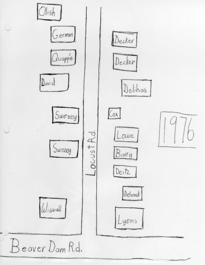
JR – Well, I was going to tell you a little bit first about how I got to Long Island. It was during the First World War, and two of my brothers — we came from Pittsburgh — and two of them had gone to France. And one was at Mitchell Field, here in Mineola. So we came and spent the first summer in 1918 at Bay Shore. And then we used to drive out here to Brookhaven. Father had a cousin, Mrs. Clyde Furst. Mr. Furst was secretary of the Carnegie Foundation in New York, and they built a house where the Hugh Browns live now. It looks like an old colonial house, but they built it before 1919 anyway. I would say sometime between 1910 and ’15, something like that. At any rate we liked it here in Brookhaven. That’s the way we first came out here and thought this was wonderful. So Father rented the house for the next three summers. And that’s the house the Wiswalls live in now, at the corner of Locust Street and Beaver Dam Road. And, let’s see what else I was going to tell you. I have to look at notes. Alfred, he can speak right off the cuff. (Laughter) And it was owned by Ellen Learned and she was a singer from New York. And if you think she taught singing. (I don’t know if people can hear me way back there.) At any rate, she and Miss Wagner lived there, I’m quite sure. She and Miss Wagner had sort of “palled up” together. It seems that those artistic and literary people sort of went in pairs, a lot of them down there. And they lived down Hawkins Lane at the time. Miss Wagner had a house down there. And Miss Learned, I believe, built a small cottage near it. You go down Hawkins Lane and then you go on a little shift to the left and it’s down near where the Stoenners live, down in there.

Voice from the audience – The Dolgers live in that house now, don’t they?

JR – Yes, I think the Dolgers live in one of them. That’s right. Yes.

Voice – And Miss Herman is in the other house.

JR – Who is that?

Miss Herman – I’m living in the present house now.

JR – Oh, you are! I see.[3]

Miss Herman – That was their first house. And then I believe they sold that piece of property and then they built the house where the Dolgers are now living.

JR – Yes. yes.

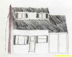
Well, Miss Learned apparently had rented. .. had inherited this house where the Wiswalls are, at any rate, and she rented it so Father signed up for three summers. So we were here the summers of 1919, ’20 and ’21. And so then the people were awfully friendly and interesting and Miss Mary Ford, who lived where Mrs. Tuthill, Dorothy Tuthill, lives now, on Beaver Dam Road, was the first one I believe who came to call. She was very enthusiastic and all, and her daughter… Mr. James L. Ford, he was a literary man and had been on the Herald, the literary critic. I guess, of the Herald newspaper in New York. And he’d written two books, one called Forty Odd Years in the Literary Shop, which I believe is on the shelves here, and Hot Corn Ike, which was about Coney Island. And he was an invalid at the time, but he liked to play bridge and Miss Ford liked to play bridge and so my parents got quite chummy with them and they played back and forth quite a lot. And then, across the road from us Miss Haskell had this little house. I have a picture of it here. I can pass it around later on if they want. And Miss Boughton lived together. Miss Haskell was the Head of the Art Department of Pratt Institute in Brooklyn and Miss Boughton was a photographer of some note and had a studio in the old Bartholdi Building in New York on Madison Square. And they came out and stayed weekends and summers in this house where the Phillips live now. It was right across from the Wiswall house. And, let me see, what else? Miss Learned and Miss Wagner. Miss Learned, I said, was a singer and taught singing. And Miss Wagner played the violin. Did she teach music too?

AN – I thought she did, yes.

JR – And she also made jewelry. And then there was Rea Irvin?

AN – Irvin, yes, an artist.

JR – Ray Irvin, down there where the Hansen house, the Mears and the Hansens had a house near where Miss Learned, down Hawkins Lane. And Ray Irvin drew the first .. he was an artist, and he drew the first cover for the New Yorker magazine.

AN -For the New Yorker magazine, yes he did.

JR – And it comes out every year.

AN – It was a dandy with a butterfly.

Voice – Eustace Tilley?

AN – Eustace Tilley, yes.

JR – And it’s on their February issue, I believe, every year.

AN – Every year.

JR – And then, next to us, on the west I guess, was the Burnett house. And Ike Burnett was a farmer there. I don’t know how many generations they’d been here. But he had three brothers and one was Thurman and we didn’t remember the other two names.

AN – Yes, there were two others.

JR – Two others.

Four brothers, and that’s where the Rowleys live now. And he was a nice old man. He farmed, and had horses of course and he owned the field across the street and farmed that with a horse, and back of his house too. And then he had a housekeeper called Mrs. Green and she was a colorful soul, who used to come over and chat at the fence with us when we were gardening along the fence line. She used to wear a little green plaid shawl and an old felt hat of Ike’s and we enjoyed her very much. Let’s see.

Oh, Mrs. Harrison lived over in the house…[4]

AN – It was the Bakers’.

JR – Yes, well, before the Bakers, Mrs. Harrison…

AN – They bought it. The Bakers bought it from Mrs. Harrison.

JR -That’s right. And that’s the house with the big white wall across from you, you know. And I remember Mrs. Harrison was very nice. She came over to see Mother in white gloves and Oh! she was very fancy. But…

Voice – Did they build that house, Janet, the Harrisons?

JR – Well, it was originally small. The Bakers moved something up to it for a kitchen, didn’t they?

AN – I think the Harrisons built it originally and the Bakers they’ve added to it. I think so.

JR – And then we made friends with the Post family, of course. And they had three daughters, and first of all Elizabeth Post, who is now Elizabeth Morrow, and Helen Morrow, who became Mrs. Ewing, married Mitchell Ewing , and they came down to see us. We got to know them and Helen Hubert. Of course, she was married and had about three or four children at the time and was living in the house Helen Maust has now. “Hillside,” wasn’t it?

Voice -“Hillcrest”

JR – “Hillcrest.” I went to the Southaven Church then; with my father and mother. They were Presbyterians and I was brought up in the Presbyterian Church. I
never joined, but I went with them. And that was of course out in Southaven, and the minister was the Reverend Allen . And then the Presbyterians had a little chapel here in Brookhaven, which most of you probably know as the Chapel House on the corner of South Country Road and Chapel Avenue.

AN – Yes.

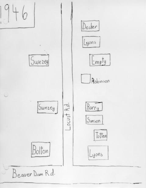
JR – And George Morse used that later for a workshop and an antique place and clock shop.

And, let’s see what else is on here and out at the Southaven Church.

Mr. and Mrs. Post always went out there to church and the Augustus Floyds from Moriches, from Mastic, I should say. He’s a descendent of the original William Floyd, the signer, who came out there to church. And the Wallace Swezey family around. They lived on Stump Road. And this is Mr. & Mrs. Swezey and they had several daughters, Mrs. Rose, Mrs. Julian Rose. She’s still living. And her daughter Antoinette, down Hawkins Lane. And Let’s see, Wallace Keating lives down there. He’s a descendent of that family too. And there’s another. Oh, Shirley Sylvester, of course. Her mother, Mrs. Poole, was a Swezey. I don’t know that there’s more I wanted to say about the Southaven Church. Oh they had, in this chapel up here, they used to have Sunday night services because when it, in the old times, when it was too far to go to Southaven, and they had horses and all, they’d just have Sunday night chapel up here, and the Sunday morning service out in Southaven. Probably some of you remember when that Old Southaven Church was moved, on skids, right from Southaven up the South Country Road to its present location here at the corner of South Country Road and Beaver Dam. Later on, after I was married in 1925, I became an Episcopalian, at St. James Church. I married an Episcopalian and (laughter) in there. And I remember that Miss Learned used to sing in the choir, and your uncle Dem Nelson, and the church used to rock over there (laughter). Oh, the original property and the church had been given to St. James by the Ireland family.

I suppose you’ve all heard of the Ireland family, who had a big[5] home. You know where Mrs. Corrigan’s brick house is on Beaver Dam Road, and the bricks in that house came from the foundation of the Ireland house, which was sort of a Victorian house, I guess, with a brick basement and then you went up to a porch. The house was wooden and this wooden porch all the way around the house. A family by the name of something lived in the basement. I can’t think of their name, but they sold milk. I remember going down there once to get milk for somebody. Mrs. Morrow, I think, asked me if I’d go down to get milk. And the bricks were put into that Corrigan house, which is beautiful. It now belongs to the Scordamaglias. And that was down in the middle of what became the nursery — the Corrigan / Tiger Nursery. And the house was torn down, I guess, before that.

But the Irelands gave that property for St. James Church and in the deed, I guess, if it ever stops being a church it reverts back to the Ireland estate, which I don’t know if anybody could find an Ireland there or not. The organist in St. James was Mrs. Gwynne, who was the mother of Thurston Gwynne, the artist. And they lived in the little house across the street and I don’t know who… It’s on the corner of Fire Place Neck Road and Beaver Dam Road, right next to where the Nortons are. I don’t know who is living there now. I’m ashamed to say I’m not a good neighbor.

Miss Louise Carman used to come out there on her wheel. She lived in Southaven and she used to ride up on her bicycle to the church. I remember that distinctly. Alfred does too.

AN – Yes.

JR – Another thing I don’t think we mentioned was that, in the house where Mr. Binnington lives now, there was a Mrs. Carman and her son, Ken.

AN – That’s right.

JR – Do you remember him?

AN – I remember him. Yes, I do.

JR – And of course the river was named for their. .. for the Carman family.

AN – For the family, yes.

JR – Yes. Miss Carman lived out in Southaven and the river was out there, of course, and on the far side of the river was a house that Mr. and Mrs. Dominy lived in.

AN – Yes.

JRCharlie’s grandmother.

AN – That’s right.

JR – That was old Mr. Jerry Dominy.

AN – Jerry Dominy, yes.

JR – And he was sort of a caretaker out there, wasn’t he, for some of that property on the river?

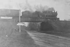
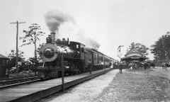
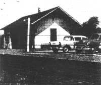
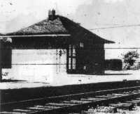
AN – Yes, the fishing club. What’s now the Southaven Park was a private club, a fishing club. They stocked it and he was superintendent there for many years. And he also had, after that, he had a coal and feed business up at the Brookhaven station. Brookhaven station had a siding and a freight house and there was quite a lot of traffic there.

JR – He had a big house, a big sort of a building where he stored coal.

AN – Yes.

JR – On the railroad tracks. Hold it! Hold it! We forgot Johnny Morton, too. You want to tell about Johnny Morton.

AN – He was the Justice of the Peace, I think. Well, I can think of several… (laughter).

That reminds me of something that Janet said that… the minister of our church, Mr. Allen. That reminds me of an incident which I think is amusing. One day, one time, he hired a boat from Selah Hawkins who had a large cat boat. He took the ladies of the church (I’m sure you weren’t there. It was before your time.) over to Smith’s Point. So it was a busy day there,[6] and the dock was loaded with boats — all on the lee side, naturally, they were sail boats. So Mr. Allen came blithely along with all. the ladies and he all the space on the windward side of the dock and he headed right for it. And people tried to wave them off. They shouted and yelled at them and BOOM! — he hit the stringer. Down came the mast all over (laughter). It was a shambles. So luckily no one was injured. But the ferry towed them back. I remember that. (laughter) I don’t know what Selah Hawkins said about the mast but I guess Mr. Allen must have paid for it, or whatever.

JR – The only story I can think of about Johnny Morton is that we always used to come back and forth on the train and had trunks and all. And nobody travels with a trunk anymore. (laughter) But he came to pick up a trunk from our house up here and it was in the morning. I don’t know, 10:00 o’clock anyway. My brothers were all back from France and one of them was asleep upstairs and he saw Johnny Morton going by his door, which is right at the head of the stairs, with this large trunk. And Mr. Morton wasn’t any higher than that (laughter). And he jumped out of bed with his pajamas and helped him down the stairs with it and, when he got to the front door he was going to take it out to… What did he carry the trunks in? That little jitney that he had?

AN – I guess so.

JR – He drove the only taxi around here too and used to meet all the trains. But, at any rate, when he got to the door Mr. Morton said, “You can’t come out in your pajamas.” (laughter) I don’t remember how they got the trunk out, but I think that Art probably took it on out to the… but that was another thing about it.

Oh, I wanted to tell about two families from Flushing who came here, who had summer homes. Your grandfather and Judge Fitch’s family, who had the home on the corner of Beaver Dam and Bay Road where the Petrettis live now, where we used to live. But your grandfather’s home was up opposite the…

AN – The Brook House.

JR – Opposite the Brook House, which wasn’t built then, of course.

AN – No, it wasn’t built, no.

JR – And I figured out — I was counting up — that you’ve had five generations of Nelsons in Brookhaven.

AN – I never thought of that (laughter), really.

JR – Well, I mean, you’re the third, and then there are two or three more, your children and grandchildren.

AN – Yes there are — grandchildren. That would be five, wouldn’t it?

JR – Yes.

AN – I never thought of that.

JR – And then the Fitches had the house that I said. He was a judge from Flushing, and Mrs. Fitch… This little book, I guess. … And that’s the house as it was when the Badettys were in it.

AN – Exactly. I remember that, yes.

NR – And the Fitches bought it from the Badettys. Not Petretti, Badetty. When the Badettys had it it was a fruit farm and a boarding house. And then Judge Fitch and his wife and two daughters, it was their summer home. And then the Reddalls bought it from Mrs. Fitch. And now the Petrettis are in it, so I see that there were only about five families who’ve lived in that house. And, of course before the Badettys… When the Badettys were in it all that fancy front was built which we tried to eliminate and make Colonial. This little book here will show the… If you want to come up later. You can pass it around.[7]

JR – As it was when… And this… And this postal is very precious. It shows the bridge. Maybe it ought to go with it, though. It shows the Beaver Dam bridge as it was before the… at that time and then it’s been changed when the hurricane of ’38 came in, of course. But it wasn’t like that when we were living there in the early 20s. It wasn’t like that picture.

Now let’s see. I think I’m almost through. Is that enough time? (laughter)

Voice – I would like to listen to you almost indefinitely.

JR – Can you hear me?

Voice – Yes, we can. We could hear you loud and clear. Mr. Nelson-

AN – Yes.

Voice – Do you have any more?

AN – Well, not other than people might have some questions that I could answer about some building or house or something that I might know about.

I’ll tell you something interesting. The river, the Carman’s River was originally called the Connecticut River, which you see the sign says Connecticut or Carman’s River. On the old maps it’s Connecticut, but Carman was a man, of course. He had a store at the head of the river where the crossing is now, that is, where the old Presbyterian Church was. And he had it named Carman’s River. I don’t know how he worked it but he did, anyway. He must have been a VIP or something.

But at the landing, down at the landing, Squassux Landing, you all must remember a large house that stood just to the north of the landing. It was later owned by the Michelsons. But back when a man named Lush who owned the house, and he was a crabby old fellow and he would extract three dollars or five dollars from everybody to put up a stake in the meadow to tie the boat up. And when the tide was high it’d be ankle deep getting down to the boat. However, Mr. Post quietly bought the property and let it be known that anyone in the Village could use the landing at no charge ever. And he built a little summer house and a slip. He had a small little Elko, I guess, cruiser. And he had a chauffeur and he also ran the boat. So subsequently the property was given to the Village Association, and it consisted of something about nine acres. We used to call it the Village Improvement Society. They held meetings in the old school house, which is pictured, the one there, the two story building was moved away. And they had monthly meetings, I guess. It was a lot of fun. We’d sit in the back of the place and listen to all the fun {laughter), swat mosquitoes and wrestle (laughter).

JR – I might add that my cousin Lowry, who always made great fun of his father’s being a Phi Beta Kappa and his intelligence and all that business, used to call that the Village Imp, I remember. I guess other people in the Village used to call it the Village Imp too.

Lowry used to be a mate on Captain Gerard’s boat, too. He was a good sailor, yes. The Fursts had two sons: Brading, who studied the jewelry-making, I remember, with Miss Wagner; then Lowry studied marine, went to a marine school. Where is that? Up at Fort Totten or some place like that…

AN – Yes, yes.

JR – … and became a mate on the, on the … not Navy, but merchant ships.

AN – Merchant Marine.

JR – Yes. And that picture of the.. .. This could go around too, if you want to. This is one that Miss Boughton painted. She was the photographer. Did I tell you about her yet?

Voice – Some.

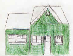
JR – And then there’re some other pictures here that I thought were very interesting. Oh, this is the cottage, the house where we live now. It’s the, it was the old barn of the[8] Badetty house. Then it was made into a winter house by Captain Wardlaw, and now…

Voice – Do you know the house called “Blue Shutters“? Is that an old house?

JR – Yes. That was a house that Miss… I don’t know how old it was but Mrs. Chase, who was…

Voice – Ilka Chase?

JR – Ilka’s mother, and they used to come out there for vacation. Oh, we didn’t tell about Mrs. de Arcas’ boarding house, did I?

AN – No we . .. I just mentioned it.

JR – Well, Mrs. de Arcas’ boarding house, where the Munhofens live now… Of course the Minhofens built a brand-new house. They attracted a lot of people from New York — artistic and literary and other people came down there. And Mrs. Chase and Ilka, I believe, started there and then Mrs. Chase bought that place, and who was the other lady that came down? She was…

AN – Boughton, was it?

JR – No, Boughton was the photographer up the street here, but there was another one. I can’t think of her name, Miss Somebody, and she added on to that cottage, the “Blue Shutters”.

Mrs. Munhofen – We found silver utensils that they had at the boarding house, yes, in the ground, and bits and pieces of the plates and bowls. It was blue and white.

AN – Kitchen middens.

JR – She set a very good table. She was noted for her food. And her daughter-in-law, Mrs. Amy de Arcas, who lived up around South Country Road, about
where the old post-office on the other side of the road, up near where Mr. Comstock is now living, she also served good meals [house]. We used to go up there after Mrs. de Arcas’ house…

Voice – That burned down.

JR – The boarding house.

Voice – About 45 years ago.

AN – Yes, it did.

JR – I used to take her with my family to market. We had to market mostly in Patchogue. We could get a few things in Bellport. And oh, we didn’t tell about the store there across the street where you live.

AN – Yes.

JR – There was a little store there. But anyway Mrs. de Arcas would always love a ride to Patchogue, and when we came back we were just like a truck full of, you know, vegetables and fruit and all. The car was packed. She always liked to go up there. And then this little store over where the Nelsons live now was called… We always called it the Store House. Did you call it the Store House?

AN – No. It was run by a man named Albin, who built the store originally, and it changed hands after a while but he ran it for a long time.

JR – I see.

Voice – Is that corner still zoned for business (laughter)? Can we have a 7-11 there or something?

AN – No. The Valentine Store was the principal store and the post office. Valentine was the post master and that was the headquarters at mail time. When the mail would come in on the 6:00 o’clock train or thereabouts, and Mr. Barnes had a little horse and buggy. He’d bring the mail to the post office. And they’d[9] “overhaul the mail” they called it. Everybody’d be there to get the mail. No RFD then, of course, and there were bicycles and wagons and cars and everything. It was a regular meeting place every night at the General Store and post office.

JR – That was up on the main road, on South Country Road.

AN – Yes, and Helen, by the way Bumpsteads lived in the house that you live in now. Ad Bumpstead was the Constable and he had a star on his vest (laughter). He really was an important man.

Voice – That was when it was a little old salt box down by the road.

AN – It was down by the road. They moved it back.

Voice – And then they moved it back. (Your house was down by the road? Um hum.)

Voice – Alfred, you went through the Brookhaven School. Tell us what school life was like.

AN – Well, it isn’t exactly that. One year my family came down early and I was in the school for I guess about a month, at the most, in this old schoolhouse, the one that was moved away and I wasn’t very attentive I’m sure, but… I think I rang the bell two times when I shouldn’t have. But it had a pot belly stove and it really was awful nice – two rooms, upstairs and down. And I was only there for about a short time, I remember.

JR – It’s down near your road, isn’t it now?

AN – Yes.

Voice – I live in it.

AN – Oh, you do? Do you really?

Voice – It was moved by barge.

Voice – Yes, my wife Lorelei and I live in it.

AN – Mr. Higgin moved it. He moved it and the belfry was used as a beach sort of a little house or whatever. It washed away in the hurricane. It was a gazebo on the beach.

Voice – About how many students were there?

AN – Oh, it’s hard to recall but there weren’t too many, about maybe 35 or 40 at the most. There were two rooms. Mr. Johnson was the Principal and Mrs. Johnson taught too in the school. I’m not sure. That’s the house that you’re in, the Jolnson house.

Voice – Al, wasn’t there some story that George Miller‘s house was built on a barge?

AN – Yes, George took my brother Norman down and showed it to him one time. It was many years ago. When Miller built the house, you’re familiar with it. It’s right by the square there, the old Miller house. Low ground it was. And he had, must have been some shipwrights to do the job. They built essentially a barge in the ground and then built the house on top of the barge. It was heavily pitched or whatever it was, and it lasted for many years. I think the Miller house was built… George told my brother it was built in about 1825 and the barge lasted. Finally it rotted of course. They must have shored it up in some manner to preserve it. An interesting idea.

The house that… the farm that my grandfather bought that’s a farm that was built some time later, 1935 [sic, probably meant 1835] or thereabouts, after the Miller house. A real old farm house, and it was added to. A large extension was built on it so it disappeared, the old farmhouse, really.

JR – Your grandfather probably put that pretty portico on the front door.

AN – That is so, yes, yes.[10]

JR – By the way, the house that the Sachs have up here had a lovely front entrance there.

AN – The Rose house, you mean? The one with the…

JR – Yes, the old Rose house.

AN – That’s one of the oldest houses.

JR – Have they kept the dimensions of that, I wonder?

AN – I hope they did.

JR – I hope so, because they hadn’t put it back on.

AN – No, they hadn’t.

JR – Of course, they put an awful lot of work into that house, really. There are other pictures up here if anyone wants to look. Oh, we had a movie over on the beach, probably you all heard about that. I think the are some pictures someplace of that. I just picked up a couple of these albums.

Voice – There was a sheik in it, wasn’t there?

AN – It was a desert scene.

Voice – Yeah, because we have one too.

Voice – Oh, is that the one that’s in this little one?

AN – It probably is in some…

Voice – Because there were palm trees and I didn’t think there were any palm trees there.

JR – That was the girl. Was her name Gene Tierney or something like that?

Voice – There was a Gene Tierney.

JR – What?

Voice – There was a Gene Tierney, actress.

JR – Well, I think she was in it and Conway Tearl, and their pictures are there. I don’t know who this other one is. Over here…

AN – They brought over camels and had Arabs (laughter), the whole works.

JR – They built an oasis. There are more pictures around someplace. Does anybody have anything else there? I think he rented that boat and that was my canoe. We used to just go down there and tie up to space, down on the Squassux Landing.

AN – That’s right.

JR – And Mr. Post never charged anybody anything, I don’t think.

AN – No.

JR – So, I guess that’s about it.

AN – Yeah.

JR – Well, we’ve had ourselves an afternoon.

Voices – It was wonderful, interesting, fantastic.

Connie Goodzeit – I think if there are any questions while we’re having some refreshments, you can talk a little bit. I want to thank you very much for enriching our lives.

JR – Oh, really? (Applause)

Transcript by Regina M. David
Locust Road, Brookhaven
August 1983

Osborne Shaw’s History of Brookhaven/Fire Place

A Note on Shaw’s History

History of Brookhaven Village

A paper written by Mr. Osborn Shaw of Bellport for the Fireplace Literary Club, and read by him at the Brookhaven Free Library, October 5th, 1933

Fire Place

When Mrs. Post asked me to address you on the history of Brookhaven Village, I little thought it was so long a subject and as I already knew the outline of events, I thought it would not take long to write it down and present it to you. However, I find that the subject is such a long one, that to do it justice, one could fill enough pages to make a small book and require weeks — possibly months — to collect and assemble the data from tradition and from the authentic records of the Town and County, therefore in the scope of this article, all I can hope to do, is to present a brief and I trust, concise outline of the history of the village. There is much material easily available and it should be collected and formulated into readable shape. I hope to do something of the sort for Bellport in the future and would welcome coöperation from some here regarding the history of Fire Place, but whoever elects to collect tradition relating to this section, should not delay, for with the influx of new comers and the dying off of the former old residents, all tradition is rapidly being lost and what little is left is worth getting, even if only fragmentary. While from authentic records is the only reliable and the only sure way of compiling a history, yet tradition sometimes is the only basis on which to assemble the data after it is collected.

Brookhaven village as you probably all know, was formerly known by the name of Fire Place and at one time, the term was applied to the whole vicinity including South Haven where the grist, saw and fulling mills are given on the Town map of 1797, as “Fire Place Mills”. The unwise change of name from Fire Place to Brookhaven occurred about the 1871, when a group of modernizers, or would-be improvers, started an agitation to drop the ancient name. Meetings were held and finally it was decided to appropriate the name of the Town, because as one of the proponents told me some few years ago “there is a brook along the eastern part, one in the middle and another along the western part”. Of course the brook at the west — Osborn’s or Dayton’s — can not be considered as anything but in Bellport as it lies well within the Bellport school and fire districts and the people living there adjoining it consider themselves Bellporters. However for the sake of argument at the time, Osborn’s or Dayton’s Brook was said to be along West Fire Place and the change in name was made. I have seen it stated that the name was changed in 1876, but Bayles’ “Sketches of Suffolk Co.” published in 1872, states that the change had but recently been made, so I assume it was about the year 1870 or 1871. If anyone can give me the exact date, I will appreciate it. Hardly a worse name could have been chosen, as from early colonial days as early as 1666, Brookhaven was the name of the Town and also the name of the mother settlement of Setauket as well. In the the town records, in Book B alone, there are fourteen references to Setauket as Brookhaven and it was from the fact that Brookhaven was the English name, while Setauket or Setalcot was the Indian name, that Governor Nicolls in 1666 and Governor Dongen in 1686, officially named the Town from its then chief settlement. When Fire Place usurped their old name, indignation was high in Setauket. The Presbyterian parish there, the oldest of any denomination in the Town, still bears the official name of “the First Presbyterian Church of Brookhaven”. Before, during, and for a number of years after the Revolutionary War, the many mentions of the place are frequently as Brookhaven, sometimes Setauket — both terms being synonymous — and both terms continued to be used according to whether a person chose to use the Indian or the English name. In like manner, Setauket was often used as a name of the Town, but in latter years to avoid the confusion which sometimes arose, Setauket was confined as the name of the village and Brookhaven used only for the Town.

It was a sad mistake that the historic and quaint name of Fire Place was dropped and the alternative name of Setauket and of the Town substituted in it’s place. But the error was made and it is to be hoped that the people of this place will see fit in the near future to restore its original name and thereby save the confusion and misunderstanding that constantly arise by the village and the Town both bearing the same name. To save such misunderstanding, I shall refer to the village only as Fire Place in the remainder of this article and I shall also refer to the river on the east only as Connecticut River, its correct name, and not by its more modern nick name, “Carman’s River”.

I have been asked why Fire Place was originally given as the name to the Neck on which most of the village is situated. Reasons for naming places are seldom found recorded and unfortunately what meager traditions exist, do not agree. In this case, we can only speculate and utilize tradition and harmonize it with the records. The survey of the Town made in 1797, shows that Smith’s Inlet or New Inlet, now referred to as “Old Inlet” was then open and opposite Fire Place Neck. There is much that can be assembled to show that the inlet was used frequently in early colonial days and it is very probable that in order to guide the whaling crews which were so numerous off shore in the later part of the 17th Century and early part of the 18th Century and also when there was expected a vessel which might have to negotiate the inlet after dark, that fires would be built, probably at Woodhull’s Point, now called Long Point, at the mouth of the Connecticut River and that these fires would serve as a range light. The inlet lay about a southwest course from the point and as it cut through the beach also on a southwest course, a light or fire on the point would very likely be seen through the inlet and out to sea and could thus be used to “make” the inlet. Such a fire would also serve at night, as a guide across the Bay to the mouth of the Connecticut River. The river was also extensively used in olden times as is evidenced by the very old names of some of the landings like Indian Landing, Zach’s Landing and Squassucks Landing at the end of Beaver Dam Road.

Now in regard to the name “Squassucks,” Tooker’s “Indian Place-Names on Long Island”, pub. 1911, states the Squassucks is a contraction of Wessquassucks, the personal name of an Indian who lived at one time at or near Squassucks Point which is either Long Point or the next point up on the west side of the River. Tooker analizes (sic) the word to mean, a pot-maker — hence we assume that Wessquassucks, the pot-maker, lived at or near Squassucks Point. I offer the suggestion that Wessquassuck may have had his firing place or kiln for his pottery in the vicinity and that his fire once used as a beacon or guiding light, gave rise to the custom of lighting fires for the purpose and the fact that Fire Place Neck is almost always spoken of in the early records, not simply as Fire Place, but “the fire place”, seems to strenghthen (sic) the idea that I have just advanced.

Whatever the origin of the name, it is found frequently in the early records of the Town. The first mention that I find of it is in Book I, under date of 30 March 1675, where the entry states that Francis Muncy “before he died”, exchanged his meadow share at the Fire Place with Samuel Dayton for the meadow at Sebomack (near Smith Point). It is the only reference that I have found mentioning Fire Place in Book I. In Book II, the references are more numerous and I will cite all that I have found in that book to contain.

18 May 1675, Abraham Dayton and Thomas Bearsley sell 18 barrels of whale oil “lying on the South Side of the Island at a place commonly called the fire place”.

25 May 1675, the town meeting voted to grant to Nicholas Chatwell and to Richard Southcott each some upland and “5 acres of meadow in the “Great Fly” at Fire Place provided they occupy the land before Christmas, but as their names do not appear again, they probably did not accept the gift under the conditions required.

30 July 1675, Richard Floyd trades his lot, No. 25, of meadow and upland in Fire Place with Joseph Davis for meadow at Unkechauge in Mastic.

24 May 1676, Samuel Dayton sells to William Rogers of Southampton, his parcels of meadow “lying on the west of the brook by the fire place” that he got by the trade with Francis Muncy.

Also in 1676, on the 4th of July, or exactly 100 years before the Declaration of Independence was voted for in Philadelphia, a sale of property here in Fire Place was made, when Robert Akerly of Setauket sold a share of meadow to Robert Kellam of Southampton.

5 Dec 1676, Richard Floyd sells half of his share of meadow, No. 10, “about the great flax” to William Jayne.

10 Dec. 1678, John Tooker sells to Joseph Mapes of Southold, another of the meadow shares, No. 6.

3 Feb 1678/9, Joseph Davis sells to William Jayne, his share of meadow, No. 20 with 15 acres of upland.

There may be other references to the Fire Place in Book II that I have overlooked, but the above are sufficient to show how much more active real estate was here in the last quarter of the 17th century, than it is today.

The many references and items relating to Fire Place and the vicinity, in the other record books of the Town and of the County, are so numerous, that I shall mention only the most important ones. What is meant by meadow share in the above quoted references, I will explain further on.

I must now outline for you, the history of your village, but before we do, I want to correct an inexcusable error which may mislead any student of your history. On page 266 of Vol. II of the History of Long Island, written by the late William S. Pelletreau of Southampton and published in 1903, will be found this statement: “West of Connecticut River comes the long extent of territory now known as Brookhaven and Bellport, but originally Fire Place and Occombomack. The earliest deed is dated July 20, 1657 when Wyandance, the Montauk Sachem and Wenecohage sell to Richard Woodhull ‘for himself and the rest of his neighbors at Setalcott two great necks of meadow lying from a river called Coneticott to a river called Wegonthotok'”. I hate to have to contradict such an eminent authority as Mr. Pelletreau, but the facts demand that I do. The deed does not apply to either Fire Place or Bellport at all, but covers the meadows known as Noccomock Meadows on the east side of the Connecticut River and the meadows in Mastic. The “River called Wegonthotok” is what we know today as Forge or Mastic River. Further on in the volume, on page 281, will be found the amazing statement that Fire Place is “entirely a place of modern growth”. We all know this last statement is utterly untrue and I shall disprove it later on in this article. Having corrected, I hope, any misconception regarding the early history of Fire Place, that any of you have gotten from the above statements, I shall now try to present to you the history of your village, taken entirely from authentic sources.

We shall have to begin by crossing the Island and starting with the first settlement in the Town of Brookhaven at Setauket where, all that is definitely known, is that a small group settled there from New England sometime between the fourteenth day of April 1655 and the first day of August 1657 — the event probably taking place sometime in the Spring or Summer of 1655. The little colony soon became well established and through the foresight of it leaders, but principly (sic) through Richard Woodhull, began to buy up as much of the Indian lands as the red-skins would sell and this is especially true of any land containing meadows which were much prized because of the salt hay and grass that the meadows produced. Very little cleared land existed at the time and what they laboured to clear from the virgin forests was put to such cultivated crops as grain, peas, flax, vegetables and fruits, depending almost entirely on the meadows for hay and for pasturing their cattle. In two years after the settlement began, the Mastic and Noccomock meadows were purchased, but some cloud appears to have hung over the title and it was not until a second or confirmatory deed was secured from the Indians in1675, that the title was cleared and the meadows used. In the mean time, the West Meadows nearer at home, probably not supplying their needs sufficiently, they made two purchases of lands both containing meadows. One was for the “tract of land commonly called the old mans” or Mount Sinai, and the other for a large tract here on the South Side. Both deeds were signed the same day, 10 June 1664. The South Side tract became known as the “Old Purchase at South”, and on it are located the western part of South Haven, called Little Neck and all of the villages of Fire Place and Bellport. It was bounded as follows: Beginning at the mouth of the Connecticut River, at Long Point (Woodhull’s Point it was formerly called) and from thence running up along the west bank of the river to Yaphank Creek (or Barteau Creek it is known today) in the western part of South Haven, thence up and along an imaginary north and south straight line, called the Yaphank Line, to the middle of the Island; from thence west-wardly along the middle of the Island to where it meets a north and south line leading from a certain little fresh pond, now called Pond Ditch, located in the south western part of the meadow on the former Lyman estate in the extreme west part of Bellport; from thence eastwardly along the shore of the Bay to Long or Woodhull’s Point, the place of beginning. Included in this immense tract of meadow and upland, there are six necks of land each divided by a stream of water. Naming them from from east to west, the necks are: Little Neck, Fire Place Neck, Tar-men’s Neck, Dayton’s Neck, Occumbomuck Neck and Starr’s Neck. Little Neck forms the western part of South Haven; Fire Place Neck, Tar-men’s Neck and the larger part of Dayton’s Neck, are in the village of Fire Place while the western part of Dayton’s Neck with Occumbomuck Neck and Starr’s Neck make up Bellport. For all this valuable land, it was agreed, according to the deed, to pay the grantor, Tobaccus, the Indian Chief of Unkechogue in Mastic, a sum of money to the value of fifty fathom of wampum — that would be 300 feet. From the receipt which is dated the 31st of March in the following year — 1665, we learn that four coats were first paid and then at the date of the receipt he was paid £6/10s. Evidently it was easier to use English money than to make a string of wampum 300 feet long. While the deed conveys the land described, it reserves to the Indians free liberty for “fishing, fowling and hunting” within the territory. It might be of interest to you to know that both the original deed and the original receipt are preserved and are in the Town Hall at Patchogue among the priceless collection of ancient papers and documents owned by the Trustees. Tobaccus’ signature mark looks like a sort of wavy line that might suggest a double m. The receipt, besides being on interesting old paper, states that it is given for money paid for a tract of lands and meadows “which is alredy layed out and bounded at the South” (sic). From these words, it is evident that the thirty-nine purchasers lost no time in dividing the meadow among themselves almost immediately after its purchase the previous June. From Book II and from Books A and B of our Town records, we find that it was only the meadow land that was first divided and that it was divided in 49 shares. The price of £6/10s paid to Tobaccus (exclusive of the four coats) divided among the 49 share holders would be about 2 shillings and 11 pence per share. Seven of the 39 buyers owned two shares and one, Richard Floyd, owned three shares, hence in dividing the meadows, these men received two pieces of meadow and Floyd three while the others each received one.

From the various deeds recorded in the town and county records, it will be found that the first 32 meadow lots lay between Connecticut River and Osborn’s Brook in the eastern part of Bellport, while the remainder were all in Bellport — the last or 49th lot probably adjoining the fresh pond on the west line of the purchase. None of the lots included any upland at first and as the meadow extends further back from the Bay in some places than in others, it must have been that the lots were of different sizes and shape so that each would contain an equal amount of meadow. A list of the original owners will be found in both Books A and B. All of the owners were the early residents of Setauket and were probably all living there at the time.

To reach these meadow shares a direct road led from Setauket to Fire Place and the Occumbomuck or Bellport and passed through Coram. The Road entered Fire Place Neck a little distance north of the railroad bridge, followed along the east side of the swamp and continued south past George Miller’s place and down either Bay Road or one near it, to a cross-road which ran about parallel with the shore along the the north or head of the meadows. It is without doubt the oldest cross-island road in the Town and was probably cut through about the year 1665 and I have no doubt but what it followed an Indian trail. It was extensively used and there are numerous references made to it in the town records, especially in Books B and C. Here are some of the terms by which it was designated: Road to South, Road to Coram, Road from Coram, South Path, Road to Fire Place, Fire Place Path, Town Path, Town Road, and more modernly, Old Town Road by which it is known today. It is still used from West Yaphank to Setauket, but the section between and its entrance into Fire Place is now so little used that it is partly grown up. Part of it the South Country Road, or Montauk Highway from Eugene Policastro’s place to the old Ketcham place now partly owned by Mr. and Mr. Nelson. From there is (sic) probably ran straight to the north end of Bay Road and so on to the south as described above. From the place where it entered the Neck, north of Policastro’s, another road branched off at about a right angle and ran east to South Haven and to Smith’ Point and to Mastic. This road later became part of the South Country Road as the Old South Country Road used to run — not the present cement road with its grand, modern, sweeping curve. From Henry Snow’s corner — possibly a little to the east, another road ran down along the east side of Fire Place Neck terminating at or near Long or Woohull’s Point. It ran a little more to the east than the present Stump Road and intersected the south crossroad, previously mentioned as running along the head of the meadows. Traces of the road, a little east of the Stump Road, could be seen only a few years ago and probably can still be found. Thus Fire Place Neck had a road along its eastern side skirting near the west sides of Little Neck Run and the south part of Connecticut River and another along the west side, a little distance east of Fire Place Creek, and both of these roads were connected by cross roads — one on the south along the upper edge of the meadow and the other along the northern part of neck following the original course of the old South Country Road. It was thus convenient to reach the meadow shares from either side of the neck. I cannot give you the dates that these roads were opened. Perhaps they never were opened: they just grew; but I believe that a careful study of the town records and some antiquarian research, might reveal them to be older than suspected.

Let it now return to the meadow shares that I said were laid out soon after Tobaccus sold out. In our town records, in Book II, we find that on the 6th of Feb. 1676, an order was passed that John Tooker and Thomas Ward should lay out 15 acres of upland as near or adjoining each man’s meadow share as could be done. This was the first allotment or apportionment of upland to the owners of the whole tract and from it resulted the first white settlement in Fire Place and Occumbomuck or Bellport. In Fire Place Neck, these fifteen acre lots became known as the “Long Lots” and the “Cross Lots”. The Long Lots extended up from the meadow along the Bay to what is now Beaver Dam Road, while the Cross Lots ran east and west from the eastern part of Neck, reaching nearly to the Town Road or Fire Place Path east of Beaver Dam Swamp, thus leaving a strip of unappropriated land along east of the road. This strip lay common and undivided until March 1750, when the Town trustees ordered that it should be annexed to the west end of the Cross lots. Consequently, the lots were so extended that they now had a public road along their west ends as well as their east ends. The whole block of lots lay between the north cross road and the north ends of the Long Lots or where Beaver Dam Road was later to be laid out. At the same time, 1750, that the Cross Lots were extended westward; it was also ordered that six rods should be reserved along the east side of Beaver Dam Swamp for the highway and for waterings. Some of these watering places were in later years sold, but I understand one or two — possibly more — are still unsold and belong to the Town Trustees.

Anyone owning property along the south side of Beaver Dam Road, can well imagine how inconvenient it would be, if he or she had to drive down to the head of the meadow along the Bay and then turn into a cross road and from it, enter his or her land. It was just such a condition as this that the owners of the Long Lots found themselves in, after each of the meadow shares skirting the Bay had 15 acres of upland annexed. They must have been very patient for it was not until 1735, that they petitioned for a change. On the 26th of March, that year, they petitioned the road commissioners to move the south crossroad up to the north ends of their lots, complaining that they had “by Experence found: ye unconveniency of ye high waye layd att ye south end of oure :15: aker lots in ye fier place neck”. From this petition, it will be learned who were the owners in 1735. They were Thomas Hulse, Daniel Rose, Eleazer Hawkins, Thomas Rose, Nathan Rose, William Helme, Richard Hulse, John Hulse, John Hulse, Jr., Nathaniel Bayles, John Wood and James Tuthill — twelve names, so we learn that there were twelve lots, each of 15 acres excluding meadow, in the Long Lots. It was two years later, on the 10th of June 1737 before the road was reported as laid out, and this road, of course, is your Beaver Dam Road. At the same time, the old south cross-road was closed and the land given to the twelve owners in exchange for the land taken off the north ends of their lots. From the report, it is learned that the old south cross-road ran from Squassucks Point to the “Little Fly”. As “Fly” is an English corruption of the old Dutch word Vlaie, meaning a low marsh piece of ground, or a meadow, evidence is added that the Little Fly is the meadow adjoining Fire Place Creek and that the old cross-road ran only to it. In connection with Little Fly, I might properly add here that the meadow adjoining the Connecticut river was called the “Great Fly”, thus Fire Place Neck had its Little Fly and its Great Fly and both are spoken of in the town records several times.

So far, I have told you only of Fire Place Neck which lies between the Head-of-the Neck line on the north and the Bay on the south and between Little Neck Run and Connecticut river on the east and Beaver Dam or Fire Place Creek on the west. I must now tell you something of the other two Necks — Tar-men’s Neck and Dayton’s Neck to which the name “Fire Place” was in later years generally applied — the three necks making up the village. Tar-men’s Neck is the relatively small tract, south of the Head-of-the-Neck line that lies between Beaver Dam Creek on the east and the Otter Swamp and Otter Hollow on the west. The neck comes to a point at the junction of Otter Creek and Fire Place Creek south east of the Methodist church property — the Otter Creek being the one where Clinton Smith now has a winter storage for small boats. The swamp and creek were evidently much larger than they are today and probably extended across the Montauk Highway through the hollow south west of the late Mrs. Edward Raynor’s and north east of Mrs. Post’s corner. It was also called Tar-men’s Swamp.
Tar-men’s Neck derives its name from the fact that tar was made from the pine trees of the vicinity and the tar-men had a house in the Neck, some time prior to 1678. According to tradition, the house or shack stood a little east of the centre of the neck, probably in the immediate neighbourhood (sic) of Mrs. Amy d’ Arcas’ place. The manufacture of tar and turpentine was carried on quite extensively in the Town at a very early date. By 1715, it had grown to such an extent that the trustees put a duty of “a bit” for every barrel of tar and ten shillings for each barrel of turpentine made in the Town. That they had difficulty in collecting the duty, is evident from that fact that on 2 Dec. 1717, they met for the expressed purpose of calling those men to account that had made or “run tar” upon Town lands, to pay the money they were owing.

Dayton’s Neck is the next neck to the west. It lies between the Head-of-the Neck and the Bay and from Fire Place Creek on the east to Dayton’s or Osborn’s Brook on the west. It was in later years sometimes called West Fire Place. The neck was named after Samuel Dayton who on 13 Sept. 1678, had 40 acres laid out to him by the Town in lieu of some other land he did not get in a former allotment. At the same time he received “another adition of land aloyning to it of the nor est corner from a lot that was part munces where the tarr mens hous stoode”, hence it is evident that Samuel Dayton owned a part of both Tar-men’s Neck and the neck that bore his name. However, he did not own the fifteen acre lots with their adjoining meadow shares which extended also along the south of his neck as they did along the south of fire Place Neck as I have previously told you. Dayton came from Southampton to Setauket and finally removed to his neck here on the South Side, probably about 1678 and from an entry in Book B of the town records, it appears that he gave the name of “West Hampton” to some part of the section. On 4 July 1690, the day before he died, he deeded his land to his two daughters, Sarah and Elizabeth, with the proviso that his wife was to have it during her lifetime. He was probably the first white man to live in this section. Just where his house stood is not known, but it probably was somewhere in the vicinity of Clam Hollow, (which some of you may not know is the name of the hollow east of the George Washington property), possibly even nearer to Bellport and he may thus properly be claimed by both villages. As the Bellport School District and Fire District boundary line is at Arter’s or the Hollow Road, the western part of Dayton’s Neck is consequently in Bellport.
I do not know the chain of title of the neck and it would be out of place to give it here even if I did. I do know that Elias Bayles owned it sometime after 24 Feb 1714/5. In 1780, it was owned by Micah Mills of Southampton, who sold it that year to Nathaniel Woodruff after which it became known as Woodruff’s Neck, and later as West Fireplace.

Probably you may have noticed that I said that the boundary of Fire Place Neck, of Tar-Men’s Neck and of Dayton’s Neck, on the North was the Head-of-the Neck Line.  This line was established when the East Division and West Division of Lots now generally called the Great Division and Little Division, was laid out in 1733[see Town Records].  Each Division contained 55 lots.  The Great Division extends back of Little Neck, Fire Place Neck, Tar-men’s, Dayton’s Neck, and Occumbomuck Neck and a part of Starr’s Neck in Bellport.  The south ends of the 55 lots is the Head-of-the Neck line.  It is really the head of the necks as it officially defines the heads of six necks.  I will quote to you from Book C where this line is described, but will somewhat modernize the wording and spelling:  “Beginning at a white oak tree near Yamphank Creek (Barteau’s, in South Haven) and so bounding westward as the path runs across Little Neck and the Fire Place Neck (i.e. the South Country Road in its old course) until it comes to Beaver Dam Swamp and then running due southwest until it comes to a due north line from a pine* tree in the head of Dayton’s swamp (now Mrs. Mott’s in Bellport) and then running from the said tree, due west until it comes to a due north line from a pond in Starr’s Neck”.  In the record of this division, there is one important item regarding some of the lots well worth remembering and it is this: — “them Lots from  Bever Dam swamp and Dayton’s Crick are to Run Due South from thare bounds untill thays Cume apon the first laid oute Lands”.  The 14th lot was the first lot west of Beaver Dam Swamp and is the old Gerard place opposite the post office.  From that lot to lot No. 35, (the old Jehiel Woodruff place just east of Mrs. Mott’s) the lots appear to have been always bounded south by the South Country Road and as the record says they are to run due south to the “first laid oute Lands” is meant the north ends of the 15 acre lots previously referred to — those west of Beaver Dam or Fire Place Creek.  Another bit of information we glean from the record of the Great Division Lots is that a four rod road was established west of Beaver Dam Creek in the lot No. 15, from the head of the swamp as far south as the road in front of the post office.  On 3 Jan 1742/3, the road was moved from the 15th to the 14th lot adjoining the swamp, but in 1814, it was closed entirely and I have the original deed in my safe whereby the trustees sold the road bed to Robert Hawkins who was the previous owner of the old Gerard place and one of my ancestors.  Traces of this road are still to be found north of “Robinson Blvd.”

Probably the first white resident of Fire Place proper, was Thomas Rose unless Samuel Dayton has that distinction, but as the location of Dayton’s residence is not determined — he might have lived so far west as to have been in the Bellport territory, therefore it is hardly possible to consider him as a resident of Fire Place until his place of residence is determined.  But concerning Thomas Rose, there seems very little doubt but that he lived in Fire Place Neck at an early date.  Unfortunately, the early Rose family genealogy has never been fully traced.  William S. Pelletreau, in his history that I mentioned in the first part of this article, states that Thomas, John and Jonathan Rose were the sons of Robert Rose of Southampton and East Hampton, but I can find no confirmation of it. I am inclined to believe that Thomas, John and Jonathan were more probably the sons of the Robert Rose who was taken in as a townsman of Brookhaven on the 17th of Dec. 1699, and that he was Robert Rose, Jr. son of Robert of Southampton.  At any rate, Jonathan became the earliest settler in Bellport while Thomas seems to be the first settler in Fire Place.  Liber A of deeds in the Suffolk County Clerk’s office shows that Thomas Rose bought lot 25 of Richard Floyd on the 12th of July 1704 and lot 26 of Benjamin Smith.  These two lots were probably in the Cross Lots.  There are doubtless other deeds I have not found which would show earlier and more extensive purchases by him.  In 1728, his water-fence is mentioned, hence he must have owned property adjoining the Bay.  He was also first among the the twelve who petitioned for the change of the road in 1735 that I have already told you of.  The fact that he had the description of the ear-mark for his cattle recorded on 12 Oct 1700, shows that he must have had a farm at the time, for a person does not have cattle unless he has a farm.  By trade, he was a weaver and his wife’s name was Rebecca, both which facts will be found in a deed he and his wife gave to Moses Burnet, 31 Jan. 1717/8 for lot No. 7 — apparently one of the Long Lots.  He had at least one son, who was Nathan Rose, Sr. and I believe Daniel Rose was also a son.  Nathan owned the old Ireland property and became the father of Jesse, Lieut. Thomas and Capt. Nathan Rose, who commanded one of the Southold companies and also one of the Brookhaven companies during the Revolutionary War.  He and his brothers, Jesse and Thomas and most of their families lie buried in the shamefully unkept (sic) little burying ground on the old Ireland place in the nursery across the street — a disgrace your Village Improvement Association should remedy .

Members of the Hulse family from Setauket also became settlers at an early date and they were followed by members of the Hawkins family also from Setauket. But on a whole, the settlement was small and continued small for a number of years. By 1790, the Federal census taken that year, shows quite some growth and the heads of families of Fire Place and South Haven taken together, gives the following names: Mordecai Homan, Francis Bates, James Greenfield (a Scotchman) (sic), Joseph Terry, John Rose (owner of the land on which this Library building stands), Timothy Rose, Zepheniah Conklin, Margaret Jayne, Jesse Rose, Joseph Hawkins, Isaac Overton, Henry Hulse, David Rose, Benajah Hobart, Joseph Swezey, Jeremiah Hobart, Stephen Swezey, Thomas Colley, Ezekiel Hand, Nathaniel Hulse, Nathan Rose, Barnabas Rider, Abigail Hulse, Eunice Rider, Richard Hulse, William Rogers, Abigail Woodruff, Abraham Corey, David Homan, Morris Homan, Daniel Rose, Mary Gee, George Lambert, Thomas Ellison, Jonathan King and Samuel Carman. It is unfortunate that the census does not give the villages in which these listed lived, but it is fortunate that the names do not appear in alphabetical order, but are in the order in which the persons lived along the various streets and by some little study, it is possible to ascertain from the census, with quite a degree of certainty, the name of the heads of families of the villages and settlements of any town or county in the State. It should be remembered that in 1790, South Haven was the largest settlement on the south side of Brookhaven Town and that probably most of the above names, were residents of that place.

In 1855, on the map of the county, (an enlarged copy of which may be seen in the Brookhaven Planning Board office in Patchogue), there are given the names of property owners. From Alfred Brown’s to Snow’s corner or Yaphank Ave., along the South Country Road, there are 27 owners; 13 on Beaver Dam Road; 1 on the School House Road, or whatever you now call it, and none on Bay Road — evidently an omission for we know that Capt. Augustus Hawkins lived on it at the time. The Stump road is not given at all and none of the roads have names on the map.

In regard to the names of your streets, in the Long Island Atlas of 1872, Beaver Dam Road appears as “South Street”, School House Road as “Beaver Street”, Bay Road as “Atlantic Avenue” and the old Fish Road running to Bellport depot from Post’s corner as “Ruland Avenue”. In the 1888 atlas, the name of but one road appears and that is Beaver Dam Road which appears as “Brookhaven Avenue”. From some of the notes left by my late uncle, Dr. Edward Shaw, I learn that an old name of this road was “Fire Place Neck Road” and I vaguely recall hearing it also called the “Squassucks Road” when I was a boy.

While I fully realize that I have already made this article more lengthy than perhaps you care to have it, I cannot properly close without telling of a grist mill, of a calamity, of your old schools and of the beginning of your two religious organizations. I will begin with the mill.

At the town meeting held 5 May 1724, the people voted that Nathaniel Brewster should have the stream called Beaver Dam on which to build a grist mill and fulling mill to be begun within two years and the right to the stream to be his and his heirs, but only as long as it was used for mill purposes, otherwise to revert to the town. At the time, Justice Brewster was the owner of, and was probably living in, Little Neck adjoining Fire Place Neck on the east and which he had bought of the Trustees at public auction 15 May 1716 for £40/13 shillings. He was then 65 years old and it was very probably (sic) that after securing the grant for the stream, he considered it too great an undertaking to build and maintain a mill and dam at his age in life and that he dropped the project. At any rate, on the 25th of March 1742, the trustees regranted Beaver Dam River north of John Hulse’s land, to William Helme, Jr. for a grist mill on the same conditions as given in the former grant. There seems to be some evidence that he did build the mill, but it probably was not much of a success either because of the competition of the mill at South Haven or the lack of proper power due to an insufficient head of water, to get which would have flooded the road on the east of the stream which we all know is not much above the level of the bank of the stream. The mill dam is today used as a road bed over the creek.

Of the terrible calamity that befell this community, there is not an old family in this section but knows about it. On Friday night, the 5th of November 1813, eleven men from this vicinity went as a fishing crew over to the South Beach. Just what happened will never be definitely known, but from what was printed in the “Long Island Star” of 10 Nov. 1813 and from what my late grandmother and father and the late Capt. Chas. E. Hulse have related to me, the men went through “Old Inlet” and hauled their boat on the “dry shoal” in the ocean opposite the inlet. The shoal was bare at low water but covered at high tide. While busily engaged in shaking out their net, they did not notice that the tide was rising under their boat and it being not properly secured, it floated away in the swift current running through the inlet. When the realized their predicament, they began calling for help, and set up such a howling that their cries were heard over here in Fire Place, it being a clam moon-light night. One woman here, went to a neighbor’s and remarked that something must be wrong over on the beach, as she was sure she recognized her husband’s voice. It is told that another rival crew was at the time, also on the Beach, and that they were fiddling and drinking and some of their members were drunk. Some one of them heard the cries of the imperiled men and suggested going to their aid. He was greeted with the remark: “Damn ’em, let ’em drownd” from another member and the eleven men were left on “dry shoal” with the tide gradually rising over them. Every man was drowned and there were six or seven women left as widows here the next morning. The names of the men were: William Rose, Isaac Woodruff, Lewis Parshall, Daniel Parshall, Benjamin Brown, Nehemiah Hand, James Homan, Henry Homan, Charles Ellison, James Prior and John Hulse. The boat came on shore in pieces and eight of the bodies were recovered. I have located the tombstones of some of them. William Rose was buried on the ground on which this building stands, but was removed some few years ago to the present village cemetery; Isaac Woodruff’s stone is in St. John’s Cemetery in Oakdale; the two Parshall boys have a stone in the old Patchogue Cemetery on Waverly Avenue; Benjamin Brown’s body and stone were removed to the Bellport Cemetery; Nehemiah Hand’s stone is in the Presbyterian Cemetery in South Haven. If the other five have stones, I have failed in finding them.

The School

Public Schools Established

At a meeting of the town trustees held 4 Jan. 1802, there was a petition presented by John Rose, Esq. and “signed by sd. John Rose, James Greenfield, Nathaniel Woodruff, Phineas Rose, Nathan Rose, Timothy Rose, Jonathan Howell &c. Praying or petitioning sd Trustee for the privilege of building a School house on the Highway between the House of the late Scudder Ketcham, dec’d (now Mr. Valentine’s place) and the lot of land owned by John Turner, so as not to interfere with the Road but to leave it four Rods wide on the east side of the School House, taking two Rods wide and four Rods long for sd privilege beginning Ten feet North of the School House — sd. Trustee do hereby grand the liberty to the Petitioners to set a School House in sd Place so as not to incumber the Road”. This quotation, from the Town records, gives the first mention of a school house in Fire Place Neck. As the school was not built until the following year — 1803, it would be 130 years ago that the first school was established here. When the Town was divided into School Districts on 3 Nov. 1813, we find that District “No. 18 is to Embrace the Inhabitants West of fire place Mills as far West as Jeffrey Brewsters”. In other words to begin at Connecticut River in South Haven and end at Osborn’s Brook. On 12 May 1815, the district was divided and the South Haven district formed: Fire Place being numbered 26. On 24 Oct. 1842, it was renumbered, No. 29 In 1855, the district was divided when all lying west of Beaver Dam Creek to Osborn’s Brook was made into a new district and numbered 38. Later on the number 38 was changed to 25. On 28 Sept. 1874, Dist. No. 25 was abolished, a small slice given to Bellport and the greater part of it was given back to Dist. 29, the dividing line being Arter’s on the Hollow Road on the west, now known as “Belhaven Rd.”

The following excerpts taken from the old school clerk’s book are worth quoting regarding the school meeting held the third Tuesday in October 1815 in the school house “at Early Candle light”. The meeting voted to raise by tax “One Hundred and seventy-five Dollars for to build a School House”. In 1816, it was voted to “raise one Hundred and fifteen Dollars for to finish the school House” and that the school master should collect from each non resident pupil “25 Cents pr Quarter ———– to be paid before the Pupil enters the School”. In 1855, a new location was bought “4 Rods on the road & running 5 Rods back for the sum of fifty dollars”. This is the present site. Also that year “a new schoolhouse 16 feet by 24 feet and 100 foot Posts” was voted to be built and to raise $350. for the building and for a suitable fence on the south and east of the lot. The old school was sold at auction and brought $44. In 1874, the building of 1855 became so small that another was voted for that year to cost $1000. The belfry was voted for later at a special meeting. The building continued in use until replaced by the present one in 1927, build (sic) at a cost of $40,000.

The Churches

Churches Established

The old church in South Haven supplied the needs of all the territory for more than a century as that parish dates back to 1740, though the present building wasn’t dedicated until New Year’s Day 1829. In 1848, a small Methodist church was build (sic) just about where Mr. Floyd Carman has recently built his new house—possibly a little to the east. In 1872, it was removed to its present site and enlarged. Until 1870, it was supplied in connection with Coram, when it was associated with Moriches and a few years later with Bellport. I haven’t the date when it became an independent organization, but that date was probably about 1890 while Mr. Stockdale was the minister.

The Episcopal church began with services held in the dwelling of Charles Swezey, whose house stood on the corner now the Mr. Avery place, north east of the present church. They were first conducted by the Rev. Charles Douglas. In 1873, the present church building was erected at a cost of about $1,500. and St. James chosen as the patronal saint. The ground on which it stands, was given by Mr. John L. Ireland from the north-west corner of his large farm, but I understand the property must be used only for an Episcopal church to hold the title. The first regular minister was the Rev. I.N.W. Irvine who was also in charge of St. Andrew’s in Yaphank — the two churches being served jointly and connected almost continually until within the last few years. I might add that in later years, Mr. Irvine left the Episcopal denomination and became a priest of the Russian Orthodox Greek-Catholic Church in America.

I thank you for bearing with me so long and patiently in presenting this article regarding your village, which only sketches an outline of the interesting history and it is my hope that someone can use the outline to build upon it so that a ral history of the place can be preserved to posterity.

KKK Flairs Up on On Long Island

Klu Klux Klan
The KKK Flares Up on LI

In the early 1920s, white robes and burning crosses are seen in many villages

Long Island Newsday, Google archived July 11, 2009

By David Behrens | Staff Writer

On a balmy June evening in 1923, more than 25,000 men and women assembled in a rolling meadow to hear the message of the Ku Klux Klan. The speakers, dressed in their familiar white robes and pointed hoods, warned that Jews and Catholics were a danger to the nation. And a Protestant minister on the rostrum branded the Catholic Church “a political party in disguise.”

The rally did not unfold in Mississippi or Alabama or any of the former states of the Confederacy. The site was East Islip, on the South Shore of Long Island. The Ku Klux Klan was alive once again.

Most Americans who have seen or read “Gone With the Wind” associate the Ku Klux Klan with the years after the Civil War. The Klan had been founded by Confederate Army veterans in 1865 to perpetuate the culture of white supremacy in the South.

In the Reconstruction era, the hooded, white-robed night-riders terrorized former slaves, burned crosses, destroyed homesteads and lynched countless black Americans. The reign of terror subsided when Democrats regained political control in the South and used poll taxes and other means to exclude blacks from voting or running for office. The riders of the Klan, seemingly, galloped off into oblivion. But galvanized by the great waves of immigration from Europe about 1900, a new generation of Klansmen sprung up in Georgia in 1915 and spread to the North.

On Long Island, the “new” Klan adopted a law-and-order stance to attract recruits, backed Prohibition and criticized the “loose” morals of the times. By the early ’20s, men in white robes were burning crosses once again, this time at rallies on the outskirts of dozens of Nassau and Suffolk villages. Within a few years, historians estimate, one out of seven to eight Long Island residents was a Klan member — about 20,000 to 25,000 men and women.

Challenging the bootleggers, the Klan organized armed patrols to intercept illegal liquor along the shores and roads of Long Island, usually acting without police authority. After one skirmish, when rumrunners killed a Southampton constable, Ferdinand Downs, 2,000 Klansmen attended the officer’s funeral.

In contrast to its 19th-Century tactics, the Klan was hardly clandestine in the 1920s on Long Island. Often, respected clergymen and public officials openly supported the Klan and attended its rallies. On Sept. 20, 1924, for instance, the Klan drew 30,000 spectators to a parade through Freeport — with the village police chief, John M. Hartman, leading a procession of 2,000 robed men.

African-Americans were no longer the sole focus of the Klan’s message of hate on Long Island, because black citizens comprised only 2 percent of the population. Catholics and foreign-born Americans were a much more visible target. By 1920, foreign-born residents had grown to 20 percent of the population. In Nassau, the number had increased in two decades from 11,004 to 25,998. In Suffolk, the figure rose from 14,650 to 23,888. These new immigrants constituted “the greatest threat to the American way of life,” the Klan claimed.

Thousands of Long Islanders were drawn to the rallies to witness the fiery spectacle and to listen to the incendiary speechmaking.

On the night on Oct. 12, 1923, for instance, the Klan put on a pyrotechnic spectacular, burning crosses in a dozen villages across Long Island. Crosses were burned through the year in more than a score of villages including Freeport, Mineola, Bay Shore, Babylon, Riverhead, Huntington, Sayville, Garden City, Valley Stream and Hempstead. After an open-air meeting in Northport, a weekly newspaper observed: “A large percentage of the members of the Knights of the Ku Klux Klan of this village do not care whether people know who they are or not.”

Klan activities drew scant criticism from officials and private citizens alike. Many Long Island churches eagerly accepted money and other gifts from the Klan, and hardly anyone raised questions of political correctness when school boards welcomed the donation of American flags by KKK members.

Among prominent Klan members were James Zegel, the U.S. Treasury agent in charge of Bay Shore’s Prohibition-enforcement office who headed the Klan’s Islip “klavern,” or chapter. He held the title of Grand Exalted Cyclops. Maynard Spahr, popular pastor of a Methodist Episcopal Church, also held the grandiose title in Brookhaven.

Church trustees openly conceded that the Klan’s appearance in a community boosted attendance at Sunday services, and many ministers in the early 1920s were reluctant to ignore the opportunity. When Lynbrook Klan members presented the Church of the Nazarene in East Rockaway with a new silk American flag and a purse of gold, Pastor Paul Hill thanked the 40 Klansmen for their generosity, the Nassau’s Daily Review reported. A West Sayville clergyman, Andrew Van Antwerpen of the First Reformed Church, permitted a hooded Klansman to address his congregants. And William Norris, a Presbyterian pastor, exhorted members of his church in Bellport to vote for pro-Klan candidates.

The founding of one of Long Island’s first klaverns, in Freeport, was memorialized on Sept. 8, 1922, in the Daily Review, which carried a banner headline about the meeting at Mechanics Hall on Railroad Avenue. About 150 new members were greeted by seven robed Klansmen, the newspaper reported.

Journalists were permitted to sit in briefly because, as a “Mr. Smith” explained, their editors would surely “twist and distort” the true story. From the rostrum, Jews were the target of the robed speaker. “He was attacking the Jew — as an individual, habits, politics and method of living … He stated that two-thirds of the advertising in the papers was controlled by Jews,” the Daily Review reported.

Another account of a Klan presence ran in the Nassau Daily Review-Star when Klansmen staged a 1925 Memorial Day celebration in Hicksville, attracting 5,000 spectators: “A thousand men and women marched from a field east of Hicksville through the streets of the village and back to the field . . . in robes and hoods but with faces uncovered,” the newspaper reported.

While membership was spurred by the rising number of foreign-born residents, the Klan’s theatrics especially attracted older citizens, said Frank J. Cavaioli, a professor at the State College of Technology at Farmingdale. Speaking at a Long Island history conference in the 1980s, Cavaioli suggested that the Klan’s melodramatic activities served “as a counterweight to the dullness of life on rural Long Island.”

But by the mid-’20s, interest in the Klan cooled and cross-burnings became less frequent. Rivalries within the Klan’s leadership had taken a toll and, politically, the Klan had begun to slip. In 1926, when anti-Klan candidates won election in Greenport, Babylon and Sag Harbor, The New York Times observed: “Long Island seems to be recovering from its belief in the Ku Klux Klan . . . Thus has good sense returned to Long Island.”